- Manti, Utah
-
For other uses, see Manti (disambiguation).
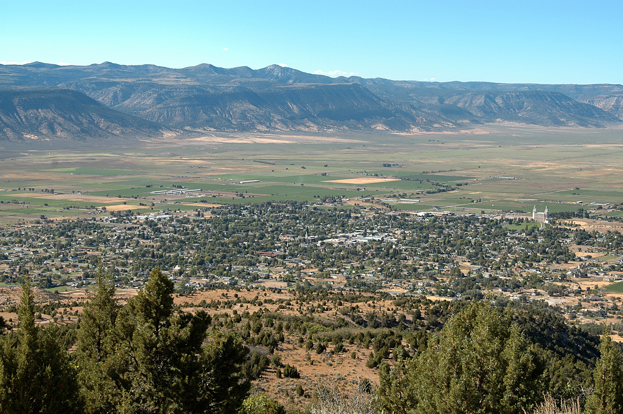
Manti, Utah — City — Birdseye view of Manti and the Sanpete Valley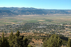 Location of Manti, Utah
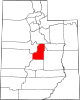
Coordinates: 39°15′53″N 111°38′20″W / 39.26472°N 111.63889°WCoordinates: 39°15′53″N 111°38′20″W / 39.26472°N 111.63889°W Country United States State Utah County Sanpete Founded 1849 Incorporated 1851 Founder Isaac Morley Named for A city in the Book of Mormon Area – Total 1.9 sq mi (5.0 km2) – Land 1.9 sq mi (5.0 km2) – Water 0.0 sq mi (0.0 km2) Elevation 5,610 ft (1,710 m) Population (2000) – Total 3,040 – Density 1,560.2/sq mi (602.4/km2) Time zone Mountain (MST) (UTC-7) – Summer (DST) MDT (UTC-6) ZIP code 84642 Area code(s) 435 FIPS code 49-47730[1] GNIS feature ID 1443136[2] Manti (
 /ˈmæntaɪ/) is a city in and the county seat of Sanpete County, Utah, United States.[3] The population was 3,276 at the 2010 United States Census.
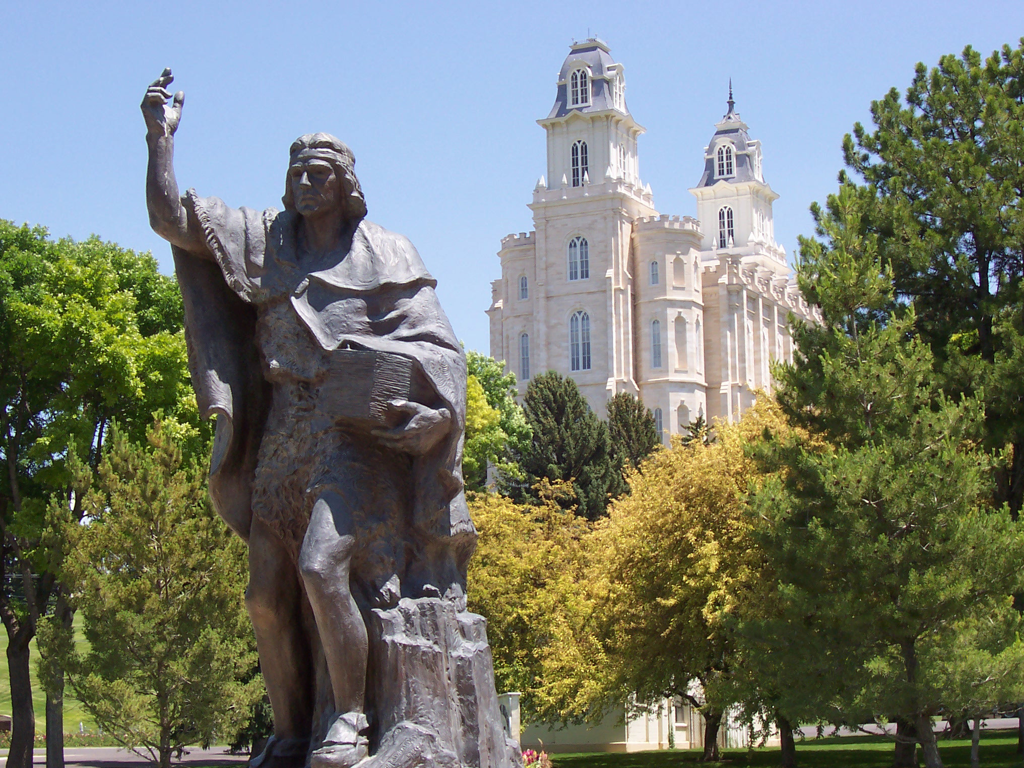
The Manti Utah Temple, one of the first temples built by The Church of Jesus Christ of Latter-day Saints is found in Manti and dominates the area's skyline. The city is also the headquarters of a polygamist offshoot of the mainstream LDS Church, the True and Living Church of Jesus Christ of Saints of the Last Days. Manti annually hosts the two-week long Mormon Miracle Pageant, one of the city's greatest sources of revenue.
Contents
Geography
Manti is located at 39°15′53″N 111°38′20″W / 39.26472°N 111.63889°W (39.264759, -111.638913).[4]
According to the United States Census Bureau, the city has a total area of 2.0 square miles (5.1 km²), all of it land.
Manti is located in a semi-arid climate with warm summers and cold winters. Its high elevation means that the climate is cooler than other populated areas of Utah, especially during summer. Summers highs average in the mid-80s°F, with winter highs in the mid-30s°F. Winter lows, however, dip to around 15-20°F. Pacific storms move through the region from October through May and spring is the wettest season. However, summer, which is the driest seasion, primarily relies on precipitation from scattered diurnal thunderstorm activity and the Gulf of California monsoon. Winter and spring see frequent snowfall. Precipitation averages 12.70 inches and snowfall 52.2 inches. The record high temperature is 110°F (43°C), set on August 6, 1895, while the record low is -27°F (-33°C), set on January 22, 1937.[5]
Although Utah as a whole only averages 2–3 tornadoes per year, Manti was hit directly by an F2 tornado on September 8, 2002. The tornado was on the ground for 15 minutes and managed to cause $2 million in damage as it tore through southeastern Manti. Remarkably, no one was injured or killed in the incident.[6]
Climate data for Manti Month Jan Feb Mar Apr May Jun Jul Aug Sep Oct Nov Dec Year Record high °F (°C) 63
(17)70
(21)82
(28)88
(31)99
(37)106
(41)108
(42)110
(43)100
(38)90
(32)76
(24)66
(19)110
(43)Average high °F (°C) 37
(3)41
(5)51
(11)60
(16)70
(21)80
(27)86
(30)84
(29)76
(24)65
(18)50
(10)39
(4)62 Average low °F (°C) 14
(−10)18
(−8)25
(−4)32
(0)40
(4)47
(8)54
(12)52
(11)44
(7)34
(1)24
(−4)16
(−9)33 Record low °F (°C) −27
(−33)−26
(−32)−5
(−21)8
(−13)18
(−8)27
(−3)32
(0)27
(−3)17
(−8)8
(−13)−8
(−22)−24
(−31)−27
(−33)Precipitation inches (mm) 1.02
(25.9)1.12
(28.4)1.34
(34)1.30
(33)1.25
(31.8)0.78
(19.8)0.79
(20.1)0.89
(22.6)1.05
(26.7)1.19
(30.2)1.01
(25.7)0.96
(24.4)12.70
(322.6)Snowfall inches (cm) 11.0
(27.9)10.2
(25.9)8.8
(22.4)4.1
(10.4)1.2
(3)0
(0)0
(0)0
(0)0.2
(0.5)1.3
(3.3)6.3
(16)9.2
(23.4)52.2
(132.6)Source: [7] Demographics
Historical populations Census Pop. %± 1860 913 — 1870 1,239 35.7% 1880 1,748 41.1% 1890 1,950 11.6% 1900 2,425 24.4% 1910 2,437 0.5% 1920 2,412 −1.0% 1930 2,200 −8.8% 1940 2,268 3.1% 1950 2,051 −9.6% 1960 1,739 −15.2% 1970 1,803 3.7% 1980 2,080 15.4% 1990 2,268 9.0% 2000 3,040 34.0% 2010 3,276 7.8% As of the census[1] of 2000, there were 3,040 people, 930 households, and 742 families residing in the city. The population density was 1,560.2 people per square mile (601.9/km²). There were 1,010 housing units at an average density of 518.3 per square mile (200.0/km²). The racial makeup of the city was 96.48% White, 0.07% African American, 1.58% Native American, 0.07% Asian, 0.43% Pacific Islander, 0.49% from other races, and 0.89% from two or more races. Hispanic or Latino of any race were 2.60% of the population.
There were 930 households out of which 46.7% had children under the age of 18 living with them, 68.0% were married couples living together, 9.7% had a female householder with no husband present, and 20.2% were non-families. 18.8% of all households were made up of individuals and 11.6% had someone living alone who was 65 years of age or older. The average household size was 3.25 and the average family size was 3.74.
In the city the population was spread out with 38.1% under the age of 18, 10.6% from 18 to 24, 20.6% from 25 to 44, 17.6% from 45 to 64, and 13.2% who were 65 years of age or older. The median age was 26 years. For every 100 females there were 97.8 males. For every 100 females age 18 and over, there were 91.1 males.
The median income for a household in the city was $32,844, and the median income for a family was $37,163. Males had a median income of $30,156 versus $22,500 for females. The per capita income for the city was $12,677. About 11.4% of families and 13.0% of the population were below the poverty line, including 16.0% of those under age 18 and 7.8% of those age 65 or over.
History
 Manti, Utah Temple of The Church of Jesus Christ of Latter-day Saints
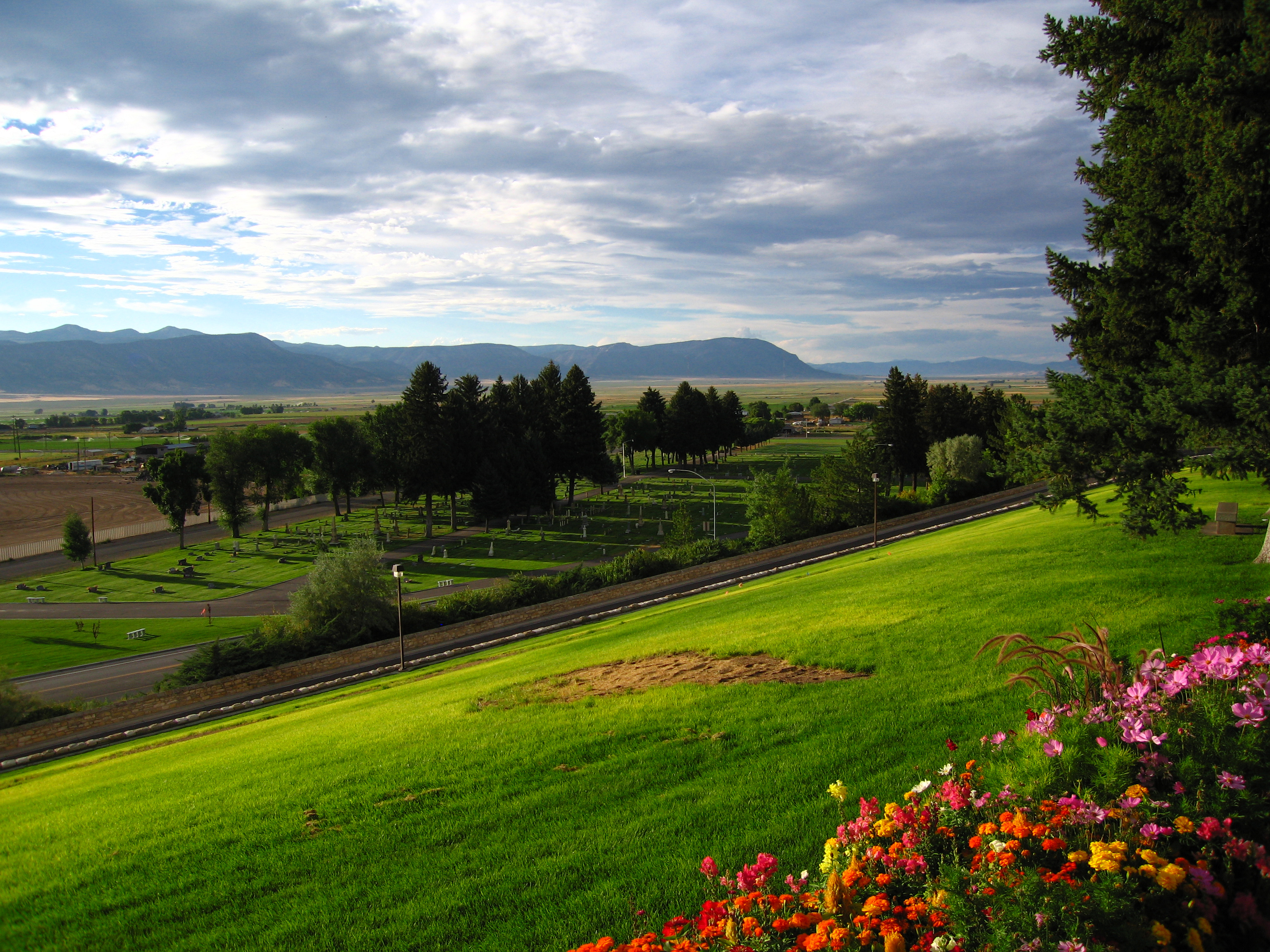
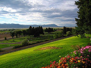 A view of Manti Cemetery from Temple Hill
Manti was one of the first communities settled in what was to become Utah. Chief Wakara (or Walker), a Ute Tribe leader, invited Brigham Young to send Mormon colonists to the area. In 1849, Brigham Young dispatched a company of about 225 settlers, consisting of several families, to the Sanpitch (now Sanpete) Valley. Under the direction of Isaac Morley, the settlers arrived at the present location of Manti in November. They endured a severe winter by living in temporary shelters dug into the south side of the hill on which the Manti Temple now stands. Brigham Young named the new community Manti, after a city mentioned in the Book of Mormon. Manti was incorporated in 1851. The first mayor of Manti was Dan Jones. Manti served as a hub city for the settlement of other communities in the valley.
Relations with the local Native Americans deteriorated rapidly and the Walker War soon ensued. The war consisted primarily of various raids conducted by the Native Americans against Mormon outposts in Central and Southern Utah. The Walker War ended in the mid-1850s in an understanding negotiated between Brigham Young and Wakara. Shortly thereafter, Welcome Chapman (who succeeded Morley) and Wakara oversaw the baptism of scores of Wakara's tribe members. Although immediate hostilities ended, none of the underlying conflicts were resolved.[8]
In 1865 Utah's Black Hawk War erupted when an incident between a Manti resident and a young chieftain exploded into open warfare between the Mormon settlers and the local Native Americans. Forts were built in Manti and other nearby communities. Smaller settlements in the area were temporarily abandoned for the duration of the war. In the fall of 1867, Chief Black Hawk made peace with the settlers, but sporadic violence occurred until 1872 when federal troops finally intervened. Many Mormon settlers who fought and died in the wars are buried in the Manti Cemetery. Most of the Utes were eventually relocated to the Uintah and Ouray Indian Reservation in Eastern Utah.
Education
Manti is located in the South Sanpete School District and has 1 elementary school, as well Manti High School, who have the Templars as their mascot and compete in the 3A level of competition (out of 5 levels). Middle school students attend in nearby Ephraim, Utah.
See also
References
- ^ a b "American FactFinder". United States Census Bureau. http://factfinder.census.gov. Retrieved 2008-01-31.
- ^ "US Board on Geographic Names". United States Geological Survey. 2007-10-25. http://geonames.usgs.gov. Retrieved 2008-01-31.
- ^ "Find a County". National Association of Counties. http://www.naco.org/Counties/Pages/FindACounty.aspx. Retrieved 2011-06-07.
- ^ "US Gazetteer files: 2010, 2000, and 1990". United States Census Bureau. 2011-02-12. http://www.census.gov/geo/www/gazetteer/gazette.html. Retrieved 2011-04-23.
- ^ Utah climate summaries - Manti temperature table
- ^ NWS Salt Lake City - Utah tornadoes
- ^ [1]
- ^ Findlay, Linnie T.M. "Welcome Chapman". Saga of the Sanpitch. 1989. Vol. 21, pp. 111-118.
External links
- The Official Manti City website
- Mormon Miracle Pageant
 Media related to Manti, Utah at Wikimedia Commons
Municipalities and communities of Sanpete County, Utah County seat: MantiCities Centerfield | Ephraim | Fairview | Fountain Green | Gunnison | Manti | Moroni | Mount Pleasant | Spring City
Towns Unincorporated
communitiesGhost towns Categories:- Cities in Utah
- Populated places in Sanpete County, Utah
- County seats in Utah
- Populated places established in 1849

Wikimedia Foundation. 2010.