- Dover, Utah
-
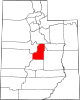
Dover — Ghost town — Location of Dover in Utah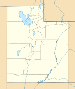
 Dover
DoverCoordinates: 39°12′27″N 111°53′46″W / 39.2075°N 111.89611°WCoordinates: 39°12′27″N 111°53′46″W / 39.2075°N 111.89611°W Country United States State Utah County Sanpete Founded 1877 Abandoned 1930s Founder William Robinson Named for Dover Dover is a ghost town located in Sanpete County, Utah, United States. The site lies west of Fayette across the Sevier River.
History
The land was first settled in 1877–1878 by 45 families led by William Robinson. They found the soil was good, but water somewhat scarce. By 1879 they had a schoolhouse, also used for church and civic functions, and a post office, which operated until 1895. There were also two general stores, where residents typically paid for goods in kind with eggs.[1]
When Utah Territory achieved statehood on January 4, 1896, Dover's celebrations took a tragic turn. They had no cannon to fire, instead exploding some dynamite with a well-driving hammer.[2] The hammer, which had been through many such celebrations before,[1] blew apart, injuring several people.[2]
In the years 1910–1916, irrigation companies in Millard County dammed the Sevier River some distance to the north.[3] The resulting reservoir, now known as Yuba Reservoir, covered parts of Dover's farmland, driving out some of the residents.[2] A severe drought in the 1930s finished off the town; a few houses were moved, and most of the others were later torn down.[1] Nothing remains but some foundations and fallen buildings, and a memorial cemetery.[4]
References
- ^ a b c Carr, Stephen L. (1986) [1972]. The Historical Guide to Utah Ghost Towns (3rd ed.). Salt Lake City: Western Epics. p. 101. ISBN 0-914740-30-X.
- ^ a b c Antrei, Albert C.T.; Roberts, Allen D. (January 1999). A History of Sanpete County. Utah Centennial County History Series. Salt Lake City, Utah: Utah State Historical Society. pp. 364–365. ISBN 0-913738-42-5.
- ^ Antrei, p.372.
- ^ "Cemetery Database". Utah State History. Utah Department of Community and Culture. http://history.utah.gov/burials/execute/viewcemetery?id=SP0101. Retrieved October 20, 2009.
External links
- Dover at GhostTowns.com
Municipalities and communities of Sanpete County, Utah County seat: Manti Cities Centerfield | Ephraim | Fairview | Fountain Green | Gunnison | Manti | Moroni | Mount Pleasant | Spring City
Towns Unincorporated
communitiesGhost towns Clarion | Dover
Categories:- Ghost towns in Utah
- Geography of Sanpete County, Utah
- Populated places established in 1877
- Utah geography stubs
- United States ghost town stubs


Wikimedia Foundation. 2010.