- Milburn, Utah
-
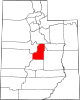
Milburn — Unincorporated community — Location within the state of Utah
 Milburn
Coordinates: 39°42′15″N 111°25′30″W / 39.70417°N 111.425°WCoordinates: 39°42′15″N 111°25′30″W / 39.70417°N 111.425°W Country United States State Utah County Sanpete Named for Sawmills Elevation[1] 6,365 ft (1,940 m) Time zone Mountain (MST) (UTC-7) – Summer (DST) MDT (UTC-6) ZIP code 84629 Area code(s) 435 FIPS code GNIS feature ID 1443385[1] Historical populations Census Pop. %± 1900 213 — 1910 103 −51.6% 1920 146 41.7% 1930 137 −6.2% 1940 101 −26.3% 1950 57 −43.6% Source: U.S. Census Bureau[2] Milburn is an unincorporated community in Sanpete County, Utah, United States. It is mainly an outgrowth of Fairview on the San Pitch River. Milburn has had several names in the past such as Milborn and Millburn, all of which were related in some way to the early sawmills built at the mouth of nearby canyons. Today Milburn is mostly an agricultural region.
References
- ^ a b U.S. Geological Survey Geographic Names Information System: Milburn, Utah. Retrieved May 19, 2011.
- ^ "Census of Population and Housing". U.S. Census Bureau. http://www.census.gov/prod/www/abs/decennial/. Retrieved November 7, 2011.
Municipalities and communities of Sanpete County, Utah Cities Centerfield | Ephraim | Fairview | Fountain Green | Gunnison | Manti | Moroni | Mount Pleasant | Spring City
Towns Unincorporated
communitiesGhost towns Categories:- Populated places in Sanpete County, Utah
- Unincorporated communities in Utah
- Utah geography stubs


Wikimedia Foundation. 2010.