- Mantua, Utah
-
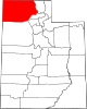
Mantua, Utah — Town — Mantua as seen from U.S. Route 91 Location of Mantua, Utah
Coordinates: 41°29′51″N 111°56′32″W / 41.4975°N 111.94222°WCoordinates: 41°29′51″N 111°56′32″W / 41.4975°N 111.94222°W Country United States State Utah County Box Elder Settled 1863 Incorporated 1911 Named for Mantua, Ohio Area - Total 5.6 sq mi (14.5 km2) - Land 4.9 sq mi (12.6 km2) - Water 0.7 sq mi (1.9 km2) Elevation[1] 5,200 ft (1,585 m) Population (2010) - Total 687 - Density 162.5/sq mi (62.8/km2) Time zone Mountain (MST) (UTC-7) - Summer (DST) MDT (UTC-6) ZIP code 84324 Area code(s) 435 FIPS code 49-47840[2] GNIS feature ID 1443141[1] Mantua (
 /ˈmænəweɪ/) is a town in eastern Box Elder County, Utah, United States. The population was 687 at the 2010 census. Mantua was settled in the mid-19th Century when future LDS President and then apostle and head church authority in Box Elder County Lorenzo Snow sent settlers to the valley to grow flax. The first group arrived in Mantua in 1863. They were all from Denmark and their local leader was Hans Jens Jensen. Snow was from Mantua, Ohio, and the town was named after the Ohio community in his honor.[3]
Contents
Geography
Mantua is located at 41°29′51″N 111°56′32″W / 41.4975°N 111.94222°W (41.497399, -111.942292).[4]
According to the United States Census Bureau, the town has a total area of 5.6 square miles (14.5 km²), of which 4.9 square miles (12.6 km²) are land and 0.7 square mile (1.9 km²) (13.21%) is water.
Demographics
Historical populations Census Pop. %± 1900 350 — 1910 377 7.7% 1920 354 −6.1% 1930 314 −11.3% 1940 319 1.6% 1950 271 −15.0% 1960 275 1.5% 1970 413 50.2% 1980 484 17.2% 1990 665 37.4% 2000 791 18.9% 2010 687 −13.1% As of the census[2] of 2000, there were 791 people, 218 households, and 189 families residing in the town. The population density was 162.5 people per square mile (62.7/km²). There were 231 housing units at an average density of 47.5 per square mile (18.3/km²). The racial makeup of the town was 96.33% White, 0.63% African American, 0.51% Native American, 0.25% Asian, 0.51% from other races, and 1.77% from two or more races. Hispanic or Latino of any race were 0.88% of the population.
There were 218 households out of which 52.8% had children under the age of 18 living with them, 79.4% were married couples living together, 5.0% had a female householder with no husband present, and 13.3% were non-families. 12.4% of all households were made up of individuals and 5.5% had someone living alone who was 65 years of age or older. The average household size was 3.63 and the average family size was 4.01.
In the town the population was spread out with 38.2% under the age of 18, 10.1% from 18 to 24, 23.3% from 25 to 44, 20.1% from 45 to 64, and 8.3% who were 65 years of age or older. The median age was 30 years. For every 100 females there were 108.7 males. For every 100 females age 18 and over, there were 103.8 males.
The median income for a household in the town was $60,234, and the median income for a family was $61,964. Males had a median income of $42,100 versus $26,875 for females. The per capita income for the town was $17,798. About 0.5% of families and 1.7% of the population were below the poverty line, including 2.1% of those under age 18 and 3.4% of those age 65 or over.
Government
Mantua is still widely considered to be a speed trap. In 1997, its two police officers issued over 1,300 speeding tickets, amounting to fines of approximately $60,000, or more than half of the city's total yearly revenue. Most tickets are issued along the town's section of U.S. Routes 89/91.[5]
References
- ^ a b U.S. Geological Survey Geographic Names Information System: Mantua
- ^ a b "American FactFinder". United States Census Bureau. http://factfinder.census.gov. Retrieved 2008-01-31.
- ^ Jenson, Andrew (1920). "Origin of Western Geographic Names". The Utah genealogical and historical magazine 11 (2): 83. http://books.google.com/books?id=u78UAAAAYAAJ&pg=RA1-PA83&lpg=RA1-PA83&dq=mantua+flaxville#v=onepage&q=mantua%20flaxville&f=false. "But in 1864 the settlement was named Mantua, after Mantua, Portage County, Ohio, the birthplace of President Lorenzo Snow."
- ^ "US Gazetteer files: 2010, 2000, and 1990". United States Census Bureau. 2011-02-12. http://www.census.gov/geo/www/gazetteer/gazette.html. Retrieved 2011-04-23.
- ^ "Mantua boasts mean speed trap". Deseret News. 10 March 1998. http://www.deseretnews.com/article/617664/. Retrieved 6 October 2009.
Municipalities and communities of Box Elder County, Utah Cities Bear River City | Brigham City | Corinne | Garland | Honeyville | Perry | Tremonton | Willard
Towns CDPs Riverside | South Willard | Thatcher
Unincorporated
areasBothwell | Collinston | Etna | Grouse Creek | Park Valley | Penrose | Promontory | Rosette | Standrod | Yost
Ghost towns Categories:- Populated places established in 1863
- Populated places in Box Elder County, Utah
- Towns in Utah


Wikimedia Foundation. 2010.