- Collinston, Utah
-
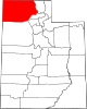
Collinston — Unincorporated community — Location within the state of Utah
 Collinston
Coordinates: 41°46′29″N 112°5′42″W / 41.77472°N 112.095°WCoordinates: 41°46′29″N 112°5′42″W / 41.77472°N 112.095°W Country United States State Utah County Box Elder Settled 1860 Named for Collins Fulmer Elevation 4,432 ft (1,351 m) Time zone Mountain (MST) (UTC-7) - Summer (DST) MDT (UTC-6) ZIP codes 84306 FIPS code GNIS feature ID 1428419[1] Collinston is an unincorporated community in Box Elder County, Utah, United States.
Historical populations Census Pop. %± 1890 798 — 1900 340 −57.4% 1910 114 −66.5% 1920 155 36.0% 1930 132 −14.8% 1940 114 −13.6% 1950 145 27.2% Source: U.S. Census Bureau[2] Mainly an agricultural community, the town is located 3 miles (4.8 km) southeast of Fielding and almost directly west of Riverside, at coordinates 41°46′29″N 112°5′42″W / 41.77472°N 112.095°W (441.7746496, -112.0949517).[1] Its elevation is 4,432 feet (1,351 m). Although it is unincorporated, it has a post office, with the ZIP code of 84306.[3]
Collinston is mentioned as the approximate location where Captain John C. Frémont crossed the Bear River in 1843.[4]
The town was originally known as Hampton or Hampton Ford. It was named for Ben Hampton, who, with William Godbe, operated a toll ferry across the Bear River from 1867 to 1868. James Standing later bought the ferry and bridge rights and moved the town to higher ground 1 mile (1.6 km) east. The name was changed to Collinston, after Utah Northern Railroad conductor Collins Fulmer.[5]
References
- ^ a b "Collinston, Utah". Geographic Names Information System, U.S. Geological Survey. http://geonames.usgs.gov/pls/gnispublic/f?p=gnispq:3:::NO::P3_FID:1428419. Retrieved 2008-04-12.
- ^ "Census of Population and Housing". U.S. Census Bureau. http://www.census.gov/prod/www/abs/decennial/. Retrieved November 4, 2011.
- ^ Zip Code Lookup
- ^ Hooton Jr LW: "The Bear River". Accessed 2008-05-12.
- ^ Van Cott, John W. (1990). Utah Place Names. Salt Lake City, Utah: University of Utah Press. pp. 173. ISBN 0-87480-345-4.
Municipalities and communities of Box Elder County, Utah Cities Bear River City | Brigham City | Corinne | Garland | Honeyville | Perry | Tremonton | Willard
Towns CDPs Riverside | South Willard | Thatcher
Unincorporated
areasBothwell | Collinston | Etna | Grouse Creek | Park Valley | Penrose | Promontory | Rosette | Standrod | Yost
Ghost towns Categories:- Populated places in Box Elder County, Utah
- Unincorporated communities in Utah
- Populated places established in 1867
- Utah geography stubs


Wikimedia Foundation. 2010.