- Grouse Creek, Utah
-
Grouse Creek — Unincorporated community — Location within the state of Utah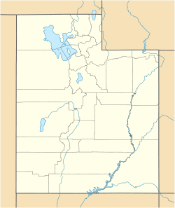
 Grouse Creek
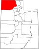
Coordinates: 41°42′34″N 113°53′0″W / 41.70944°N 113.883333°WCoordinates: 41°42′34″N 113°53′0″W / 41.70944°N 113.883333°W Country United States State Utah County Box Elder Settled 1876 Founder Benjamin F. Cook Named for Sage Grouse Elevation 5,331 ft (1,625 m) Time zone Mountain (MST) (UTC-7) – Summer (DST) MDT (UTC-6) ZIP codes 84313 FIPS code GNIS feature ID 1428419[1] Historical populations Census Pop. %± 1880 267 — 1890 274 2.6% 1900 278 1.5% 1910 337 21.2% 1920 342 1.5% 1930 329 −3.8% 1940 267 −18.8% 1950 167 −37.5% Source: U.S. Census Bureau[2] Grouse Creek (also Cookesville) is an unincorporated community in the nearly unpopulated northwestern region of Box Elder County, Utah, United States, near the Idaho and Nevada borders. It lies along unpaved roads north of State Route 30 in the Grouse Creek Mountains.[3] Its elevation is 5,331 feet (1,625 m).[1] Although it is unincorporated, it has a post office, with the ZIP code of 84313.[4]
Grouse Creek was first settled in 1876.[5]
References
- ^ a b "Grouse Creek, Utah". Geographic Names Information System, U.S. Geological Survey. http://geonames.usgs.gov/pls/gnispublic/f?p=gnispq:3:::NO::P3_FID:1428419. Retrieved 2008-04-12.
- ^ "Census of Population and Housing". U.S. Census Bureau. http://www.census.gov/prod/www/abs/decennial/. Retrieved November 4, 2011.
- ^ Rand McNally. The Road Atlas '08. Chicago: Rand McNally, 2008, p. 102.
- ^ Zip Code Lookup
- ^ Andrew Jenson. Encyclopedic History of the Church. p. 305
External links
- Grouse Creek Country Club Unofficial community website
Municipalities and communities of Box Elder County, Utah Cities Bear River City | Brigham City | Corinne | Garland | Honeyville | Perry | Tremonton | Willard
Towns CDPs Riverside | South Willard | Thatcher
Unincorporated
areasBothwell | Collinston | Etna | Grouse Creek | Park Valley | Penrose | Promontory | Rosette | Standrod | Yost
Ghost towns Categories:- Populated places established in 1876
- Populated places in Box Elder County, Utah
- Unincorporated communities in Utah
- Utah geography stubs


Wikimedia Foundation. 2010.