- Olmito, Texas
-
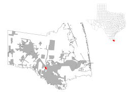
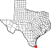
Olmito, Texas — CDP — Location of Olmito, Texas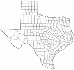
Coordinates: 26°1′11″N 97°32′5″W / 26.01972°N 97.53472°WCoordinates: 26°1′11″N 97°32′5″W / 26.01972°N 97.53472°W Country United States State Texas County Cameron Area – Total 0.7 sq mi (1.8 km2) – Land 0.7 sq mi (1.7 km2) – Water 0.0 sq mi (0.1 km2) Elevation 30 ft (9 m) Population (2000) – Total 1,198 – Density 1,787.9/sq mi (690.3/km2) Time zone Central (CST) (UTC-6) – Summer (DST) CDT (UTC-5) ZIP code 78575 Area code(s) 956 FIPS code 48-53964[1] GNIS feature ID 1375292[2] Olmito is a census-designated place (CDP) in Cameron County, Texas, United States. Olmito is Spanish for "little elm." The population was 1,198 at the 2000 census. It is part of the Brownsville–Harlingen Metropolitan Statistical Area. Olmito is the self-described "mesquite capital of the world."
Contents
Geography
Olmito is located at 26°1′11″N 97°32′5″W / 26.01972°N 97.53472°W (26.019655, -97.534690)[3].
According to the United States Census Bureau, the CDP has a total area of 0.7 square miles (1.8 km2), of which, 0.7 square miles (1.8 km2) of it is land and 0.04 square miles (0.1 km², or 2.90%) of it is water.
Demographics
As of the census[1] of 2000, there were 1,198 people, 303 households, and 270 families residing in the CDP. The population density was 1,787.9 people per square mile (690.4/km²). There were 322 housing units at an average density of 480.6/sq mi (185.6/km²). The racial makeup of the CDP was 98.25% White, 1.34% from other races, and 0.42% from two or more races. Hispanic or Latino of any race were 96.49% of the population.
There were 303 households out of which 56.8% had children under the age of 18 living with them, 68.3% were married couples living together, 18.2% had a female householder with no husband present, and 10.6% were non-families. 9.9% of all households were made up of individuals and 5.3% had someone living alone who was 65 years of age or older. The average household size was 3.95 and the average family size was 4.22.
In the CDP the population was spread out with 38.1% under the age of 18, 12.9% from 18 to 24, 23.5% from 25 to 44, 17.7% from 45 to 64, and 7.8% who were 65 years of age or older. The median age was 24 years. For every 100 females there were 96.1 males. For every 100 females age 18 and over, there were 85.7 males.
The median income for a household in the CDP was $13,333, and the median income for a family was $15,000. Males had a median income of $13,125 versus $12,279 for females. The per capita income for the CDP was $5,170. About 47.6% of families and 55.9% of the population were below the poverty line, including 73.4% of those under age 18 and 20.3% of those age 65 or over.
Education
Olmito is served by the Los Fresnos Consolidated Independent School District.
In addition, South Texas Independent School District operates magnet schools that serve the community.
Government and infrastructure
The United States Postal Service operates the Olmito Post Office.[4]
References
- ^ a b "American FactFinder". United States Census Bureau. http://factfinder.census.gov. Retrieved 2008-01-31.
- ^ "US Board on Geographic Names". United States Geological Survey. 2007-10-25. http://geonames.usgs.gov. Retrieved 2008-01-31.
- ^ "US Gazetteer files: 2010, 2000, and 1990". United States Census Bureau. 2011-02-12. http://www.census.gov/geo/www/gazetteer/gazette.html. Retrieved 2011-04-23.
- ^ "Post Office™ Location - OLMITO." United States Postal Service. Retrieved on May 9, 2010.
Municipalities and communities of Cameron County, Texas Cities Brownsville | Harlingen | La Feria | Los Fresnos | Palm Valley | Port Isabel | Rio Hondo | San Benito
Towns Bayview | Combes | Indian Lake | Laguna Vista | Los Indios | Primera | Rancho Viejo | Santa Rosa | South Padre Island
CDPs Arroyo Colorado Estates | Arroyo Gardens-La Tina Ranch | Bixby | Bluetown-Iglesia Antigua | Cameron Park | Chula Vista-Orason | Del Mar Heights | El Camino Angosto | Encantada-Ranchito El Calaboz | Grand Acres | Green Valley Farms | La Feria North | La Paloma | Lago | Laguna Heights | Las Palmas-Juarez | Lasana | Laureles | Lozano | Olmito | Ratamosa | Reid Hope King | San Pedro | Santa Maria | Solis | South Point | Tierra Bonita | Villa del Sol | Villa Pancho | Yznaga
Unincorporated
communitiesArroyo City | Rangerville
Categories:- Populated places in Cameron County, Texas
- Census-designated places in Texas
- Populated places in Texas with Hispanic majority populations


Wikimedia Foundation. 2010.