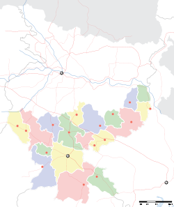
- Saranda forest
-
Saranda forest — national park — Coordinates 22°12′N 85°21′E / 22.2°N 85.35°ECoordinates: 22°12′N 85°21′E / 22.2°N 85.35°E Country India State Jharkhand District(s) West Singhbhum Nearest city Jamshedpur Time zone IST (UTC+05:30) Area
820 square kilometres (320 sq mi)
• 550 metres (1,800 ft)
Saranda forest is a dense forest in the hilly region of West Singhbhum district in the Indian state of Jharkhand. This area was formerly the private hunting reserve of the Singh Deo family( the erstwhile royal family of Saraikela(Seraikella).The forest covers an area of 820 km²[1] Saranda literally means seven hundred hills.[2] Thalkobad is a scenic village at a height of 550 m (1,800 ft) in the heart of the forest.[3] Thalkobad is about 46 km (29 mi) from Manoharpur, and about 160 km (99 mi) from Jamshedpur.
Ho people inhabit the area, which is dotted with iron ore mining towns including Gua, Chiria, Kiriburu and Noamundi.
Sal (Shorea robusta) is the most important tree in the area and it seems to have a preference for the rocky soil of the area. Although sal is a deciduous tree and sheds its leaves in early summer, the forest undergrowth is generally evergreen, which has such trees as mangoes, jamun, jackfruit, and piar. Other important trees are mahua, kusum, tilai, harin hara (Armossa rohitulea), gular (Fiscus glomerata), asan.[4]
The reserved forests are the haunt of many animals. Wild elephants are common in Saranada and Porahat forests. Herds of sambar and chital roam about the forests. Bison is still found. Tigers were never numerous but they are there. Leopards are more common.[5]
1100 hectares of virgin forests of >40 per cent canopy cover is presently under iron ore mining leases. Several new aspirants for mining lease are in the waiting. The forest of Saranda is the home range for several elephants and also a very important overlapping habitat of the elephants from adjacent Keonjhar district of Orissa. The perennial rivers, Karo and Koina, pass through these forested areas supporting a diverse floral and faunal resource.
Since 2000 the area is under influence of Communist Party of India (Maoist) group and hence is an unsafe place for tourist.
References
- ^ "Saranda Forest". india9.com. http://www.india9.com/i9show/Saranda-Forest-16431.htm. Retrieved 2008-03-06.
- ^ "Forest in the Light and Shade". yahoo.com. http://blog.360.yahoo.com/blog-_lh4Bb0ibqvWvz6z2OwBn_ORgqfEjydBmA--?cq=1&p=26. Retrieved 2008-03-06.
- ^ "Saranda Forest". india9.com. http://www.india9.com/i9show/Saranda-Forest-16431.htm. Retrieved 2008-03-06.
- ^ Prasad, Hem Chandra, Bihar, 1983/2003, p. 13, National Book Trust, New Delhi, ISBN 81-237-0151-9
- ^ Houlton, Sir John, Bihar: The Heart of India, 1949, p. 169, Orient Longmans, Kolkata.
Kolhan division topics General Districts Rivers, Waterfalls, Dams Languages, people Transport National Highway 6 • National Highway 32 • National Highway 33 • South Eastern Railway • Sonari Airport • Tatanagar Railway StationIndustries Institutes of higher learning Lok Sabha constituencies Vidhan Sabha constituencies Jamshedpur Baharagora • Ghatsila • Potka • Jugsalai • Jamshedpur East • Jamshedpur West Singhbhum Seraikella • Chaibasa • Majhgaon • Jaganathpur • Manoharpur • ChakradharpurSee also Cities and towns in Kolhan Division • Villages in Seraikela Kharswan district • Villages in East Singhbhum district • Mahanadi-Brahmani-Bitarani Basin • Jamshedpur topicsOther Divisions North Chotangapur • South Chaotanagpur • Palamu • Santhal ParganaCategories:- West Singhbhum district
- Forests of India
Wikimedia Foundation. 2010.


