- Derry, Pennsylvania
-
- There are also four Derry Townships in Pennsylvania.
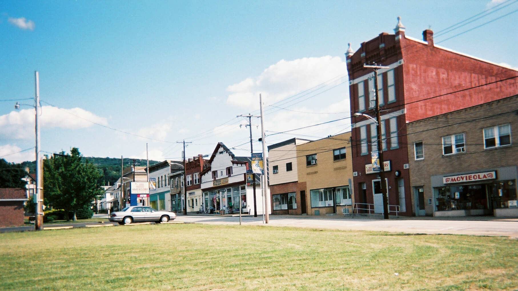
Derry, Pennsylvania — Borough — Derry's business district (Chestnut Street)
Coat of arms
 Derry, Pennsylvania
Coordinates: 40°19′59″N 79°18′04″W / 40.33306°N 79.30111°WCoordinates: 40°19′59″N 79°18′04″W / 40.33306°N 79.30111°W Country United States State Pennsylvania County Westmoreland Settled 1852 Incorporated October 22, 1881 Government – Type Borough Council – Mayor Area – Total 0.8 sq mi (2.1 km2) Elevation 1,171 ft (357 m) Population (2010) – Total 2,688 – Density 3,360/sq mi (1,297.3/km2) Time zone Eastern (EST) (UTC-5) – Summer (DST) EDT (UTC-4) Zip code 15627 Website http://www.derryborough.org Derry is a borough in Westmoreland County in the Commonwealth of Pennsylvania, 45 miles (72 km) east of Pittsburgh. The Borough of Derry, consisting of the town area, should not be confused with Derry Township, which is a separate municipality surrounding the borough. In 1900, the population numbered 2,347, and in 1910, 2,954. The population was 2,688 at the 2010 census.
Contents
History
Derry, originally known as Derry Station, was created in 1852 to serve the Pennsylvania Railroad. It was named after the village on PA Route 982 originally known as Derry and now known as New Derry (even though it is older than the community being discussed here).[1] The original "Derry" in Westmoreland County, Pennsylvania was named after the city Derry in Northern Ireland, because the area’s first non-Indian inhabitants were Scotch-Irish.
Derry was ideally suited for major railroad facilities because of its ready access to water from McGee Run (essential in the era of steam locomotives) and because it sits atop a slight summit along the railroad right-of-way. In Derry's heyday in the late 1800s, it had four hotels, mainly to serve railroad workers, as well as a roundhouse for locomotive maintenance and a massive railroad yard.[1] Derry was incorporated as a borough on October 22, 1881.[2]
Also, Derry served as the terminal for Pittsburgh commuter trains until 1964, when the Pennsylvania Railroad ceased operating its commuter service. The annual Railroad Days Festival serves to remind residents of Derry's railroading heritage.[3]
Little remains of Derry's railroading boom, although some might notice an unused railroad right-of-way that extends from Derry westward to PA Route 981, running slightly north but parallel to the currently-used railroad tracks. This was an ill-fated project known as the Derry-Donohoe-Jeannette (DDJ) bypass, in which the Pennsylvania Railroad attempted to build a new main line that would avoid the curves and slopes of the existing main line, bypassing Latrobe and Greensburg.[1] Construction of the bypass began in the 1920s, including a large trestle near Bradenville, but the new route was never completed.
A tragic helicopter crash into a crowd assembled for a festival at St. Joseph's Catholic Church in Derry killed eight people and injured 18 others on Labor Day, 1978. The railroad crossing in downtown Derry has also been the site of other tragic fatal accidents.
Geography
Derry is located at 40°19′59″N 79°18′4″W / 40.33306°N 79.30111°W (40.333037, -79.301011)[4]. According to the United States Census Bureau, the borough has a total area of 0.8 square miles (2.1 km2), of which, 0.8 square miles (2.1 km2) of it is land and 0.04 square miles (0.10 km2) of it (2.41%) is water.
Demographics
As of the census[5] of 2010, there were 2,688 people, 1,235 households, and 824 families residing in the borough. The population density was 3,696.5 people per square mile (1,425.7/km²). There were 1,317 housing units at an average density of 1,627.7 per square mile (627.8/km²). The racial makeup of the borough was 99.00% White, 0.64% African American, 0.03% Native American, 0.07% from other races, and 0.27% from two or more races. Hispanic or Latino of any race were 0.47% of the population.
There were 1,235 households out of which 29.6% had children under the age of 18 living with them, 48.7% were married couples living together, 14.4% had a female householder with no husband present, and 33.2% were non-families. 29.6% of all households were made up of individuals and 17.2% had someone living alone who was 65 years of age or older. The average household size was 2.41 and the average family size was 2.97.
In the borough the population was spread out with 24.1% under the age of 18, 6.8% from 18 to 24, 28.6% from 25 to 44, 21.7% from 45 to 64, and 18.8% who were 65 years of age or older. The median age was 40 years. For every 100 females there were 90.3 males. For every 100 females age 18 and over, there were 87.1 males.
The median income for a household in the borough was $29,785, and the median income for a family was $37,585. Males had a median income of $28,641 versus $21,929 for females. The per capita income for the borough was $15,671. About 10.4% of families and 12.4% of the population were below the poverty line, including 16.1% of those under age 18 and 7.4% of those age 65 or over.
References
- ^ a b c Roberts, Charles S. (1997). Triumph I: Altoona to Pitcairn: 1846-1996. Baltimore, Maryland: Barnard, Roberts, and Co., Inc.. pp. 279–285. ISBN 0-934118-23-X. http://www.barnardroberts.com.
- ^ "Westmoreland County (Dates of incorporation of municipalities)" (PDF). Pennsylvania Historical and Museum Commission. http://www.phmc.state.pa.us/Bah/dam/counties/pdfs/Westmoreland.pdf. Retrieved 2008-08-08.
- ^ "Borough of Derry". 2008-07-11. http://www.derryborough.org. Retrieved 2008-08-08.
- ^ "US Gazetteer files: 2010, 2000, and 1990". United States Census Bureau. 2011-02-12. http://www.census.gov/geo/www/gazetteer/gazette.html. Retrieved 2011-04-23.
- ^ "American FactFinder". United States Census Bureau. http://factfinder.census.gov. Retrieved 2008-01-31.
External links
Categories:- Boroughs in Westmoreland County, Pennsylvania
- Populated places established in 1852
- Pittsburgh metropolitan area


Wikimedia Foundation. 2010.