- Martigny-les-Bains
-
Martigny-les-Bains

 Martigny-les-BainsLocation within Lorraine region
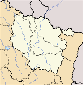 Martigny-les-Bains
Administration Country France Region Lorraine Department Vosges Arrondissement Neufchâteau Canton Lamarche Intercommunality Association of Lamarche (Lorraine) communes Mayor Gérard Sancho
(2008–2014)Statistics Elevation 342–490 m (1,122–1,610 ft)
(avg. 369 m/1,211 ft)Land area1 29.22 km2 (11.28 sq mi) Population2 912 (2006) - Density 31 /km2 (80 /sq mi) INSEE/Postal code 88289/ 88320 1 French Land Register data, which excludes lakes, ponds, glaciers > 1 km² (0.386 sq mi or 247 acres) and river estuaries. 2 Population without double counting: residents of multiple communes (e.g., students and military personnel) only counted once. Coordinates: 48°06′23″N 5°49′26″E / 48.1063888889°N 5.82388888889°E
Martigny-les-Bains is a commune in the Vosges department in Lorraine in northeastern France.
It acquired its present name only in 1880s, before which it was called Martigny-lès-Lamarche. The modern name highlights the thermal springs and spa facilities which remain a defining feature of the place.
Inhabitants are called Octoduriens.
Contents
Geography
Martigny-les-Bains is positioned in the south-west of Lorraine and at the western end of the Vosges Plain, forty kilometres (twenty-five miles) to the south of the administrative centre of the arrondissement, Neufchâteau, approximately six kilometres (four miles) to the north-east of Lamarche, and twenty-two kilometres to the north of another noted spa town, Bourbonne-les-Bains ("Aquae borvonis" in Roman times).
The village occupies a sheltered plateau. On the higher ground forests of oak and beech alternate with conifer plantations. The village is protected by the topography from the worst extremes of wind and temperature.
The railway which since 1881 has provided a connection with Vittel and Contrexéville skirts the village on its north-western side. Some fifteen kilometres to the west the Autoroute A31 offers access to the autoroute network for the age of mass motorisation, while five kilometres to the east, roughly parallel with the autoroute and the railway line, the remnants of a Roman road provide evidence that the district has been much transited over many centuries.
The altitude above sea level at the station is 370 meters, equivalent to 114 meters higher than the valley of the Saône at Les Thons, just fourteen kilometres (nine miles) to the south-south-east. The commune is close to the watershed that separates the catchment areas of the Rivers Saône and Meuse. The commune includes within its confines the sources of the Anger and Mouzon rivers which set off in opposite directions before they connect between Pompierre and Circourt after about thirty kilometres (nineteen miles). The valley of the Mouzon, which sets off in a westerly direction before turning to the north, flows over relatively flat plateau land rather than in some form of a gorge: claims appropriate to a spa village are made for the health giving properties of the air here.
History
Following the successive wars against France that characterised the seventeenth century, the village consisted of two parts, namely Martigny-Saint-Remy and Martigny-Saint-Pierre. The nearby village of Saint-Pierre had been destroyed by the Swedes who were in the pay of the French king at this time: the inhabitants turned up as refugees in Martigny-Saint-Remy and constructed the quarter which became known as Martigny-Saint-Pierre, including a church of which the remains survived until recently.
See also
References
Categories:- Communes of Vosges


Wikimedia Foundation. 2010.