- Mont-lès-Lamarche
-
Mont-lès-Lamarche

 Mont-lès-LamarcheLocation within Lorraine region
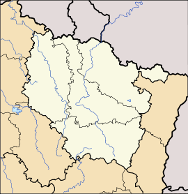 Mont-lès-Lamarche
Administration Country France Region Lorraine Department Vosges Arrondissement Neufchâteau Canton Lamarche Intercommunality Association of Lamarche (Lorraine) communes Mayor Jean-Paul Petit
(2008–2014)Statistics Elevation 312–487 m (1,024–1,598 ft)
(avg. 357 m/1,171 ft)Land area1 7.10 km2 (2.74 sq mi) Population2 106 (2006) - Density 15 /km2 (39 /sq mi) INSEE/Postal code 88307/ 88320 1 French Land Register data, which excludes lakes, ponds, glaciers > 1 km² (0.386 sq mi or 247 acres) and river estuaries. 2 Population without double counting: residents of multiple communes (e.g., students and military personnel) only counted once. Coordinates: 48°01′19″N 5°48′30″E / 48.0219444444°N 5.80833333333°E
Mont-lès-Lamarche is a commune in the Vosges department in Lorraine in northeastern France.
Geography
Mont-lès-Lamarche is positioned 6 kilometres (4 mi) to the south of Lamarche and 10 kilometres (6 mi) to the north of Bourbonne-les-Bains. Monthureux-sur-Saône is 15 kilometres (9 mi) to the east and Jussey is 26 kilimeters (16 miles) to the south-south-east. The commune is on the departmental frontier with Haute-Marne, but there is no direct route across thanks to the intervening topography, the highest point of which is the 487 meter high Malaumont. The commune's 182 hectares of forest are, like the hills, concentrated to the west of the little village: these include the Bois Brûlé (literally burnt wood/forest), Bois de la Plaine and the Bois Chava. The appropriately named Bois des Moines (literally monks' wood/forest) was formerly controlled by the Abbots of Morimond.
At the time of the French revolution the recorded population stood at 357, and it increased to a peak of 465 in 1866. Subsequently the picture is one of decline: registered population had fallen to just 93 by the end of the twentieth century.
At the start of the twentieth century, much of the land surrounding the village was still devoted to viticulture, but the vineyards have subsequently disappeared.
See also
References
Categories:- Communes of Vosges
- Vosges geography stubs


Wikimedia Foundation. 2010.