- Méménil
-
Méménil

 MéménilLocation within Lorraine region
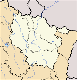 Méménil
Administration Country France Region Lorraine Department Vosges Arrondissement Épinal Canton Bruyères Intercommunality Association of Arentèle-Durbion-Padozel communes Mayor Eric Bichotte
(2008–2014)Statistics Elevation 343–582 m (1,125–1,909 ft) Land area1 9.15 km2 (3.53 sq mi) Population2 155 (2006) - Density 17 /km2 (44 /sq mi) INSEE/Postal code 88297/ 88600 1 French Land Register data, which excludes lakes, ponds, glaciers > 1 km² (0.386 sq mi or 247 acres) and river estuaries. 2 Population without double counting: residents of multiple communes (e.g., students and military personnel) only counted once. Coordinates: 48°13′16″N 6°36′42″E / 48.2211111111°N 6.61166666667°E
Méménil is a commune in the Vosges department in Lorraine in northeastern France.
Contents
Geography
Méménil is positioned some ten kilometres (six miles) to the east-north-east of Épinal, along one of the routes to Saint-Dié-des-Vosges. Surrounding communes are Fontenay to the west, Girecourt-sur-Durbion to the north and Viménil to the east. The forested hillside to the south of the village is part of the commune of Méménil.
The commune is surrounded by forests and is crossed by two little streams, the Rouot and the Grande Roye: these cross the north of the commune through an unusually complex array of little channels before both feed into the little River Durbion, which itself runs through the commune to the east of the village itself.
History
The name Memesnil dates back at least to 1594 when Méménil was part of the territory belonging to Dompierre under the bailiwick of Bruyere. In 1656 there is a reference to the village as Memeny.
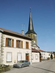
The Church, consecrated to the The Assumption of Our Lady, was controlled by the parish of nearby Aydoilles.
It is recorded that in 1892 the 60 families of the village owned between them 140 head of cattle.
On 27 September 1944, towards the end of the Second World War, 70 buildings suffered in a German bombing attack. Victims included the church windows.
Features
The village is the setting for a Christmas market at the end of each November.
The Church of the Assumption of Our Lady retains its dominating position in the heart of the village: villagers are particularly proud of three substantial church bells: Agathe (321 kg), Anne (440 kg) and Marie herself (647 kn).
 Watercourses at Méménil
See also
References
Categories:- Communes of Vosges
- Vosges geography stubs


Wikimedia Foundation. 2010.