- Palmyra, Pennsylvania
Infobox Settlement
official_name = Palmyra, Pennsylvania
other_name =
native_name =
nickname =
settlement_type = Borough
motto =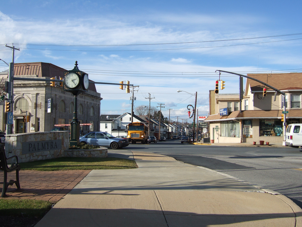
imagesize =
image_caption = Downtown Palmyra
flag_size =
image_
seal_size =
image_shield =
shield_size =
image_blank_emblem =
blank_emblem_size =
mapsize = 250x200px
map_caption = Map of Lebanon County, Pennsylvania highlighting Palmyra
mapsize1 =
map_caption1 =
image_dot_
dot_mapsize =
dot_map_caption =
dot_x =
dot_y =
pushpin_
pushpin_label_position =
pushpin_map_caption =
pushpin_mapsize =
subdivision_type = Country
subdivision_name =United States
subdivision_type1 = State
subdivision_name1 =Pennsylvania
subdivision_type2 = County
subdivision_name2 = Lebanon
subdivision_type3 =
subdivision_name3 =
subdivision_type4 =
subdivision_name4 =
government_footnotes =
government_type =
leader_title =
leader_name =
leader_title1 =
leader_name1 =
leader_title2 =
leader_name2 =
leader_title3 =
leader_name3 =
leader_title4 =
leader_name4 =
established_title = Settled
established_date = 1717
established_title2 = Incorporated (borough)
established_date2 = 1913
area_magnitude =
unit_pref =
unit_pref = Imperial
area_footnotes =
area_total_km2 = 4.8
area_land_km2 =
area_water_km2 =
area_total_sq_mi = 1.9
area_land_sq_mi =
area_water_sq_mi =
area_water_percent =
area_urban_km2 =
area_urban_sq_mi =
area_metro_km2 =
area_metro_sq_mi =
area_blank1_title =
area_blank1_km2 =
area_blank1_sq_mi =
population_as_of = 2000
population_footnotes =
population_note =
population_total = 7096
population_density_km2 = 1473.0
population_density_sq_mi = 3814.3
population_metro =
population_density_metro_km2 =
population_density_metro_sq_mi =
population_urban =
population_density_urban_km2 =
population_density_urban_sq_mi =
population_blank1_title =
population_blank1 =
population_density_blank1_km2 =
population_density_blank1_sq_mi =
timezone = Eastern (EST)
utc_offset = -5
timezone_DST = EDT
utc_offset_DST = -4
latd = 40
latm = 18
lats = 29
latNS = N
longd = 76
longm = 35
longs = 38
longEW = W
elevation_footnotes =
elevation_m =
elevation_ft = 456
postal_code_type =
postal_code =
area_code = 717
blank_name =
blank_info =
blank1_name =
blank1_info =
website = [http://www.palmyrapa.com/ Palmyra]
footnotes =Palmyra is a
borough in Lebanon County,Pennsylvania ,United States . It is part of theLebanon County, PA Metropolitan Statistical Area . The population was 7,096 at the 2000 census.Geography
Palmyra is located at coor dms|40|18|29|N|76|35|38|W|city (40.307960, -76.593782).GR|1
According to the
United States Census Bureau , the borough has a total area of 1.9 square miles (4.8 km²), all of it land.Palmyra is located in the Lebanon Valley between Annville and Hershey. Situated on the western edge of Lebanon County, the borough is 10 mi (16 km) west of Lebanon, and 17 mi (27 km) east of Harrisburg. The village of Campbelltown is only 2 mi (3 km) south of Palmyra.
Palmyra sits atop a portion of the Indian Echo Cavern System. Because of this, the Palmyra area is frequently plagued by
sinkhole s. Although no water source runs directly through the borough, the Killinger, Quittapahilla, Spring, and Swatara Creeks are all nearby.History
Early Settlement
The land on which Palmyra rests was originally home to the
Lenape andSusquehannock tribes. The first European explorers and traders came to the region around 1650. Settlers were drawn to the area because of its rich land and abundance of fish and game. Additionally, being part ofWilliam Penn ’s colony, his charter providing civil rights and religious freedom also attracted settlers to the area. In the beginning of its colonization, many ofPennsylvania ’s settlers occupied the land not through acquiring the legal rights, but by building on any unclaimed land they found, orsquatting . The squatters came to the Palmyra area between 1717 and 1740. Because the squatters had no official documents stating when they came to the land, it is difficult to precisely trace family migrations to and from the area. From looking at what records do exist, and by the people still living in the Palmyra area, it is clear that the first settlers to live near Palmyra came from two distinct nationalities, the Scotch-Irish and the German Palatinates. The Scotch-Irish immigrants left their homelands due to a number of political, economic and religious reasons. As expected, they were clannish, and tended not to mix with the other ethnic groups settling the area at the same time. They were also politically-minded, and became involved in local governments quickly after settling in the area. A majority of the Scotch-Irish were Presbyterian, and they established several churches as they moved westward across the state. Examples of the churches they built include Donegal in Lancaster County, Derry near Hershey, Paxtang near Harrisburg, and Silver Spring near Carlisle. As the years passed, many of the Scotch-Irish continued westward, leaving the Lebanon Valley. Of the first Scotch-Irish settlers in the Palmyra area, the surnames of Aspey, Campbell, Caruthers, Ewing, Galbraith, McCallen, McClure, McCord, Mitchell, Sawyer, Walker and Wilson are recorded.The German Palatinates who settled in Pennsylvania, erroneously known as the
Pennsylvania Dutch , also left their homelands for a number of reasons. Politically they had been oppressed in the old country, and economically they were poor. They were also gravely persecuted for their religious beliefs. Like the Scotch-Irish, the Germans kept to themselves and did not interfere with settlers of other backgrounds. Throughout the parts of Pennsylvania that had already been settled, German was the prominently spoken language, surpassing English. This encouraged more German settlers to lay down roots in Pennsylvania more so than in the other colonies. Most of the German settlers were farmers, and they flourished in rural areas. These Germans saw farming as a way of life, and tended to be conservative, religious, frugal and hard working people. Unlike the Scotch-Irish, the Germans were not politically-minded, and they had no qualms with the English governing them. A majority of the Germans did not leave Pennsylvania, but stayed to work the rich soil. Of the first German settlers in the Palmyra area, the surnames of Bindnagle, Bowman, Carmany, Deininger, Early, Forney, Gingrich, Hemperly, Kettering, Killinger, Naftzger, Nye, Ober, Ricker, and Zimmerman are recorded.The Palmyra area, as well as the entire western edge of the European colonies, was susceptible to attack from the tribes of natives living in the region. In their histories of Lebanon County, Rupp and Egle note many raids that took place in what is now northern Lebanon County. In 1756, the Provincial government decided to build a chain of forts stretching from the
Susquehanna River at Harrisburg in the west to theDelaware River at Easton in the east. These forts were built at regular intervals, roughly ten to fifteen miles (24 km) apart, and in any major gaps along the mountains. One of these forts, Fort Swatara, was built by Capt. Frederick Smith near modern-day Inwood where the Swatara Creek flows through the Blue Mountain. By the end of theFrench and Indian War in 1763, the frequency and intensity of native attacks diminished.Johannes Palm
Johannes Palm, whose name is often anglicized to John Palm, is given credit for founding Palmyra. He was a prominent figure in the early days of the community, who served his country as a doctor and soldier.
Johannes Palm was born in
Heilbronn to Matthias and Sibylla Palm on July 15, 1713. At the time, Heilbronn was still an independent "reichsstadt" (Free Imperial City ). In 1739, Palm moved toBacknang , nearStuttgart . He married Christina Dorothea Kern on August 2, 1740. After a visit toAmsterdam , Palm began to study medicine inWürttemberg . He was most likely aided by relatives, as many physicians and druggists in Württemberg at that time held the Palm family name. Palm left Germany, and arrived inPhiladelphia in 1749. He first settled in NorthernNew Jersey , near Elizabeth. After the death of his wife, he married Catharine Salome Fenger around 1754. He would outlive her as well. On June 17, 1766, Palm secured his convert|100|acre|km2|sing=on plot from Conrad Raisch. Palm was the third owner of the tract since it was surveyed for Johannes Deininger in 1751. This tract can be located today using Railroad St. as the eastern border, Maple St. as the southern border, and the Dauphin County Line as the western border. His house would be in the center of the 100 block on W. Main St.By the time the
American Revolution broke out in 1775, Palm was 62. Although he felt was too old to take an active part in the revolution, he did participate in theBattle of Brandywine on September 11, 1777. He would later recall howGeorge Washington would encourage his men in battle. Sixteen days after he served at Brandywine, Palm took the Oath of Allegiance and Fidelity beforeJustice of the Peace John Thomas. Ten other soldiers from the Palmyra area also served in the American Revolution. Their names are recorded and their graves are marked in Bindnagle Cemetery.Palm had an extensive medical practice. Since the region was still sparsely populated, many of his patients traveled great distances to receive his attention. He had a sophisticated laboratory where he prepared most of his medicines. He distilled his own essential oils and waters from herbs, flowers and other plants. His medical books were mostly from German authors. Palm was baptized and confirmed into the Lutheran Church.
Johannes Palm died on April 25, 1799 in Palmyra at the age of 85. He had practiced medicine in North America for nearly 50 years.
On July 24, 1932, American Legion Post No. 72, with the assistance of S. M. Aument of Montoursville, a great-great-great-great granddaughter of Johannes Palm, unveiled a new marker at Palm’s grave at Bindnagle Cemetery. On November 20 of that same year, the John Palm Memorial was erected on a small triangle of land on Railroad St. On hand was Dr. Howard Palm of Camden, who was also a direct descendant of Johannes Palm.
Growth of Palmstown
Transportation from one settlement to the next was essential if either settlement wanted to grow. Most of the early settlers built their homes along the road (now
US 422 ) leading from Millerstown (now Annville) to Derry (now Hershey). Other important roads that crossed the Palmyra area include the road which led from the Bindnagle settlement to Campbelltown (nowPA 117 ), and the Downingtown, Ephrata and Harrisburg Pike, which was known as the Horseshoe Pike (nowUS 322 ). With the incorporation of Harrisburg as the State Capital in 1812, even more travelers began to come to the area. A direct route from Reading to Harrisburg opened in 1817. Known as the Berks and Dauphin Turnpike, U.S. Route 422 ran directly through Palmyra, and employed the settlement’s only real street, Main St. With the opening of these routes, more and more traffic moved through the Palmyra area. The passage of more travelers encouraged taverns and hotels to be built in Palmyra to accommodate them. In the first decades of the 19th century, Palmyra had five taverns and three hotels to serve the needs of those moving through the area. Blacksmith shops, general stores and other small business also began to pop up in Palmyra to serve both travelers and locals alike.The U.S. Mail also began to arrive in Palmyra. The settlement’s Post Office was established on April 1, 1804. The name of the town submitted to the Postal Service was “Palmstown”, in honor of Johannes Palm. Yet in the following year, there are records of the settlement being referred to as “Palmyra”, most likely referencing the Roman outpost of
Palmyra inSyria . The exact date of the name change, and the reason for the change, remains one of the town’s mysteries. Both names were used throughout the early 19th century. The demand of greater speed and tonnage of goods being moved prompted the building of the Union Canal. Completed in 1827, the Union Canal connected theSchuylkill River at Reading to the Susquehanna River at Middletown. The canal passed just north of Palmyra, and the settlement’s citizens benefited from the increased traffic. The canal was later widened to allow larger boats to pass through in 1849. The Age of Steam also came to Palmyra in 1857, as the first locomotives ran through the settlement on the Lebanon Valley Railroad in that year. Two years later, the Lebanon Valley Railroad merged with the Philadelphia and Reading Railroad to form the Reading Railroad. The growth of rail traffic signaled the end for the Union Canal, and for the Berks and Dauphin Turnpike as a toll road.Palmyra Since the Civil War
Palmyra continued to grow steadily through the 19th & 20th Centuries. By 1845, the settlement consisted of 160 people in about 20 dwellings. By 1875, the population had increased to 500 people in about 100 dwellings. By 1890, the population had skyrocketed in just fifteen years to 1,760 people. And by 1960, the population had reached 7,000. With the fall of
Fort Sumter in 1861 to the Confederate Army, PresidentAbraham Lincoln called on volunteers to preserve the Union. About 78 men from the Palmyra area answered the President’s call, and donned the blue uniforms of the Union. After the Civil War concluded in 1865, a variety of new businesses were established to better serve the Palmyra area. A large grain warehouse, a slaughterhouse and lumber mill were some of the first industries developed in Palmyra. The town’s first newspaper was printed in 1878 and was titled “The Londonderry Gazette”. The Palmyra Bank opened in 1887. The first of several shoe factories opened in 1888. A knitting mill, paper box factory, gas and fuel company, bakery, bottling works, and a feed mill was also open in Palmyra around the turn of the century. The growth ofMilton S. Hershey ’s chocolate company in nearby Derry also encouraged people to move to the Palmyra area.In 1899, the Lebanon Valley Street Railway Company was formed to provide transit across the length of Lebanon County. The trolley line reached Palmyra in 1904. By this time, the Hershey Trolley Company had also formed, and soon thereafter connected to the Lebanon Valley Line at the square in Palmyra. This trolley connected lasted until 1933, when the Lebanon Valley system switched to bus services. By 1946, the Hershey Line also folded.
250th Anniversary
Palmyra will celebrate its 250th Anniversary in 2010. A committee has been formed to plan the commemoration, and among other duties, has selected the official logo for the anniversary. 18 yr. old Tyler Keshner created the design, which is modeled on the Pennsylvania state seal and features the official orange and black colors of the Palmyra School District. Visit [http://www.palmyrapa.com/250thBirthday the official anniversary website] to view an image of the winning logo.
Culture
Palmyra in Popular Culture
The 2000 film
Lucky Numbers , starringJohn Travolta had multiple scenes shot throughout Palmyra.Economy
Due to its position between Harrisburg and Lebanon, and the popularity of neighboring Hershey, Palmyra is economically prosperous. Palmyra is the headquarters for several companies, including [http://www.askfoods.com/ ASK Foods, Inc.] , [http://www.decherts.com/ Dechert Dynamics Corp.] ,
Das Distributors, Inc. , [http://www.pachevroletbuickpontiac.com/ Klick-Lewis, Inc.] , and thePalmyra Bologna Co., Inc. , which produces [http://www.seltzerslebanonbologna.com/ Seltzer's Lebanon Bologna] .Demographics
As of the
census GR|2 of 2000, there were 7,096 people, 3,200 households, and 1,952 families residing in the borough. Thepopulation density was 3,814.3 people per square mile (1,473.0/km²). There were 3,363 housing units at an average density of 1,807.7/sq mi (698.1/km²). The racial makeup of the borough was 96.72% White, 0.90% African American, 0.11% Native American, 0.92% Asian, 0.01% Pacific Islander, 0.34% from other races, and 1.00% from two or more races. Hispanic or Latino of any race were 1.20% of the population.There were 3,200 households out of which 25.9% had children under the age of 18 living with them, 47.7% were married couples living together, 10.2% had a female householder with no husband present, and 39.0% were non-families. 34.3% of all households were made up of individuals and 14.4% had someone living alone who was 65 years of age or older. The average household size was 2.20 and the average family size was 2.83.
In the borough the population was spread out with 22.2% under the age of 18, 8.0% from 18 to 24, 30.4% from 25 to 44, 21.4% from 45 to 64, and 18.0% who were 65 years of age or older. The median age was 38 years. For every 100 females there were 88.3 males. For every 100 females age 18 and over, there were 82.8 males.
The median income for a household in the borough was $39,677, and the median income for a family was $49,091. Males had a median income of $35,140 versus $25,524 for females. The
per capita income for the borough was $20,500. About 3.9% of families and 5.3% of the population were below thepoverty line , including 5.2% of those under age 18 and 6.4% of those age 65 or over.Education
The first two free public schools opened in Palmyra in 1840. Before this time, church schools and private schools served the children of Palmyra.
In addition to the public schools, the Palmyra Academy, also known as the Witmer Academy after its founder, Peter B. Witmer, opened in 1857. The Palmyra Academy was praised as one of the best schools of its kind in the area. It prepared its students for continued education at colleges and universities, and educated students from all around the Susquehanna Valley and neighboring states. The Palmyra Academy closed its doors in 1890, and the Academy Building was torn down nine years later.
Coming with the growth of the area and the formation of a Borough Government, the Palmyra Borough School District was created in 1913. The first building for the district was erected on South Railroad St. on October 12, 1915. A new secondary school serving grades seven through twelve was built on W. Cherry St. in 1937.
In 1952, the directors of the Borough of Palmyra and North Londonderry Township agreed to operate their schools cooperatively, and three years later merged to create the Palmyra Area School District. In 1962, the schools of South Londonderry Township joined the Palmyra Area School District.
This district consists of five schools; Three elementary (Forge Road, Pine Street, and Northside) and two secondary (High School and Middle School). Recent Renovations were completed on the High School in 2007. The district is currently planning and acquiring land for a fourth elementary school.
Since its formation the district has served the Borough of Palmyra, and both North and South Londonderry Townships, including the villages of Campbelltown, Lawn and Mt. Gretna. The Palmyra Area School District currently operates three elementary schools, one middle school and one high school. All school buildings are located within the Borough of Palmyra, with the exception of the high school, which is just outside the borough limits in North Londonderry Township.
The school colors of the district are
Black and Orange, and the school mascot is theCougar . In 1999, the Palmyra High School baseball team defeated Waynesburg for thePennsylvania Interscholastic Athletic Association Class AA Championship, giving Palmyra a PIAA Title.In 2005 the Palmyra High School field hockey team won the PIAA Class AA Championship
In 2007, the Palmyra High School soccer team defeated Mars for the PIAA Class AA championship.
Visit the district's official [http://www.palmyra.k12.pa.us homepage] for more information.
References
Bowman, Ray S. (1960). A Brief History of Palmyra, Pennsylvania. In "This Is Palmyra: 200th Anniversary" (pp. 6-13). External links
Wikimedia Foundation. 2010.