- Douglas, North Dakota
-
Douglas, North Dakota — City — Location of Douglas, North Dakota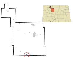
Coordinates: 47°51′28″N 101°30′8″W / 47.85778°N 101.50222°WCoordinates: 47°51′28″N 101°30′8″W / 47.85778°N 101.50222°W Country United States State North Dakota County Ward Area – Total 0.3 sq mi (0.8 km2) – Land 0.3 sq mi (0.7 km2) – Water 0.0 sq mi (0.0 km2) Elevation 2,054 ft (626 m) Population (2010)[1] – Total 64 – Density 223.1/sq mi (86.2/km2) Time zone Central (CST) (UTC-6) – Summer (DST) CDT (UTC-5) ZIP code 58735 Area code(s) 701 FIPS code 38-20020[2] GNIS feature ID 1028705[3] Douglas is a city in Ward County, North Dakota in the United States. The population was 64 at the 2010 census.[1] It is part of the Minot Micropolitan Statistical Area. Douglas was founded in 1906.
Geography
Douglas is located at 47°51′28″N 101°30′8″W / 47.85778°N 101.50222°W (47.857725, -101.502198)[4].
According to the United States Census Bureau, the city has a total area of 0.3 square miles (0.78 km2), of which, 0.3 square miles (0.78 km2) of it is land and 0.04 square miles (0.10 km2) of it (6.67%) is water.
Demographics
Historical populations Census Pop. %± 1910 171 — 1920 284 66.1% 1930 288 1.4% 1940 313 8.7% 1950 236 −24.6% 1960 210 −11.0% 1970 144 −31.4% 1980 112 −22.2% 1990 93 −17.0% 2000 64 −31.2% 2010 64 0% U.S. Decennial Census As of the census[2] of 2000, there were 64 people, 30 households, and 17 families residing in the city. The population density was 223.1 people per square mile (85.2/km²). There were 44 housing units at an average density of 153.4 per square mile (58.6/km²). The racial makeup of the city was 93.75% White and 6.25% Native American. Hispanic or Latino of any race were 3.12% of the population.
There were 30 households out of which 16.7% had children under the age of 18 living with them, 46.7% were married couples living together, 10.0% had a female householder with no husband present, and 43.3% were non-families. 36.7% of all households were made up of individuals and 20.0% had someone living alone who was 65 years of age or older. The average household size was 2.13 and the average family size was 2.59.
In the city the population was spread out with 17.2% under the age of 18, 7.8% from 18 to 24, 15.6% from 25 to 44, 40.6% from 45 to 64, and 18.8% who were 65 years of age or older. The median age was 49 years. For every 100 females there were 68.4 males. For every 100 females age 18 and over, there were 76.7 males.
The median income for a household in the city was $23,125, and the median income for a family was $43,333. Males had a median income of $31,000 versus $14,444 for females. The per capita income for the city was $14,409. There were 7.1% of families and 13.0% of the population living below the poverty line, including 100.0% of under eighteens and none of those over 64.
References
- ^ a b "2010 Census Redistricting Data (Public Law 94-171) Summary File". American FactFinder. United States Census Bureau. http://factfinder2.census.gov/faces/tableservices/jsf/pages/productview.xhtml?pid=DEC_10_PL_GCTPL2.ST13&prodType=table. Retrieved 2 May 2011.
- ^ a b "American FactFinder". United States Census Bureau. http://factfinder.census.gov. Retrieved 2008-01-31.
- ^ "US Board on Geographic Names". United States Geological Survey. 2007-10-25. http://geonames.usgs.gov. Retrieved 2008-01-31.
- ^ "US Gazetteer files: 2010, 2000, and 1990". United States Census Bureau. 2011-02-12. http://www.census.gov/geo/www/gazetteer/gazette.html. Retrieved 2011-04-23.
Municipalities and communities of Ward County, North Dakota Cities 
Townships Afton | Anna | Baden | Berthold | Brillian | Burlington | Burt | Cameron | Carbondale | Carpio | Denmark | Des Lacs | Elmdale | Eureka | Evergreen | Foxholm | Freedom | Gasman | Greely | Greenbush | Harrison | Hiddenwood | Hilton | Iota Flat | Kenmare | Kirkelie | Linton | Lund | Mandan | Margaret | Maryland | Mayland | McKinley | Nedrose | New Prairie | Newman | Orlien | Passport | Ree | Rice Lake | Rolling Green | Ruthville | Rushville | Ryder | St. Marys | Sauk Prairie | Sawyer | Shealy | Spencer | Spring Lake | Sundre | Surrey | Tatman | Tolgen | Torning | Vang | Waterford | Willis
CDPs Foxholm | Logan | Minot AFB | Ruthville
Unincorporated
communitiesAurelia | Drady | Hartland | Hesnault | Lynch | Lonetree | Ralston | Rice Lake | Roach | Wolseth
Categories:- Cities in North Dakota
- Populated places in Ward County, North Dakota
- Populated places established in 1906
- Minot micropolitan area


Wikimedia Foundation. 2010.