- Mercer, North Dakota
-
This article is about the city of Mercer. For the county, see Mercer County, North Dakota.
Mercer, North Dakota — City — Location of Mercer, North Dakota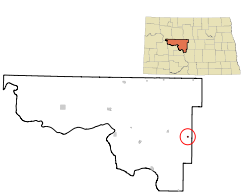
Coordinates: 47°29′26″N 100°42′41″W / 47.49056°N 100.71139°WCoordinates: 47°29′26″N 100°42′41″W / 47.49056°N 100.71139°W Country United States State North Dakota County McLean Area – Total 0.2 sq mi (0.6 km2) – Land 0.2 sq mi (0.6 km2) – Water 0.0 sq mi (0.0 km2) Elevation 1,929 ft (588 m) Population (2010)[1] – Total 94 – Density 398.2/sq mi (153.7/km2) Time zone Central (CST) (UTC-6) – Summer (DST) CDT (UTC-5) ZIP code 58559 Area code(s) 701 FIPS code 38-52340[2] GNIS feature ID 1030203[3] Mercer is a city in McLean County, North Dakota in the United States. The population was 94 at the 2010 census.[1]
Mercer was founded in 1905 along a now-abandoned branch line of the Northern Pacific Railway extending from Carrington to Turtle Lake. The name comes from William Henry Harrison Mercer, a well known rancher in the Missouri River Valley for many years and for whom Mercer County is also named.[4]
The city of Mercer lies on North Dakota Highway 200 between Underwood and McClusky.
Geography
Mercer is located at 47°29′26″N 100°42′41″W / 47.49056°N 100.71139°W (47.490594, -100.711254)[5].
According to the United States Census Bureau, the city has a total area of 0.2 square miles (0.52 km2), of which, 0.2 square miles (0.52 km2) of it is land and 4.55% is water.
Demographics
Historical populations Census Pop. %± 1950 214 — 1960 154 −28.0% 1970 132 −14.3% 1980 134 1.5% 1990 104 −22.4% 2000 86 −17.3% 2010 94 9.3% U.S. Decennial Census As of the census[2] of 2000, there were 86 people, 49 households, and 22 families residing in the city. The population density was 398.2 people per square mile (150.9/km²). There were 56 housing units at an average density of 259.3 per square mile (98.3/km²). The racial makeup of the city was 100.00% White.
There were 49 households out of which 18.4% had children under the age of 18 living with them, 36.7% were married couples living together, 4.1% had a female householder with no husband present, and 55.1% were non-families. 55.1% of all households were made up of individuals and 32.7% had someone living alone who was 65 years of age or older. The average household size was 1.76 and the average family size was 2.59.
In the city the population was spread out with 16.3% under the age of 18, 2.3% from 18 to 24, 20.9% from 25 to 44, 29.1% from 45 to 64, and 31.4% who were 65 years of age or older. The median age was 51 years. For every 100 females there were 75.5 males. For every 100 females age 18 and over, there were 71.4 males.
The median income for a household in the city was $28,750, and the median income for a family was $46,250. Males had a median income of $48,125 versus $15,000 for females. The per capita income for the city was $18,937. There were 25.0% of families and 25.3% of the population living below the poverty line, including 23.5% who were under eighteen and 34.8% who were over 64.
References
- ^ a b "2010 Census Redistricting Data (Public Law 94-171) Summary File". American FactFinder. United States Census Bureau. http://factfinder2.census.gov/faces/tableservices/jsf/pages/productview.xhtml?pid=DEC_10_PL_GCTPL2.ST13&prodType=table. Retrieved 2 May 2011.
- ^ a b "American FactFinder". United States Census Bureau. http://factfinder.census.gov. Retrieved 2008-01-31.
- ^ "US Board on Geographic Names". United States Geological Survey. 2007-10-25. http://geonames.usgs.gov. Retrieved 2008-01-31.
- ^ Wick, Douglas A.. "Mercer (McLean County)". North Dakota Place Names. http://www.webfamilytree.com/North_Dakota_Place_Names/M/mercer_%28mclean_county%29.htm. Retrieved 6 May 2011.
- ^ "US Gazetteer files: 2010, 2000, and 1990". United States Census Bureau. 2011-02-12. http://www.census.gov/geo/www/gazetteer/gazette.html. Retrieved 2011-04-23.
Municipalities and communities of McLean County, North Dakota Cities 
Townships Amundsville | Andrews | Aurena | Blackwater | Blue Hill | Butte | Byersville | Cremerville | Deepwater | Dogden | Douglas | Gate | Greatstone | Horseshoe Valley | Lake Williams | Longfellow | Loquemont | Malcolm | McGinnis | Medicine Hill | Mercer | Otis | Roseglen | Rosemont | Snow | St. Mary | Turtle Lake | Victoria | Wise |
CDP Unorganized
territoryEast McLean | Fort Berthold | North Central McLean | South McLean | Underwood | West McLean
Unincorporated
communityEmmet | Falkirk | Merida | Raub | Riverdale Junction | Roseglen
Footnotes ‡This populated place also has portions in an adjacent county or counties
Categories:- Cities in North Dakota
- Populated places in McLean County, North Dakota
- Populated places established in 1905


Wikimedia Foundation. 2010.