- Neche, North Dakota
-
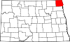
Neche, North Dakota — City — An old hotel in Neche Location of Neche, North Dakota
Coordinates: 48°59′1″N 97°33′3″W / 48.98361°N 97.55083°WCoordinates: 48°59′1″N 97°33′3″W / 48.98361°N 97.55083°W Country United States State North Dakota County Pembina Founded 1882 Area – Total 0.4 sq mi (0.9 km2) – Land 0.4 sq mi (0.9 km2) – Water 0.0 sq mi (0.0 km2) Elevation 823 ft (251 m) Population (2010)[1] – Total 371 – Density 1,248.0/sq mi (481.9/km2) Time zone Central (CST) (UTC-6) – Summer (DST) CDT (UTC-5) ZIP code 58265 Area code(s) 701 FIPS code 38-55620[2] GNIS feature ID 1030364[3] Neche (pronunciation: /ˈnɪtʃiː/ nich-ee) is a city in Pembina County, North Dakota in the United States. It sits on the banks of the Pembina River. The population was 371 at the 2010 census.[1] Neche was founded in 1882. The name is said to come from the Ojibwe word nidji, which means friend, neighbor, or one like myself.[4]
Contents
Geography
Neche is located at 48°59′1″N 97°33′3″W / 48.98361°N 97.55083°W (48.983610, -97.550732).[5]
According to the United States Census Bureau, the city has a total area of 0.3 square miles (0.78 km2), all of it land.
The closest community to Neche is Gretna, Manitoba, on the other side of the United States-Canada border.
Demographics
Historical populations Census Pop. %± 1890 314 — 1900 682 117.2% 1910 528 −22.6% 1920 528 0% 1930 502 −4.9% 1940 565 12.5% 1950 615 8.8% 1960 545 −11.4% 1970 451 −17.2% 1980 471 4.4% 1990 434 −7.9% 2000 437 0.7% 2010 371 −15.1% U.S. Decennial Census As of the census[2] of 2000, there were 437 people, 169 households, and 114 families residing in the city. The population density was 1,248.0 people per square mile (482.1/km²). There were 188 housing units at an average density of 536.9 per square mile (207.4/km²). The racial makeup of the city was 98.40% White, 0.46% Native American, 0.23% Asian, 0.69% from other races, and 0.23% from two or more races. Hispanic or Latino of any race were 5.26% of the population.
There were 169 households out of which 33.7% had children under the age of 18 living with them, 59.8% were married couples living together, 4.7% had a female householder with no husband present, and 32.0% were non-families. 29.6% of all households were made up of individuals and 13.6% had someone living alone who was 65 years of age or older. The average household size was 2.59 and the average family size was 3.25.
In the city the population was spread out with 24.9% under the age of 18, 10.5% from 18 to 24, 21.1% from 25 to 44, 25.6% from 45 to 64, and 17.8% who were 65 years of age or older. The median age was 41 years. For every 100 females there were 113.2 males. For every 100 females age 18 and over, there were 105.0 males.
The median income for a household in the city was $42,500, and the median income for a family was $48,125. Males had a median income of $26,563 versus $21,875 for females. The per capita income for the city was $23,813. About 7.1% of families and 7.9% of the population were below the poverty line, including 17.6% of those under age 18 and 6.6% of those age 65 or over.
Notable people
- Henry Gurke, World War II Medal of Honor recipient.
- James H Symington, former leader of the Exclusive Brethren.
References
- ^ a b "2010 Census Redistricting Data (Public Law 94-171) Summary File". American FactFinder. United States Census Bureau. http://factfinder2.census.gov/faces/tableservices/jsf/pages/productview.xhtml?pid=DEC_10_PL_GCTPL2.ST13&prodType=table. Retrieved 2 May 2011.
- ^ a b "American FactFinder". United States Census Bureau. http://factfinder.census.gov. Retrieved 2008-01-31.
- ^ "US Board on Geographic Names". United States Geological Survey. 2007-10-25. http://geonames.usgs.gov. Retrieved 2008-01-31.
- ^ Wick, Douglas A.. "Neche (Pembina County)". North Dakota Place Names. http://www.webfamilytree.com/North_Dakota_Place_Names/N/neche_%28pembina_county%29.htm. Retrieved 4 May 2011.
- ^ "US Gazetteer files: 2010, 2000, and 1990". United States Census Bureau. 2011-02-12. http://www.census.gov/geo/www/gazetteer/gazette.html. Retrieved 2011-04-23.
Municipalities and communities of Pembina County, North Dakota Cities Bathgate | Canton City | Cavalier | Crystal | Drayton | Hamilton | Mountain | Neche | Pembina | St. Thomas | Walhalla
Townships Unincorporated
communitiesAkra | Backoo | Bowesmont | Concrete | Fleece | Gardar | Glasston | Hallson | Joliette | Leroy | Leyden | McArthur | Pittsburgh | Svold
Categories:- Cities in North Dakota
- Populated places in Pembina County, North Dakota
- Populated places established in 1882


Wikimedia Foundation. 2010.