- Dickey, North Dakota
-
Dickey, North Dakota — City — Location of Dickey, North Dakota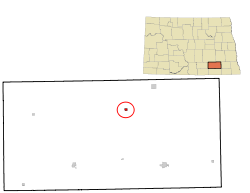
Coordinates: 46°32′11″N 98°28′11″W / 46.53639°N 98.46972°WCoordinates: 46°32′11″N 98°28′11″W / 46.53639°N 98.46972°W Country United States State North Dakota County LaMoure Area – Total 0.2 sq mi (0.6 km2) – Land 0.2 sq mi (0.6 km2) – Water 0.0 sq mi (0.0 km2) Elevation 1,355 ft (413 m) Population (2010)[1] – Total 42 – Density 260.8/sq mi (100.7/km2) Time zone Central (CST) (UTC-6) – Summer (DST) CDT (UTC-5) ZIP code 58431 Area code(s) 701 FIPS code 38-19580[2] GNIS feature ID 1033635[3] Dickey is a city in LaMoure County, North Dakota in the United States. The population was 42 at the 2010 census.[1] Dickey was founded in 1885.
Geography
Dickey is located at 46°32′11″N 98°28′11″W / 46.53639°N 98.46972°W (46.536315, -98.469659)[4].
According to the United States Census Bureau, the city has a total area of 0.2 square miles (0.52 km2), all of it land.
Demographics
Historical populations Census Pop. %± 1910 187 — 1920 190 1.6% 1930 168 −11.6% 1940 203 20.8% 1950 165 −18.7% 1960 143 −13.3% 1970 118 −17.5% 1980 74 −37.3% 1990 53 −28.4% 2000 57 7.5% 2010 42 −26.3% U.S. Decennial Census As of the census[2] of 2000, there were 57 people, 26 households, and 12 families residing in the city. The population density was 260.8 people per square mile (100.0/km²). There were 31 housing units at an average density of 141.8 per square mile (54.4/km²). The racial makeup of the city was 100.00% White.
There were 26 households out of which 26.9% had children under the age of 18 living with them, 38.5% were married couples living together, 3.8% had a female householder with no husband present, and 53.8% were non-families. 53.8% of all households were made up of individuals and 30.8% had someone living alone who was 65 years of age or older. The average household size was 2.19 and the average family size was 3.50.
In the city the population was spread out with 17.5% under the age of 18, 14.0% from 18 to 24, 21.1% from 25 to 44, 29.8% from 45 to 64, and 17.5% who were 65 years of age or older. The median age was 43 years. For every 100 females there were 119.2 males. For every 100 females age 18 and over, there were 104.3 males.
The median income for a household in the city was $18,500, and the median income for a family was $23,750. Males had a median income of $28,333 versus $11,250 for females. The per capita income for the city was $10,547. There were 50.0% of families and 39.0% of the population living below the poverty line, including 16.7% of under eighteens and none of those over 64.
References
- ^ a b "2010 Census Redistricting Data (Public Law 94-171) Summary File". American FactFinder. United States Census Bureau. http://factfinder2.census.gov/faces/tableservices/jsf/pages/productview.xhtml?pid=DEC_10_PL_GCTPL2.ST13&prodType=table. Retrieved 2 May 2011.
- ^ a b "American FactFinder". United States Census Bureau. http://factfinder.census.gov. Retrieved 2008-01-31.
- ^ "US Board on Geographic Names". United States Geological Survey. 2007-10-25. http://geonames.usgs.gov. Retrieved 2008-01-31.
- ^ "US Gazetteer files: 2010, 2000, and 1990". United States Census Bureau. 2011-02-12. http://www.census.gov/geo/www/gazetteer/gazette.html. Retrieved 2011-04-23.
Municipalities and communities of LaMoure County, North Dakota Cities 
Townships Adrian | Alfred | Badger | Black Loam | Bluebird | Dean | Gladstone | Glen | Glenmore | Golden Glen | Grand Rapids | Grandview | Greenville | Henrietta | Kennison | Litchville | Mikkelson | Nora | Norden | Ovid | Pearl Lake | Pomona View | Prairie | Raney | Ray | Roscoe | Russell | Ryan | Saratoga | Sheridan | Swede | Wano | Willowbank
Unincorporated
communitiesAdrian | Alfred | Deisem | Grand Rapids | Independence | Medberry | Nortonville
Categories:- Cities in North Dakota
- Populated places in LaMoure County, North Dakota
- Populated places established in 1885


Wikimedia Foundation. 2010.