- Dunn Center, North Dakota
-
Dunn Center, North Dakota — City — Location of Dunn Center, North Dakota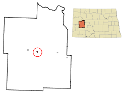
Coordinates: 47°21′12″N 102°37′22″W / 47.35333°N 102.62278°WCoordinates: 47°21′12″N 102°37′22″W / 47.35333°N 102.62278°W Country United States State North Dakota County Dunn Area – Total 0.4 sq mi (1.0 km2) – Land 0.4 sq mi (1.0 km2) – Water 0.0 sq mi (0.0 km2) Elevation 2,188 ft (667 m) Population (2010)[1] – Total 146 – Density 304.5/sq mi (117.6/km2) Time zone Mountain (MST) (UTC-7) – Summer (DST) MDT (UTC-6) ZIP code 58626 Area code(s) 701 FIPS code 38-20940[2] GNIS feature ID 1028746[3] Dunn Center is a city in Dunn County, North Dakota in the United States. The population was 146 at the 2010 census.[1] Dunn Center was founded in 1914.
Geography
Dunn Center is located at 47°21′12″N 102°37′22″W / 47.35333°N 102.62278°W (47.353307, -102.622740)[4].
According to the United States Census Bureau, the city has a total area of 0.4 square miles (1.0 km2), all of it land.
Dunn Center is located on North Dakota Highway 200 east of Lake Ilo.
Demographics
Historical populations Census Pop. %± 1920 247 — 1930 276 11.7% 1940 238 −13.8% 1950 246 3.4% 1960 250 1.6% 1970 107 −57.2% 1980 170 58.9% 1990 128 −24.7% 2000 122 −4.7% 2010 146 19.7% U.S. Decennial Census As of the census[2] of 2000, there were 122 people, 58 households, and 33 families residing in the city. The population density was 304.5 people per square mile (117.8/km²). There were 81 housing units at an average density of 202.2 per square mile (78.2/km²). The racial makeup of the city was 90.98% White, 6.56% Native American, and 2.46% from two or more races.
There were 58 households out of which 15.5% had children under the age of 18 living with them, 50.0% were married couples living together, 3.4% had a female householder with no husband present, and 43.1% were non-families. 36.2% of all households were made up of individuals and 20.7% had someone living alone who was 65 years of age or older. The average household size was 2.10 and the average family size was 2.67.
In the city the population was spread out with 16.4% under the age of 18, 4.9% from 18 to 24, 23.0% from 25 to 44, 32.8% from 45 to 64, and 23.0% who were 65 years of age or older. The median age was 49 years. For every 100 females there were 90.6 males. For every 100 females age 18 and over, there were 92.5 males.
The median income for a household in the city was $23,500, and the median income for a family was $27,500. Males had a median income of $18,750 versus $16,071 for females. The per capita income for the city was $13,736. There were 8.3% of families and 9.6% of the population living below the poverty line, including no under eighteens and 3.1% of those over 64.
References
- ^ a b "2010 Census Redistricting Data (Public Law 94-171) Summary File". American FactFinder. United States Census Bureau. http://factfinder2.census.gov/faces/tableservices/jsf/pages/productview.xhtml?pid=DEC_10_PL_GCTPL2.ST13&prodType=table. Retrieved 2 May 2011.
- ^ a b "American FactFinder". United States Census Bureau. http://factfinder.census.gov. Retrieved 2008-01-31.
- ^ "US Board on Geographic Names". United States Geological Survey. 2007-10-25. http://geonames.usgs.gov. Retrieved 2008-01-31.
- ^ "US Gazetteer files: 2010, 2000, and 1990". United States Census Bureau. 2011-02-12. http://www.census.gov/geo/www/gazetteer/gazette.html. Retrieved 2011-04-23.
Municipalities and communities of Dunn County, North Dakota Cities 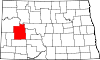
CDP Unorganized
territoriesFort Berthold | Halliday | Killdeer | South Dunn
Unincorporated
communitiesEmerson | Fayette | Hirschville | Marshall | Medicine Hole | New Hradec | Oakdale | Twin Buttes | Werner
Categories:- Cities in North Dakota
- Populated places in Dunn County, North Dakota
- Populated places established in 1914


Wikimedia Foundation. 2010.