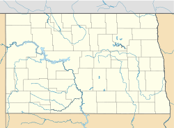
- Manning, North Dakota
-
Manning, North Dakota — Census-designated place — Location within the state of North Dakota Coordinates: 47°13′45″N 102°46′9″W / 47.22917°N 102.76917°WCoordinates: 47°13′45″N 102°46′9″W / 47.22917°N 102.76917°W Country United States State North Dakota County Dunn Elevation 1,834 ft (559 m) Population (2010)[1] – Total 74 Time zone Central (CST) (UTC-6) – Summer (DST) CDT (UTC-5) ZIP Code 58642 Area code(s) 701 FIPS code 38-50220[2] GNIS feature ID 2628576[2] Manning is a census-designated place in and the county seat of Dunn County, North Dakota, United States.[3] An unincorporated community, it was designated as part of the U.S. Census Bureau's Participant Statistical Areas Program on March 31, 2010.[4] It was not counted separately during the 2000 Census,[5] but was included in 2010 Census,[6] where a population of 74 was reported.[1] Its ZIP Code is 58642.
Historical populations Census Pop. %± 2010 74 — U.S. Decennial Census References
- ^ a b "2010 Census Redistricting Data (Public Law 94-171) Summary File". American FactFinder. United States Census Bureau. http://factfinder2.census.gov/faces/tableservices/jsf/pages/productview.xhtml?pid=DEC_10_PL_GCTPL2.ST13&prodType=table. Retrieved 2 May 2011.
- ^ a b "US Board on Geographic Names". United States Geological Survey. 2007-10-25. http://geonames.usgs.gov. Retrieved 2008-01-31.
- ^ "Find a County". National Association of Counties. http://www.naco.org/Counties/Pages/FindACounty.aspx. Retrieved 2011-06-07.
- ^ "Manning Census Designated Place". Geographic Names Information System, U.S. Geological Survey. http://geonames.usgs.gov/pls/gnispublic/f?p=gnispq:3:::NO::P3_FID:2628576. Retrieved 2010-07-13.
- ^ U.S. Census Bureau (2003). "Population and Housing Unit Counts, North Dakota" (PDF). 2000 Census of Population and Housing. Government Printing Office. http://www.census.gov/prod/cen2000/phc-3-36.pdf. Retrieved 2008-07-20.
- ^ U.S. Census Bureau (February 13, 2008). "Census Designated Place (CDP) Program for the 2010 Census—Final Criteria" (PDF). Federal Register. http://www.census.gov/geo/www/psap2010/cdp_criteria.pdf. Retrieved 2010-07-13.
Municipalities and communities of Dunn County, North Dakota County seat: ManningCities Dodge | Dunn Center | Halliday | Killdeer
CDP Manning
Unorganized
territoriesFort Berthold | Halliday | Killdeer | South Dunn
Unincorporated
communitiesEmerson | Fayette | Hirschville | Marshall | Medicine Hole | New Hradec | Oakdale | Twin Buttes | Werner
Categories:- North Dakota geography stubs
- Populated places in Dunn County, North Dakota
- Unincorporated communities in North Dakota
- County seats in North Dakota
- Census-designated places in North Dakota
Wikimedia Foundation. 2010.


