- Dazey, North Dakota
-
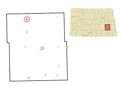
Dazey, North Dakota — City — Location of Dazey, North Dakota Location of Dazey, North Dakota Coordinates: 47°11′21″N 98°12′8″W / 47.18917°N 98.20222°WCoordinates: 47°11′21″N 98°12′8″W / 47.18917°N 98.20222°W Country United States State North Dakota County Barnes Founded 1883 Incorporated (village) 1904 Incorporated (city) 1967 Area – Total 0.4 sq mi (1.0 km2) – Land 0.4 sq mi (1.0 km2) – Water 0.0 sq mi (0.0 km2) Elevation 1,434 ft (437 m) Population (2010)[1] – Total 104 – Density 238.5/sq mi (92.1/km2) Time zone Central (CST) (UTC-6) – Summer (DST) CDT (UTC-5) ZIP code 58429 Area code(s) 701 FIPS code 38-18340[2] GNIS feature ID 1028623[3] Dazey is a city in Barnes County, North Dakota in the United States. The population was 104 at the 2010 census.[1] Dazey was founded in 1883 after a local farmer, Charles Dazey, donated land to start a townsite.[4]
Contents
Geography
According to the United States Census Bureau, the city has a total area of 0.4 square miles (1.0 km2), all land.
History
Dazey was founded in 1883 and named for Charles Turner Dazey, who moved there from Illinois to run a bonanza farm in the early 1880s. Mr. Dazey donated the land to start the townsite. Mr. Dazey later moved back to Illinois where he became a successful playwright.[4] It was incorporated as a village in 1904, and reached a peak population of 293 in 1920.[5] It became a city in 1967, after the North Dakota Legislature enacted legislation that eliminated all existing incorporation titles for towns and villages in the state.[6]
Demographics
Historical populations Census Pop. %± 1910 265 — 1920 293 10.6% 1930 251 −14.3% 1940 215 −14.3% 1950 196 −8.8% 1960 226 15.3% 1970 128 −43.4% 1980 143 11.7% 1990 129 −9.8% 2000 91 −29.5% 2010 104 14.3% U.S. Decennial Census As of the 2000 census, there were 91 people, 39 households, and 23 families residing in the city. The population density was 238.5 people per square mile (92.5/km2). There were 47 housing units at an average density of 123.2 per square mile (47.8/km2). The racial makeup of the city was 100.00% White.[7]
There were 39 households out of which 25.6% had children under the age of 18 living with them, 43.6% were married couples living together, 7.7% had a female householder with no husband present, and 38.5% were non-families. 30.8% of all households were made up of individuals and 17.9% had someone living alone who was 65 years of age or older. The average household size was 2.33 and the average family size was 2.83.[7]
In the city the population was spread out with 25.3% under the age of 18, 2.2% from 18 to 24, 28.6% from 25 to 44, 20.9% from 45 to 64, and 23.1% who were 65 years of age or older. The median age was 42 years. For every 100 females there were 97.8 males. For every 100 females age 18 and over, there were 106.1 males.[8]
The median income for a household in the city was $22,813, and the median income for a family was $30,000. Males had a median income of $21,875 versus $40,000 for females. The per capita income for the city was $15,056. There were 12.5% of families and 12.5% of the population living below the poverty line, including 14.3% of under eighteens and none of those over 64.[7]
External links
References
- ^ a b "2010 Census Redistricting Data (Public Law 94-171) Summary File". American FactFinder. United States Census Bureau. http://factfinder2.census.gov/faces/tableservices/jsf/pages/productview.xhtml?pid=DEC_10_PL_GCTPL2.ST13&prodType=table. Retrieved 2 May 2011.
- ^ "American FactFinder". United States Census Bureau. http://factfinder.census.gov. Retrieved 2008-01-31.
- ^ "US Board on Geographic Names". United States Geological Survey. 2007-10-25. http://geonames.usgs.gov. Retrieved 2008-01-31.
- ^ a b Wick, Douglas A. (1988). North Dakota Place Names. Bismarck, North Dakota: Hedemarken Collectibles. pp. {{{1}}}. ISBN 0-9620968-0-6. OCLC 191277027.
- ^ U.S. Census Bureau (1921). "Number and Distribution of Inhabitants, North Dakota" (PDF). Fourteenth Census of the United States: 1920. Government Printing Office. http://www2.census.gov/prod2/decennial/documents/06229686v32-37ch2.pdf. Retrieved 2008-07-20.
- ^ North Dakota Secretary of State (1989). North Dakota Centennial Blue Book. Bismarck, ND: North Dakota Legislative Assembly. pp. 500 & 504. http://books.google.com/books?id=HZKEOgAACAAJ.
- ^ a b c U.S. Census Bureau. Census 2000. "Census Demographic Profiles, Dazey, North Dakota" (PDF). CenStats Databases. <http://censtats.census.gov/data/>. http://censtats.census.gov/data/ND/1603818340.pdf. Retrieved 2009-01-31.
- ^ U.S. Census Bureau. Census 2000. "QT-P1. Age Groups and Sex, Dazey, North Dakota". American FactFinder. <http://factfinder.census.gov>. http://factfinder.census.gov/servlet/QTTable?_bm=y&-geo_id=16000US3818340&-qr_name=DEC_2000_SF1_U_QTP1&-ds_name=D&-_lang=en&-redoLog=false. Retrieved 2009-01-31.
Municipalities and communities of Barnes County, North Dakota Cities Dazey | Fingal | Kathryn | Leal | Litchville | Nome | Oriska | Pillsbury | Rogers | Sanborn | Sibley | Tower City‡ | Valley City | Wimbledon
Townships Alta | Anderson | Ashtabula | Baldwin | Binghampton | Brimer | Cuba | Dazey | Eckelson | Edna | Ellsbury | Getchell | Grand Prairie | Green | Greenland | Hemen | Hobart | Lake Town | Mansfield | Marsh | Meadow Lake | Minnie Lake | Nelson | Noltimer | Norma | Oakhill | Oriska | Pierce | Potter | Raritan | Rogers | Rosebud | Sibley Trail | Skandia | Spring Creek | Springvale | Stewart | Svea | Thordenskjold | Uxbridge | Valley | Weimer
Unincorporated
communitiesBerea | Cuba | Daily | Eastedge | Eckelson | Hastings | Koldok | Lucca | North Valley City | Peak | Urbana
Footnotes ‡This populated place also has portions in an adjacent county or counties
Categories:- Populated places in Barnes County, North Dakota
- Cities in North Dakota
- Populated places established in 1883
Wikimedia Foundation. 2010.


