- Clyde, New York
-
Clyde, New York — Village — Location within the state of New York
 Clyde, New York
Coordinates: 43°5′3″N 76°52′13″W / 43.08417°N 76.87028°WCoordinates: 43°5′3″N 76°52′13″W / 43.08417°N 76.87028°W Country United States State New York County Wayne Area - Total 2.3 sq mi (5.9 km2) - Land 2.2 sq mi (5.7 km2) - Water 0.1 sq mi (0.1 km2) Elevation 400 ft (122 m) Population (2000) - Total 2,269 - Density 1,025.7/sq mi (396.0/km2) Time zone Eastern (EST) (UTC-5) - Summer (DST) EDT (UTC-4) ZIP code 14433 Area code(s) 315 FIPS code 36-16573 GNIS feature ID 0946941 Clyde is a village in Wayne County, New York, United States. The population was 2,269 at the 2000 census.
The Village of Clyde is in the Town of Galen and is northeast of Geneva, NY. Clyde is approximately equidistant between the cities of Rochester and Syracuse, NY.
Contents
History
Prior to the French and Indian War, a French trading post and block house was located on the site of the future village. During the American Revolution it was known for its smuggling and was called the "Blockhouse."
The Smith-Ely Mansion and U.S. Post Office are listed on the National Register of Historic Places.[1]
Civil War
During the American Civil War, men from Clyde served in B Company of the 111th New York Infantry, their last company commnder of the war being Philip I. Lape. The regiment commander was Colonel Clinton D. MacDougall.
The 111th New York was present at, among others, the Battle of Gettysburg, the Battle of the Wilderness, the Battle of Cold Harbor and the Appomattox Campaign. During the Battle of Gettysburg, the 111th took the second highest casualties as a regiment of the entire battle.
Throughout the war, the regiment took a total of 1803 casualties, of which 158 were KIA, 557 were WIA (490 of whom recovered to some extent), and 1088 MIA.
(http://home.comcast.net/~33dny/111thnew.htm)
Geography
Clyde is located at 43°5′3″N 76°52′13″W / 43.08417°N 76.87028°W (43.084232, -76.870297)[2].
According to the United States Census Bureau, the village has a total area of 2.3 square miles (6.0 km2), of which, 2.2 square miles (5.7 km2) of it is land and 0.1 square miles (0.26 km2) of it (2.21%) is water.
Clyde is an Erie Canal village. The Clyde River was incorporated into the canal structure. The route of the canal through village was changed during canal renovations.
The village is at the intersection of New York State Route 31 and New York State Route 414.
Demographics
As of the census[3] of 2000, there were 2,269 people, 859 households, and 601 families residing in the village. The population density was 1,025.7 people per square mile (396.4/km²). There were 967 housing units at an average density of 437.1 per square mile (168.9/km²). The racial makeup of the village was 91.32% White, 5.69% African American, 0.09% Native American, 0.04% Asian, 1.06% from other races, and 1.81% from two or more races. Hispanic or Latino of any race were 1.85% of the population.
There were 859 households out of which 35.4% had children under the age of 18 living with them, 49.2% were married couples living together, 13.7% had a female householder with no husband present, and 30.0% were non-families. 26.1% of all households were made up of individuals and 15.8% had someone living alone who was 65 years of age or older. The average household size was 2.61 and the average family size was 3.09.
In the village the population was spread out with 27.9% under the age of 18, 7.5% from 18 to 24, 28.1% from 25 to 44, 19.6% from 45 to 64, and 16.9% who were 65 years of age or older. The median age was 36 years. For every 100 females there were 93.8 males. For every 100 females age 18 and over, there were 88.3 males.
The median income for a household in the village was $31,053, and the median income for a family was $41,518. Males had a median income of $33,553 versus $25,347 for females. The per capita income for the village was $15,211. About 7.5% of families and 10.6% of the population were below the poverty line, including 11.8% of those under age 18 and 3.3% of those age 65 or over.
References
- ^ "National Register Information System". National Register of Historic Places. National Park Service. 2009-03-13. http://nrhp.focus.nps.gov/natreg/docs/All_Data.html.
- ^ "US Gazetteer files: 2010, 2000, and 1990". United States Census Bureau. 2011-02-12. http://www.census.gov/geo/www/gazetteer/gazette.html. Retrieved 2011-04-23.
- ^ "American FactFinder". United States Census Bureau. http://factfinder.census.gov. Retrieved 2008-01-31.
External links
Municipalities and communities of Wayne County, New York County seat: Lyons Towns 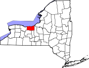
Villages Hamlets Alloway | Angells Corners | Bear Creek | Bonni Castle | Butler Center | Desbrough Park | East Bay Park | East Palmyra | East Williamson | Evans Corner | Fairville | Fairville Station | Fort Hill | Furnace Village | Furnaceville | Gananda | Glenmark | Huddle | Hydesville | Lake Bluff | Lakeside | Lincoln | Lock Berlin | Lummisville | Marbletown | Marengo | Mud Mills | Noble Corner | North Huron | North Macedon | North Wolcott | Ontario-on-the-Lake | Owls Nest | Pilgrimport | Pultneyville | Resort | Rice Mill | Shephards Corner | Sodus Center | South Butler | South Sodus | Sunset View | Thorntons Corner | Union Hill | Wallington | Wayne Center | Wayneport | West Butler | West Walworth | Westbury | Yellow Mills | York | Zurich
Categories:- Villages in New York
- Rochester, New York metropolitan area
- Populated places in Wayne County, New York


Wikimedia Foundation. 2010.