- Mahopac, New York
-
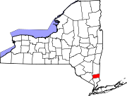
Mahopac, New York — CDP — Location within the state of New York
 Mahopac, New York
Coordinates: 41°22′11″N 73°44′15″W / 41.36972°N 73.7375°WCoordinates: 41°22′11″N 73°44′15″W / 41.36972°N 73.7375°W Country United States State New York County Putnam Area - Total 6.4 sq mi (16.7 km2) - Land 5.3 sq mi (13.7 km2) - Water 1.1 sq mi (2.9 km2) Elevation 666 ft (203 m) Population (2010) - Total 8,369 - Density 1,579/sq mi (610.8/km2) Time zone Eastern (EST) (UTC-5) - Summer (DST) EDT (UTC-4) ZIP code 10541 Area code(s) 845 FIPS code 36-44534 GNIS feature ID 0956273 Mahopac, New York, is a hamlet (and census-designated place) in the Town of Carmel in Putnam County, New York. An exurb of New York City some 47 miles (76 km) to the south, Mahopac is located on US Route 6 on the County's southern central border with Westchester County. As of the 2011 census, the population was 8,675.
Contents
History
Mahopac and Mahopac Falls play central roles in the history of Putnam County.
Originally inhabited by the Wappinger Native Americans, an Algonquian tribe, the hamlet's land was patented in 1697 by Adolphus Philipse, son of a wealthy Anglo-Dutch gentryman. During the French and Indian War, Wappingers throughout Putnam County traveled north to Massachusetts to fight for the British.
When the Crown refused to return their land after the war, most Wappingers abandoned the area and joined with other displaced Native Americans elsewhere. Farmers and their families migrated to Mahopac from as far away as Cape Cod and rented land from the Philipse family. Wheelwrights and blacksmiths set up shops to assist the tenant farmers.
Although no battles were fought in Mahopac during the American Revolution, the area was strategically important due to its location. With troop encampments in nearby Patterson, Yorktown, West Point, and Danbury, Connecticut, it was a cross-roads between key Colonial garrisons.
Soldiers were also stationed in Mahopac Falls to guard the Red Mills, an important center for grinding grain and storing flour for the American troops.
Upon Colonial victory in the Revolution the Tory-sympathizing Philipse family lost its claim to the land, which was then resold to farmers by New York State.
After the incorporation of Putnam County in 1812 the Mahopac area grew steadily. By the middle-19th century the hamlet had become a summer resort community. The New York Central Railroad brought vacationers north from New York City to Croton Falls then transferred them via horse-drawn coach to Lake Mahopac. After the Civil War a direct rail spur was laid, creating boom times for the village.
The locale remained primarily a summer resort until after World War II, when nearby highways such as the Taconic State and Saw Mill River parkways began to make travel by automobile convenient. With the passing of the last passenger service to Mahopac in 1959 the hamlet evolved into a year-round community, many of its residents making the reverse commute to New York City.
During the summer of 1956 Richard Yates moved to Mahopac with his family and wrote much of his most famous novel Revolutionary Road in the wellhouse of the estate on which he lived.[1]
Mahopac today
The hamlet of Mahopac encircles a picturesque 587-acre (238 ha) lake, from which it draws its name. Mahopac has had several motion pictures filmed on location. Among them are scenes from "TOOTSIE" a 1982 American comedy film that tells the story of a talented but volatile actor whose reputation for being difficult forces him to go to extreme lengths to land a job. The movie stars Dustin Hoffman and Jessica Lange, with a supporting cast that includes Teri Garr, Dabney Coleman, Charles Durning, Bill Murray, and producer/director Sydney Pollack.
An exterior shot is used in which the Mahopac Farm Playhouse exterior was converted to read "SYRACUSE FARM PLAYHOUSE". The property which at times has been host to flea markets and antique shows was originally "The Borden Dairy Farm", which produced dairy products sold as far south as NYC.
Lake Mahopac contains three islands, Fairy, Petre, and Canopus, all privately owned. Fairy Island sports multiple homes accessible via a short causeway; Petre boasts a single Frank Lloyd Wright designed residence, the A. K. Chahroudi Cottage; and Canopus has undeveloped land available for purchase. Boating, fishing and other water sports are permitted on the lake. Slips and support services are provided by two marinas.
Besides Lake Mahopac, other lakes include Lake Baldwin, Lake MacGregor, Kirk Lake, Lake Casse, Long Pond, Wixon Pond, Bryant Pond and Lake Secor.
Mahopac has a 33,000-square-foot (3,100 m2) library, featuring multiple reading rooms overlooking Lake Mahopac, abundant computers, a law library and conference rooms.
The Carmel Historical Society Museum in the Old Town Hall on McAlpin Avenue features many fascinating area artifacts.
Mahopac Falls
In Colonial times a large grist mill sat near the present-day intersection of Route 6N, Hill Street, and Myrtle Avenue. Drawing its water from the streams that drained Kirk Lake and Lake Mahopac, it was the largest building in the entire county. Early settlers to the area, tenant farmers renting land from the Philipse family, provided grain for its wheel. Over time the mill's red paint came to identify the area, known to this day as 'Red Mills'.
It was the falls of the waters of the pond that drove the mill that gave the larger community comprising the southern half of the hamlet of Mahopac the name "Mahopac Falls".
Today, although the famous mill there is gone, one of its original millstones forms a part of the front steps of the Red Mills Branch of Mahopac National Bank.
Lake Secor
Lake Secor received its name from the Secor family who were the first white people to officially call the land their own. In the early 20th century Secor turned into a "bungalow city" where the urbanites spent their summer weekends. At first the area was largely Germans, later in the mid fiftys it peaked opening up to all family types. In the 1940s and 50s a summer camp for Jewish children (Secor Lake Camp) operated on the other side of the lake from the bungalows. In the eighties Secor was divided half and half between the people that resided there and the city folk who came up on weekends. Today it has over 500 families living on the 26 roads that enclose it.
Geography
Mahopac is located at 41°22′11″N 73°44′15″W / 41.36972°N 73.7375°W (41.369657, -73.737463)[2].
According to the United States Census Bureau, the community has a total area of 6.4 square miles (16.7 km²), of which, 5.3 square miles (13.7 km²) of it is land and 1.1 square miles (2.9 km²) of it (17.57%) is water.
While the hamlet of Carmel is the seat of the county government, the largest population center in the township of Carmel, Mahopac, hosts the Town Hall. Both Mahopac (10541) and Mahopac Falls (10542) have their own post offices.
Demographics
As of the census[3] of 2000, there were 8,478 people, 2,922 households, and 2,258 families residing in the hamlet. The population density was 1,600.7 per square mile (617.6/km²). There were 3,099 housing units at an average density of 585.1/sq mi (225.8/km²). The racial makeup of the CDP was 90.2%White, 1.1% African American, 0.15% Native American, 1.21% Asian, 1.92% from other races, and 1.33% from two or more races. Hispanic or Latino of any race were 6.7% of the population.
There were 2,922 households out of which 37.9% had children under the age of 18 living with them, 65.6% were married couples living together, 8.6% had a female householder with no husband present, and 22.7% were non-families. 17.6% of all households were made up of individuals and 5.6% had someone living alone who was 65 years of age or older. The average household size was 2.89 and the average family size was 3.28.
In the hamlet the population was spread out with 25.3% under the age of 18, 7.7% from 18 to 24, 30.8% from 25 to 44, 26.4% from 45 to 64, and 9.7% who were 65 years of age or older. The median age was 38 years. For every 100 females there were 99.7 males. For every 100 females age 18 and over, there were 96.7 males.
The median income for a household in the community was $86,592, and the median income for a family was $91,148. Males had a median income of $52,315 versus $36,419 for females. The per capita income for the CDP was $29,245.
Mahopac Central School District
The Mahopac Central School District is divided into six schools: an all-kindergarten facility (the Falls School), three 1-5 schools (Lakeview, Fulmar Road, and Austin Road), a Middle School (Mahopac MS) and a High School (Mahopac HS).
In athletics, Mahopac boasts strong legacies in wrestling ( John Degl 1991 NYS Champion & Joe Mazzurco 2000 NYS Champion), basketball, softball, volleyball, gymnastics, field hockey, baseball(Dave Fleming 1987 MHS Graduate & former Pitcher for the Seattle Mariners), football (The Russo Brothers) and lacrosse. School teams have won several New York State Championships. A long-time rivalry exists between the "Indians" and the neighboring Carmel High School Rams.
Notable residents, past and present
- Joe Torre, a former professional baseball player, owns a home on Lake Mahopac.
- Marc Weiner, a comedian and puppeteer featured on the Nickelodeon show Weinerville.[4]
- Jeff Pearlman, a sportswriter.[5]
- The B-52s, a rock band, rented a mansion on Lake Mahopac.[6]
- Richard Yates, a novelist. [7]
- Henry Winkler, an actor, famous for his role in Happy Days.[8]
- Dave Fleming, a former Seattle Mariners pitcher. [9]
- Sour Shoes, a member of Howard Stern's "Wack Pack". [10]
Pronunciation differences
While the name "Mahopac" is believed to stem from a Native American word, its original pronunciation is lost to history. Long-time Mahopac residents claim that "Ma-HO-pac" was used by residents until the hamlet's evolution into a full-time community after World War II.
In spite of a 3-2 vote by the Carmel Town Board in favor of that pronunciation [11] no consensus has emerged, the modern-day first-syllable-inflected "MAY-o-pac" being used by a large number of residents today.
Carmel itself has a pronunciation issue as well, with local residents unanimously pronouncing it CAR-mel, while visitors usually assume it's pronounced car-MEL until instructed otherwise.
External links
- Mahopac News
- Town of Carmel
- Mahopac Central School District
- Mahopac Public Library
- Mahopac Real Estate
- Mahopac Volunteer Fire Department
- Town of Carmel Police Department
- East Lake Blvd Neighborhood Watch
- The Greater Mahopac-Carmel Chamber of Commerce
Municipalities and communities of Putnam County, New York County seat: Carmel Towns Carmel | Kent | Patterson | Philipstown | Putnam Valley | Southeast
Villages CDPs Brewster Hill | Carmel | Lake Carmel | Mahopac | Peach Lake‡ | Putnam Lake
Other
hamletFootnotes ‡This populated place also has portions in an adjacent county or counties
References
- ^ Bailey, Blake. A Tragic Honesty: The Life and Work of Richard Yates. New York: Picador, 2003.
- ^ "US Gazetteer files: 2010, 2000, and 1990". United States Census Bureau. 2011-02-12. http://www.census.gov/geo/www/gazetteer/gazette.html. Retrieved 2011-04-23.
- ^ "American FactFinder". United States Census Bureau. http://factfinder.census.gov. Retrieved 2008-01-31.
- ^ Marc, Weiner. "Weinerville Productions LLC - About Us". Weinerville Productions LLC. http://weinerville.com/about_us. Retrieved 7/11/2011.
- ^ Pearlman, Jeff. "Dave Fleming, My Hometown Hero". ESPN. ESPN. http://sports.espn.go.com/espn/page2/story?page=pearlman/080609&sportCat=mlb. Retrieved 7/5/2011.
- ^ Schoemer, Karen (March 1990). "Beehives and Ballyhoo". Spin Magazine 5 (12): 44.
- ^ Nackman, Barbara (12/15/2008). "Revolutionary Road in Mahopac". LoHud. http://books.lohudblogs.com/2008/12/15/revolutionary-road-in-mahopac/. Retrieved 7/5/2011.
- ^ Winkler, Henry. "IMDB biography". IMDB. IMDB. http://www.imdb.com/name/nm0001857/bio. Retrieved 7/5/2011.
- ^ Pearlman, Jeff. "Dave Fleming, My Hometown Hero". ESPN. ESPN. http://sports.espn.go.com/espn/page2/story?page=pearlman/080609&sportCat=mlb. Retrieved 7/5/2011.
- ^ DelCampo, Michael. "DelCampo Bio". Michael DelCampo's website. http://mike.sourshoes.biz/files/bio.htm. Retrieved 6/5/2011.
- ^ Associated Press. "Vote Ends Old Battle Over Name of Hamlet", The New York Times, December 30, 1988. Accessed May 11, 2007.
Categories:- Hamlets in New York
- Census-designated places in New York
- Populated places in Putnam County, New York
- Place names in New York of Native American origin


Wikimedia Foundation. 2010.