- New York State Route 118
-
NYS Route 118
Route information Maintained by NYSDOT Length: 10.71 mi[2] (17.24 km) Existed: 1930[1] – present Major junctions South end:  NY 100 in Yorktown
 US 202 in Somers
North end:  US 6 in Carmel
Location Counties: Westchester, Putnam Highway system Numbered highways in New York
Interstate • U.S. • N.Y. (former) • Reference • County←  NY 117
NY 119  →
→New York State Route 118 (NY 118) is a north–south state highway that extends for 10.71 miles (17.24 km) in Downstate New York in the United States. Much of the highway is located within Westchester County; however, a small portion of the route near the northern terminus is situated in Putnam County. The southern terminus of the route is at an intersection with NY 100 in the town of Yorktown. Its northern terminus is at a junction with U.S. Route 6 (US 6) in the town of Carmel. NY 118 passes through the hamlets of Yorktown Heights and Amawalk, where it overlaps with US 202 and NY 35. The route was assigned as part of the 1930 renumbering of state highways in New York; however, it was initially routed on the portion of modern NY 100 and US 202 between the New Croton Reservoir and Croton Falls. It was moved onto its current alignment in the late 1930s.
Contents
Route description
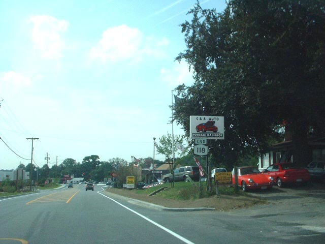
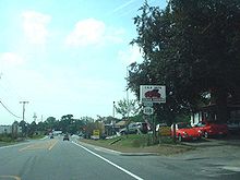 Approaching the northern terminus of NY 118 at US 6 in Carmel
NY 118 begins at an intersection with NY 100 north of Croton Lake in the town of Yorktown. It heads westward as Saw Mill River Road, following the northern edge of the reservoir for 1 mile (1.6 km) to an intersection with NY 129. Here, the northern lake perimeter road becomes Croton Dam Road and continues west as NY 129 while Saw Mill River Road and NY 118 turn northward, passes through mostly residential areas as it heads toward the hamlet of Yorktown Heights. In the center of the hamlet, NY 118 enters a large commercial district based around NY 118's junction with NY 35 and US 202.[3]
NY 118 joins US 202 and NY 35 here, forming a three-way overlap that extends northeasterly into the town of Somers. At the hamlet of Amawalk, NY 35 splits off to the east on Amawalk Road while US 202 and NY 118 continue northeastward along the western edge of the Amawalk Reservoir on Tomahawk Street. The overlap between US 202 and NY 118 ends at the northern edge of the reservoir, at which point US 202 leaves to the east on Lincolndale Road. NY 118, meanwhile, continues northward through residential neighborhoods into Putnam County. Just past the county line, NY 118 makes a 90-degree turn to the west onto Baldwin Place Road, then crossing the Putnam County Rail-Trail. The route ends 0.25 miles (0.40 km) later at an intersection with US 6 in the Carmel hamlet of Baldwin Place.[3]
History
NY 118 was assigned as part of the 1930 renumbering of state highways in New York; however, it did not initially follow any of its modern alignment. Instead, NY 118 headed northeastward from its current southern terminus on modern NY 100 and US 202 to a terminus at NY 22 in Croton Falls while all of what is now NY 118 was part of NY 100. At the time, NY 100 continued north along Baldwin Place Road and Myrtle Avenue to meet then-US 6 near Mahopac Falls.[1] In June 1934, the portion of NY 118 between Somers and Croton Falls became concurrent to US 202, a new interstate route extending from Delaware to Maine.[4][5] The alignments of NY 100 and NY 118 north of New Croton Reservoir were flipped ca. 1939, placing NY 118 on its modern alignment.[6][7] NY 118 initially continued north to NY 6N over NY 100's original alignment;[8] however, this extension was eliminated in the mid-1940s.[9][10]
Major intersections
County Location Mile[2] Destinations Notes Westchester Yorktown 0.00 NY 1001.28  NY 129
Eastern terminus of NY 129  To Taconic Parkway via Underhill Avenue (CR 131)
4.34  US 202 west / NY 35 west
Southern terminus of US 202 / NY 118 and NY 35 / NY 118 overlaps Somers 5.81 NY 35 eastNorthern terminus of NY 35 / NY 118 overlap 8.63 US 202 eastNorthern terminus of US 202 / NY 118 overlap Putnam Carmel 10.71 US 6Hamlet of Baldwin Place 1.000 mi = 1.609 km; 1.000 km = 0.621 mi References
- ^ a b Standard Oil Company of New York (1930). Road Map of New York (Map). Cartography by General Drafting.
- ^ a b "2008 Traffic Volume Report for New York State" (PDF). New York State Department of Transportation. June 16, 2009. p. 165. https://www.nysdot.gov/divisions/engineering/technical-services/hds-respository/NYSDOT%20TVR%202008%20by%20Route.pdf. Retrieved February 1, 2010.
- ^ a b Yahoo! Inc. Yahoo! Maps – overview map of NY 118 (Map). Cartography by NAVTEQ. http://maps.yahoo.com/#mvt=h&lat=41.287515&lon=-73.76561&zoom=13&q1=41.232048%2C-73.767261&q2=41.255754%2C-73.787527&q3=41.344987%2C-73.757015. Retrieved April 13, 2010.
- ^ Weingroff, Richard (January 9, 2009). "U.S. 202 – Maine to Delaware". Highway History. Federal Highway Administration. http://www.fhwa.dot.gov/infrastructure/us202.cfm. Retrieved April 13, 2010.
- ^ Sun Oil Company (1935). Road Map & Historical Guide – New York (Map). Cartography by Rand McNally and Company.
- ^ Esso (1938). New York Road Map for 1938 (Map). Cartography by General Drafting.
- ^ Standard Oil Company (1939). New York (Map). Cartography by General Drafting.
- ^ Esso (1940). New York (Map). Cartography by General Drafting.
- ^ Esso (1942). New York with Pictorial Guide (Map). Cartography by General Drafting.
- ^ Texas Oil Company (1946). New York with Pennsylvania (Map). Cartography by Rand McNally and Company.
External links
Categories:- State highways in New York
- Transportation in Westchester County, New York
- Transportation in Putnam County, New York

Wikimedia Foundation. 2010.