- Omo River
-
Lower Valley of the Omo * UNESCO World Heritage Site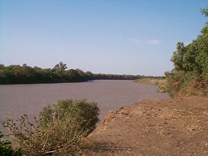
Country Ethiopia Type Cultural Criteria iii, iv Reference 17 Region ** Africa Inscription history Inscription 1980 (4th Session) * Name as inscribed on World Heritage List
** Region as classified by UNESCOThe Omo River is an important river of southern Ethiopia. Its course is entirely contained within the boundaries of Ethiopia, and empties into Lake Turkana on the border with Kenya. It is the principal stream of an endorheic drainage basin; the part that the Omo drains includes part of the western Oromia Region and the middle of the Southern Nations, Nationalities, and People's Region.
During his second expedition (1895–1897), Vittorio Bottego was the first European explorer to follow the course of the lower Omo River to its confluence with Lake Turkana.
Contents
Geography
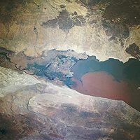 Omo River Delta
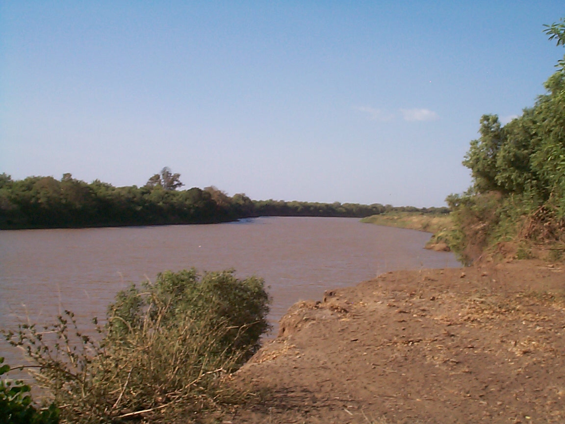
This river rises in the Shewan highlands and is a perennial river. Its course is generally to the south, however with a major bend to the west at about 7° N 37° 30' E to about 36° E where it turns south until 5° 30' N where it makes a large S- bend then resumes its southerly course to Lake Turkana. According to materials published by the Ethiopian Central Statistical Agency, the Omo River is 760 kilometers long.[1]
In its course the Omo has a total fall of about 6000 ft (2,000 m), from an elevation of 7600 ft at its source to 1600 ft at lake-level, and is consequently a very rapid stream, being broken by the Kokobi and other falls, and navigable only for a short distance above where it empties into Lake Turkana, one of the lakes of the Great Rift Valley. The Spectrum Guide to Ethiopia describes it as a popular site for white-water rafting in September and October, when the river is still high from the rainy season.[2] Its most important tributary is the Gibe River; smaller tributaries include the Wabi, Denchya, Gojeb, Mui and Usno rivers.
The Omo River formed the eastern boundaries for the former kingdoms of Janjero, and Garo. The Omo also flows past the Mago and Omo National Parks, which are known for their wildlife. Many animals live near and on the river, including hippopotamuses, crocodiles and Bitis arietans.
Early findings
On the banks of the Omo River archeologists have found fossil fragments of Olduwan hominids from the early Pleistocene era and up to the Pliocene era. An important finding is Australopithecus man, now extinct.[3]
Human impact
The lower valley of the Omo is currently believed by some to have been a crossroads for thousands of years as various cultures and ethnic groups migrated around the region.[citation needed] To this day, the people of the Lower Valley of the Omo, including the Mursi, Suri, Nyangatom, Dizi and Me'en, are studied for their diversity.[4]
Jules Borelli was the first European explorer to thoroughly explore the upper and middle reaches of the Omo in the 1880s. Italian explorer Vittorio Bottego reached the Omo river on 29 June 1896 during his second African expedition (1895–97), dying during this expedition on 17 March 1897. Herbert Henry Austin and his men reached the Omo delta on 12 September 1898, and found that an Ethiopian expedition, led by Ras Wolda Giyorgis, had previously planted Ethiopian flags on the northern shore of Lake Turkana on 7 April, as well as having plundered the locals and reduced them to poverty. Lieutenant Alexander Bulatovich led a second Ethiopian expedition which reached the lake August 21, 1899, and was equally destructive. Despite this, the Frenchmen in the party accurately mapped for the first time many of the meanders of the Omo River delta. This rendition of the Omo River remained in use until the 1930s.[5]
The entire Omo river basin is also important geologically and archaeologically. Several hominid fossils and archaeological localities, dating to the Pliocene and Pleistocene, have been excavated by French and American teams. Fossils belonging to the genera Australopithecine and Homo have been found at several archaeological sites, as well as tools made from quartzite, the oldest of which date back to about 2.4 million years ago. Because of this, the site was designated a UNESCO World Heritage Site in 1980.[6]
When they were discovered it was thought that the tools may have been part of a so-called pre-Oldowan industry, even more primitive than what was found in the Olduvai Gorge. Later research has shown that the crude looks of the tools were in fact caused by very poor raw materials, and that the techniques used and the shapes permit their inclusion in the Oldowan.
Gibe III proposed dam
Main article: Gibe III damThe Gibe III Hydroelectric dam is a 243 m high roller-compacted concrete dam with an associated hydropower plant under construction on the Omo river in Ethiopia. Once completed it would be the largest hydropower plant in Africa.
A group of international campaigners launched an online petition against Ethiopia's dam project over human rights concerns.[7][8]
2006 floods
Heavy rains in 2006 caused the Omo to flood its lower course, drowning at least 456 people and stranding over 20,000 people over the space of five days ending 16 August. While seasonal heavy rains are normal for this part of the country, overgrazing and deforestation are blamed for this tragedy. "The rivers in Ethiopia have less capacity to hold as much water as they did years before, because they are being filled up with silt," World Food Programme spokeswoman Paulette Jones said. "It takes less intensity of rainfall ... to make a river in any particular part of the country overflow."[9] The seasonal flooding of the Omo River is vital to the indigenous groups that live along it. The flood brings fertile silt and inundates the banks with water, making river bank cultivation possible. The diverse peoples along the lower Omo—which include the Turkana, Dassanach, Hamer, Nyangatom, Karo, Kwegu, Mursi, Bodi, and Me'en—derive a great portion of their food supply from flood retreat cultivation.[10]
The large and destructive flood of 2006 is the only one that has occurred within the past fifty years. Recent drop in the level of Lake Turkana, which is generally recognized to receive about ninety percent of its waters from the Omo River's inflow, has already caused a rise in salinity level. The increased size of the delta, now about 500 square miles (1,000 km2) in extent, has provided lands for recessional cultivation and pasture for cattle and other domestic livestock of the pastoralists and agro-pastoralists indigenous to the lower Omo basin.[citation needed]
See also
- List of Ethiopian rivers
- List of fossil sites (with link directory)
- Omo Remains
Notes
- ^ "Climate, 2008 National Statistics (Abstract)", Table A.1. Central Statistical Agency website (accessed 26 December 2009)
- ^ Camerapix (2000), p. 262
- ^ Crandall (2007)
- ^ Hurd (2006)
- ^ Local History in EthiopiaPDF The Nordic Africa Institute website (accessed 29 January 2008)
- ^ UNESCO (2007)
- ^ http://news.bbc.co.uk/2/hi/africa/8582682.stm
- ^ http://www.survivalinternational.org/news/5683
- ^ "More than 700 killed or missing in Ethiopian floods", Zeenews.com 16 August 2006; "Ethiopian floods feared to have killed 870" by Tsegaye Tadesse, Eircom net, 16 August 2006
- ^ http://www.internationalrivers.org/files/Gibe3FS_051509final.pdf
References
- Butzer, Karl W. (1971). Recent history of an Ethiopian delta: the Omo River and the level of Lake Rudolph, Research paper 136, Department of Geography, University of Chicago, 184 p., LCCN 70-184080
- Camerapix (2000). Spectrum Guide to Ethiopia, First American Ed., Brooklyn: Interlink, ISBN 1-56656-350-X
- Crandall, Ben (2007). The Omo River Valley, eMuseum @ Minnesota State University, Mankato; website accessed 31 October 2007
- Hurd, W. (2006). "Rangers by Birth", Cultural Survival Quarterly, 30.2, website accessed 31 October 2007
- UNESCO World Heritage Centre (2007). Lower Valley of the Omo, World Heritage List, website accessed 31 October 2007
- Vannutelli, L. and Citerni, C. (1899). Seconda spedizione Bòttego: L'Omo, viaggio d'esplorazione nell'Africa Orientale, Milano : Hoepli, 650 p.
External links
Rivers of Ethiopia Rivers World Heritage Sites in Ethiopia Aksum · Fasil Ghebbi, Gondar Region · Harar Jugol, the Fortified Historic Town · Lower Valley of the Awash · Lower Valley of the Omo · Rock-Hewn Churches, Lalibela · Simien National Park · Tiya

Coordinates: 4°48′1.27″N 35°58′1.45″E / 4.8003528°N 35.9670694°E
Categories:- Rivers of Ethiopia
- World Heritage Sites in Ethiopia
- Archaeological sites in Ethiopia
- Omo River

Wikimedia Foundation. 2010.