- Mathangwane
-
Mathangwane Location of Mathangwane in Botswana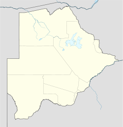
 Mathangwane
Coordinates: 21°00′S 27°20′E / 21°S 27.333°E Country  Botswana
District Central District Sub-District Tonota Constituency Tonota North Government - Type Tribal - Chief Itekeng Mongwaketsi Mathangwane - Headman Batisani Moeti Population (2001) - Total 3,962 Time zone Central Africa Time (UTC+2) Area code(s) 241xxxx Mathangwane is a village in the Central District of Botswana. It is located at the confluence of the Shashe and Vukwi rivers, 25 kilometres west of Francistown along the road from Francistown to Nata. The population of the village was 3,962 in 2001 census and was ranked 39th largest city in Botswana.[1] The village is characterised by many river valleys (tributaries to the Shashe river) most of which are the boundaries of the village wards (dikgotla).
Contents
History
The village is originally an ethnic kalanga and is currently ruled by She Itekeng Mongwaketsi Mathangwane.[2] In 2008, Mathangwane planned to celebrated its centenary anniversary.[3]
In the 1980s, Mathangwane was known for vehicle accidents that occurred on a one-lane narrow bridge across the Shashe River which linked the village to Francistown. It was widely believed that the accidents were caused by a ghost which deceived drivers into driving off the bridge at night. The old one-lane narrow bridge was replaced in the mid 1990s with a new dual-lane bridge that brought an end to those tragic accidents.
With the emagence of Francistown as a city in 1997 and the political and economic instability of Zimbabwe, Mathangwane saw an influx of migrants from other tribes of Botswana who couldn't afford accommodation rentals in the new city and illegal immigrants from Zimbabwe who fled economic collapse and political persecution causing rapid growth to the village population. This led to indigenous villagers being made to forfeit their farm land around the village to government for allocation to new-comers as residential land.[4]
In 2003, Mathangwane became the headquarters of Tonota North constituency following a constitutional amendment which increased the number of constituencies in Botswana from 40 to the present 57 seats.[5]
Infrastructure
- Schools
There are two primary schools, one junior secondary school, and two day-care centres in Mathangwane. After attaining junior certificate, children are often admitted to either Shashe River School, Mater Spei College, Tutume McConnel college or Masunga Senior Secondary School. This arrangement long proved strenuous to underprivileged families with their children dropping from school or performing badly in form five examinations due to the economic pressure.
- Roads
With the exception of the Francistown to Nata Highway going through the village, all village internal roads are dirt roads mostly impassable after heavy rains; existing un-bridged River valleys within the village along the roads are a challage to villagers' free movement. Villagers eagerly approved plans for the construction of Mmandunyane-Shashe Mooke-Borolong-Chadibe-Mathangwane road in early 2007 which they viewed as the only hope for the inprovement of the village internal road infrastractures. Arup Botswana was appointed for the construction of the road which totaled 70 km in length.[6] It later emerged that in light of the revenue constraints due to the on-going global economic and financial crisis, the Central District Council (CDC) decided to prioritise its projects and the impending road was never constructed.[7]
- Health System
The health system consists of one clinic with full time general nurses and a doctor to handle short time inpatients. Since the turn of 2000 the only inprovements to the clinic was the construction of a Maternity Ward and addition of a Caraven which serves as a Voluntary HIV counselling and testing (VCT) center[8] being part of Botswana's national HIV treatment programme; the move which saw the Government of Botswana being commended by World Health Organisation for demonstrating a very high level of political commitment to addressing the HIV/AIDS epidemic and the success considered a fine example of how antiretroviral therapy can be provided on a large scale in resource-constrained settings.[9] The clinic refers major cases to the Nyangabwe Referral hospital and patients with mental disorder to Jubilee hospital which are both located in Francistown.
- Clean Water
The village was connected to the Shashe Dam water supply reticulation through Francistown in 2001. This was followed by the upgrading of the Shashe Dam water treatment plant to augment increased water demand.[10] Before the implementation of The Water Sector Reforms Programme in February 2010 through which water supply in the village was taken over by Water Utilities Corporation,[11] water connections applications and water bill payments were done in Tutume which is 75 km west of the village.
- Village Shortfalls
Villagers receive Government services from different places with vast geographical distances, i.e. Francistown, Tonota, Tutume, Marapong, Masunga and Serowe, and this disadvantage locals from benefiting from existing government programs and services.
Like many Botswana villages, community developments and minor projects that do not require expert consultancy are controlled by a group of volunteers called the Village Development Committee (VDC). Majority of Mathangwane VDC volunteers use it as a platform to gain popularity before joining the village politics; an unproductive and egocentric practice hindering the success of the Village VDC. Villages simillar to Mathangwane in size and population through their VDC developed community projects that continue to sustain the livelihood of their villagers, for example, Mathangwane does not have a Community Hall nor rented small business stalls all which are schemes supported by government through community projects and long proved worthy in income generation for small communities like Mathangwane.
Demographics
Mathangwane is divided into wards or dikgotla. They are Mathangwane (main ward), Mpatane, Nkuelegwa, Matshegong/Matiwa (nicknamed 'Palamakuwe' for its residents' noisy unruly parting style in the early 1980s), and other wards that emerged with village growth. Each kgotla has its own sub-chief or Kgosana. Until recently, Hobona village, 10 km west of Mathangwane along the road from Francistown to Nata was one of the main and oldest wards of Mathangwane under the leadership of Mfi Kgosana Seitshwenyeng Hobona.
Settlement in the area may have been chosen for the presence of perennial water sources (from Shashe and Vukwi Rivers). In the late 20th century the village streached along the river bank from the North to the South with the west being locals' seasonal farm land. The eatern side of the Shashe river is the North East District tribal land and it is predominately elite villagers' farm land and ranches administered in Masunga Village. The increase in population and water system reticulation by government saw new settlers being allocated residential land on the underprivileged villagers' seasonal farm land in the west. This prompted locals to informally call the area 'New Xadi' (named after the government resettlement area for the former Central Kalahari Game Reserve (CKGR) San people in the Ghanzi District[12]).
Politics
- Brief History
The Botswana Democratic Party (BDP) dominated the village local government politics since the first elections in Botswana in 1965 making the village a BDP stronghold.
Mfi Chite was the first councilor for the village following a win in the October 1974 general elections; this was after the 1972 constitutional amendment which grouped villages of Borolong, Chadibe, Makobo, Mathangwane, Natale and Shashemoke into a single council ward un-axing them from the then Tonota council ward. The grouping was broken down further in 1982 constitutional amendment un-axing villages of Borolong, Natale, and Shashemoke from the ward.
Mfi Chite retained the council seat for BDP in both the 1979 and 1984 general elections. Mfi Rabeka Hulela won the council seat again for the BDP in the October 1989 general elections following Mfi Chite's retirement from politics at the end of his office term in 1989. Mfi Hulela retained the council seat for the BDP in the October 1994 general election and remained the ward councilor until her passing in 1998 after which the ward remained without a councilor until the October 1999 general elections when Mfi Munyadzwe won the ward for the BDP.
In 2000, Mr. Ookame Ntobedze won the bye-elections of the ward for the BDP following the passing of Mr. Munyadzwe. In 2003, another constitutional amendment saw Mathangwane being split into two council wards (Mathangwane North and Mathangwane South council wards). BDP won both council wards in the October 2004 general elections with Mr. Ookame Ntobedzi represanting the Mathangwane South council ward and Mfi Gilbert Nkhukhu represanting the Mathangwane North council ward. In 2007, Mr. Ipuseng Chikanda won the bye-election of the Mathangwane North council ward for the BDP following the passing of Mr. Nkhukhu.[13]
- Upsets
With known village political trend, BDP council candidates fiercely contested their party primary elections with the knowledge that a win guaranteed individuals seats at the Council Chambers.[14] Both Mr. Chikanda and Mr. Ntobedze were upset by the Botswana Congress Party (BCP) candidates in the October 2009 general elections marking the first ever BDP defeat in the village. This surprise defeat of the BDP council candidates led to a major campaign in the village in 2010 following the passing of Mr. Gaolatlhe Balizi for the Tonota North Parliamentary by-elections which BDP won.[15][16] Opposition parties later accused the ruling party (BDP) of using government resources including public media in their party campaigns and at the same time opposing funding of political parties by government.
The BCP's council surprise victory in the village was viewed as a significant breakthrough in a historical BDP stronghold and opposition parties made an un-official pact in surpport of the BCP's Tonota North Parliamentary candidate, Dr. Habaundi Njiro Hobona during the 2010 Parliamentary by-election.[17][18]
Industry
The area around Mathangwane consists of crop and cattle farmland. There are also a number of poultry and vegetable farms who supply Francistown and the local market.
Mathangwane does not have a major shopping center but has a cluster of shops and bars mostly along the Francistown-Nata main road, selling clothes, fast food, alcohol, building materials to car and bicycle parts. There are also a number of hair salons that boom around Christmas time specialising in afro-styles. The most stable are a few brick molding entrepreneurs who specialise in pressed concrete bricks and supply locals for individual house construction developments. Trade services such as metal-smiths, plumbing, bricklaying, and electrical installation are supplied by individuals, in a largely unregulated trade.
Just like other villages in the proximity of a city, Mathangane Villagers has a potential to drive their economy from real estate and construction trade. The Village has recently attracted influx of people working in Francistown looking for rented accommodation and outright property purchases; this resulted in a rapid property appreciation in the Village. There is, however, been little growth in the number of job creation. High rates of crime have become a disincentive to permanent settlement and micro business sector growth in the village.[19]
References
- ^ "Distribution of population by sex by villages and their associated localities: 2001 population and housing census". Archived from the original on 2007-11-24. http://web.archive.org/web/20071124145416/http://www.cso.gov.bw/html/census/dist54.html. Retrieved 2008-01-01.
- ^ Botswana Donor : Kgosi (Chief) Itekeng Mathangwane ~ A Gift of Land
- ^ Mathangwane Hits Centenary Mark, Mmegi Online
- ^ Available Land in Botswana
- ^ History of the Parliament, Parliament of Botswana
- ^ Central District Council Projects
- ^ Central District Council Prioritises Projects
- ^ HIV and AIDS in Botswana
- ^ WHO estimate of number of people requiring treatment in Botswana
- ^ Water treatment plant upgrade
- ^ Water Utilities Corporation
- ^ Statement by Ditshwanelo - The Botswana Centre For Human Rights
- ^ Why opposition parties lost Mathangwane
- ^ Tonota North has been regarded as a safe haven for the ruling party
- ^ Molao wins Tonota North
- ^ The Botswana Democratic Party (BDP) has retained the Tonota North parliamentary seat
- ^ Hobona has a chance in Tonota North
- ^ BNF supports BCP at Tonota North
- ^ Choppers will boost war on crime - Tsimako
Italics indicate capitals of districts - Gaborone
- Francistown
- Molepolole
- Serowe
- Selebi-Phikwe
- Maun
- Kanye
- Mahalapye
- Mogoditshane
- Mochudi
- Shakawe
- Lentsweletau
- Molapowabojang
- Gumare
- Tshabong
- Lerala
- Mmathethe
- Gweta
- Mathangwane
- Mmankgodi
Retrieved from Botswana's 2001 Population and Housing Census Categories:- Villages in Botswana

Wikimedia Foundation. 2010.