- Palapye
Infobox Settlement
official_name = PAGENAME
other_name =
native_name =
nickname =
settlement_type =
motto =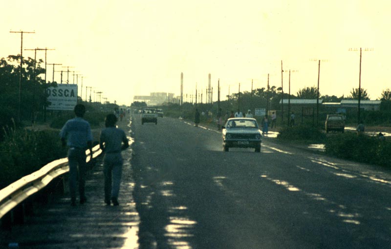
imagesize = 300px
image_caption = Palapye, looking towards Morupule power station, 1987
flag_size =
image_
seal_size =
image_shield =
shield_size =
image_blank_emblem =
blank_emblem_type =
blank_emblem_size =
mapsize =
map_caption =
mapsize1 =
map_caption1 =
image_dot_
dot_mapsize =
dot_map_caption =
dot_x = |dot_y =
pushpin_
pushpin_label_position =bottom
pushpin_map_caption =Location in Botswana
subdivision_type = Country
subdivision_name =
subdivision_type1 = District
subdivision_name1 =Botswana Central District
subdivision_type2 =
subdivision_name2 =
subdivision_type3 =
subdivision_name3 =
subdivision_type4 =
subdivision_name4 =
government_footnotes =
government_type =
leader_title =
leader_name =
leader_title1 =
leader_name1 =
leader_title2 =
leader_name2 =
leader_title3 =
leader_name3 =
leader_title4 =
leader_name4 =
established_title =
established_date =
established_title2 =
established_date2 =
established_title3 =
established_date3 =
area_magnitude =
unit_pref =Imperial
area_footnotes =
area_total_km2 =
area_land_km2 =
area_water_km2 =
area_total_sq_mi =
area_land_sq_mi =
area_water_sq_mi =
area_water_percent =
area_urban_km2 =
area_urban_sq_mi =
area_metro_km2 =
area_metro_sq_mi =
area_blank1_title =
area_blank1_km2 =
area_blank1_sq_mi =
population_as_of =
population_footnotes =
population_note =
population_total =
population_density_km2 =
population_density_sq_mi =
population_metro =
population_density_metro_km2 =
population_density_metro_sq_mi =
population_urban =
population_density_urban_km2 =
population_density_urban_sq_mi =
population_blank1_title =Ethnicities
population_blank1 =
population_blank2_title =Religions
population_blank2 =
population_density_blank1_km2 =
population_density_blank1_sq_mi =
timezone =
utc_offset =
timezone_DST =
utc_offset_DST =
latd=22 |latm=33 |lats= |latNS=S
longd=27 |longm=08 |longs= |longEW=E
elevation_footnotes =
elevation_m =
elevation_ft =
postal_code_type =
postal_code =
area_code =
blank_name =
blank_info =
blank1_name =
blank1_info =
website =
footnotes =Palapye is a large town in
Botswana , situated about halfway betweenFrancistown andGaborone . Over the years its position has made it a convenient stopover on one of Southern Africa's principal north–south rail and road routes. It also has a small airfield, as well as theMorupule Colliery coal mine, which suppliesMorupule Power Station , Botswana's principal domestic source of electricity. The power station has undertaken an expansion project to increase its generation capacity in an effort to meet the country's increasing demand for electricity. Construction is propsed to begin in 2009.In 1997 Palapye was said to be the fastest-growing village in Africa, with plans to expand its population from 30,000 to 180,000.
Development
Palapye is experiencing a wide variety of development. Plans are in the advanced stages to build the second
University of Botswana in Palapye. Construction for this is expected to commence by early 2009.Due to current black-outs across the country, resulting from South Africa's refusal to supply electricity to Botswana, construction of the campus has been further delayed. The current power shortages have also halted construction for further developments in the area, such as the expansion for the Morupule Power Station. Plans for a new hospital, similar to the newly constructed
Serowe Hospital , have also been proposed.An International Airport, that will be located on the Palapye-Serowe road, is another development that is being considered. Construction for this, if the plan goes through, shall commence, by late 2009. This will follow the expansion of the
Sir Seretse Khama International Airport , which is the maininternational airport in Botswana.Education
.
There are also other Government High Schools. Lotsane Senior Secondary School is one of the main government schools in Palapye. It accommodates learners from Forms 1 to 5. It is one of the few boarding schools in the area.
Palapye also has a technical College.
Tourist Attractions
There are several well known tourist attractions close to Palapye. The Khama Rhino sanctuary is probably the best known and is 40km from Palapye. The Tswapong Hills also have many areas of historical significance and well as the Moremi Gorge. This is an area of great beauty as it has a permanent water source.
Some 20 km ESE of Palapye, close to the village of Malaka, are the remains of Phalatswe, also called Old Palapye, the capital of the
Bamangwato people underKhama III from 1889 to 1902. [http://www.thuto.org/ubh/bw/oldp.htm]Transport
In 2008, proposals were made to build a new Trans-Kalahari Railway to a port in Namibia.
External links
* http://www.palapye.com
* http://www.mcl.co.bw/
* http://www.ub.bw/
* http://www.kgaswe.comReferences
* [http://www.fallingrain.com/world/BC/0/Palapye.html FallingRain Map - elevation = 919m (Red dots are railways)]

Wikimedia Foundation. 2010.