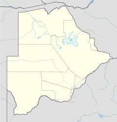
Nata, Botswana

Nata, Botswana
Nata, Botswana is located in Botswana
{{{alt}}}
Location of Nata

Nata is a village in Central District of Botswana. It is located in the northern part of the district, and is served by Nata Airport. The population was 4150 in 2001 census.[1] The village of Nata lies along the Nata River which carries its rainy season flow to the Makgadikgadi Pans, a seasonal hypersaline lake.

See also

References

Coordinates: 20°12′38″S 26°10′50″E / 20.21056°S 26.18056°E / -20.21056; 26.18056


Wikimedia Foundation. 2010.

Игры ⚽ Нужна курсовая?

Look at other dictionaries:

  • Nata — could refer to: Locations: Nata, Cyprus Natá, Panama Nata, Botswana Nata Island, Greece Foods: Cajeta, a Mexican dessert or confection typically from burnt goat s milk (leche quemada) Gordita de Nata, a Mexican pastry made in soft or toasted… …   Wikipedia

  • Nata Bird Sanctuary — Pelicans in the Nala Bird Sanctuary …   Wikipedia

  • Nata River — The Nata River or Amanzanyama River is a natural watercourse in Southern Africa. Within the country of Botswana the Nata River is a source of water to the ephemeral wetlands of the Makgadikgadi Pans, where a number of species of limited… …   Wikipedia

  • Botswana — /bot swah neuh/, n. a republic in S Africa: formerly a British protectorate; gained independence 1966; member of the Commonwealth of Nations. 1,500,765; 275,000 sq. mi. (712,250 sq. km). Cap.: Gaborone. Formerly, Bechuanaland. * * * Botswana… …   Universalium

  • North-East District (Botswana) — North East   District   Location within Botswana Coordinates …   Wikipedia

  • Rivers and streams of Botswana — These streams are all those given in the database of the GEOnet Names Server in January 2007. They are official standard names and do not necessarily include every name in common use. Cuando River , Khwai River and Okanavango River are not in the …   Wikipedia

  • FBNT — ICAO Airportcode f. Nata (Botswana) …   Acronyms

  • FBNT — ICAO Airportcode f. Nata ( Botswana) …   Acronyms von A bis Z

  • Mathangwane — Mathangwane …   Wikipedia

  • Makgadikgadi Pan — The Makgadikgadi pans are clearly visible to the right of the dark green broom shaped Okavango Delta in this satellite image of Botswana The Makgadikgadi Pan is a large salt pan in the middle of the dry savanna of northeastern Botswana. It is one …   Wikipedia

Share the article and excerpts

Direct link
Do a right-click on the link above
and select “Copy Link”