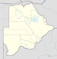
Mopipi

Mopipi
Mopipi is located in Botswana
{{{alt}}}
Location of Mopipi

Mopipi is a village in Central District of Botswana. It is located close to Makgadikgadi Pan. The population was 3,066 in 2001 census.[1] This area has witnessed steady aridification and desertfication since the Pleistocene, but perhaps most dramatically since the 19th century.[2] In particular, the Boteti River used to flow year around in this area[2] on its way to discharge to the Makgadikgadi Pans,[3] but presently this flow is only in the rainy season.

References

  1. ^ "Distribution of population by sex by villages and their associated localities: 2001 population and housing census". Archived from the original on 2007-11-24. http://web.archive.org/web/20071124145541/http://www.cso.gov.bw/html/census/dist52_53.html. Retrieved 2008-01-06. 
  2. ^ a b Michael Main (2001) African Adventurer's Guide to Botswana, Published by Struik, ISBN 1868725766, 9781868725762 304 pages
  3. ^ C. Michael Hogan (2008) Makgadikgadi, The Megalithic Portal, ed. A. Burnham

Coordinates: 21°12′7″S 24°52′6″E / 21.20194°S 24.86833°E / -21.20194; 24.86833


Wikimedia Foundation. 2010.

Игры ⚽ Нужно сделать НИР?

Look at other dictionaries:

  • Mopipi B&B — (Nietverdiend,Южно Африканская Республика) Категория отеля: Адрес: R49 between Zeerust a …   Каталог отелей

  • Mopipi — Original name in latin Mopipi Name in other language Mopipi State code BW Continent/City Africa/Gaborone longitude 21.18333 latitude 24.88333 altitude 906 Population 3301 Date 2013 06 06 …   Cities with a population over 1000 database

  • Botswana — /bot swah neuh/, n. a republic in S Africa: formerly a British protectorate; gained independence 1966; member of the Commonwealth of Nations. 1,500,765; 275,000 sq. mi. (712,250 sq. km). Cap.: Gaborone. Formerly, Bechuanaland. * * * Botswana… …   Universalium

  • Gaborone —   City   From top to bottom: skyline view of Gaborone, statue of Seretse Khama, the city centre of Gaborone, bird s eye view of Gaborone …   Wikipedia

  • Maun — from the air in 2007 Location of Maun in Botswana …   Wikipedia

  • Mochudi —   Village   View of Mochudi in August 2007 …   Wikipedia

  • Molepolole — is Botswana s biggest village. It lies in the south east of the county. The people who reside in Molepolole are the Bakwena, who are one of the eight major tribes in Botswana. The Bakwena chief was among the three chiefs who went to England to… …   Wikipedia

  • Orapa — Coordinates: 21°20′02″S 25°21′53″E / 21.33389°S 25.36472°E / 21.33389; 25.36472 …   Wikipedia

  • Boteti River — The Boteti River is a river in Botswana. It got its water from the main Okavango Delta through the Thamalakane River in Maun. It flowed year round before it was hit by a drought in the mid 1990s. It stretches from Ngamiland to the main Boteti… …   Wikipedia

  • Moshupa — is a large village in the Southern District of Botswana with a population of approximately 20,000 (2011 est.). The people of Moshupa are called the Bakgatla ba ga Mmanaana, a group also found in Thamaga. Along with the related BaKgatla ba ga… …   Wikipedia

Share the article and excerpts

Direct link
Do a right-click on the link above
and select “Copy Link”