- Wanaque, New Jersey
Infobox Settlement
official_name = Wanaque, New Jersey
settlement_type = Borough
nickname =
motto =
imagesize =
image_caption =
image_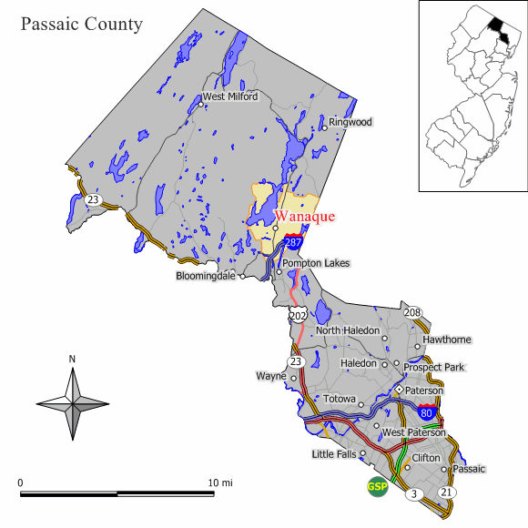
mapsize = 250x200px
map_caption = Map of Wanaque in Passaic County. Inset: Passaic County highlighted in State of New Jersey.
mapsize1 = 250x200px
map_caption1 = Census Bureau map of Wanaque, New Jerseysubdivision_type = Country
subdivision_name =United States
subdivision_type1 = State
subdivision_name1 =New Jersey
subdivision_type2 = County
subdivision_name2 = Passaic
government_footnotes =
government_type =Borough (New Jersey)
leader_title =Mayor
leader_name = Thomas Balunis
leader_title1 =
leader_name1 =
established_title = Incorporated
established_date =March 22 ,1918 unit_pref = Imperial
area_footnotes =
area_magnitude =
area_total_km2 = 23.8
area_land_km2 = 20.7
area_water_km2 = 3.2
area_total_sq_mi = 9.2
area_land_sq_mi = 8.0
area_water_sq_mi = 1.2population_as_of = 2006
population_footnotes =
population_total = 11171
population_density_km2 = 496.8
population_density_sq_mi = 1286.8timezone = Eastern (EST)
utc_offset = -5
timezone_DST = EDT
utc_offset_DST = -4
elevation_footnotes = [Gnis|885431|Borough of Wanaque,Geographic Names Information System . AccessedJanuary 4 ,2008 .]
elevation_m = 66
elevation_ft = 217
latd = 41 |latm = 02 |lats = 36 |latNS = N
longd = 74 |longm = 17 |longs = 25 |longEW = Wpostal_code_type =
ZIP code
postal_code = 07465
area_code = 973
blank_name = FIPS code
blank_info = 34-76730GR|2 [ [http://mcdc2.missouri.edu/webrepts/commoncodes/ccc_nj.html A Cure for the Common Codes: New Jersey] , Missouri Census Data Center. AccessedJuly 14 ,2008 .]
blank1_name = GNIS feature ID
blank1_info = 0885431GR|3
website = http://www.wanaqueborough.com/
footnotes =Wanaque is a borough in Passaic County,
New Jersey ,United States . As of theUnited States 2000 Census , the borough population was 10,266.Wanaque was incorporated as an independent Borough on
February 23 ,1918 , when Pompton Township was split up into three Boroughs, along with Bloomingdale and Ringwood, based on the results of a referendum held onMarch 22 ,1918 ."The Story of New Jersey's Civil Boundaries: 1606-1968", John P. Snyder, Bureau of Geology and Topography; Trenton, New Jersey; 1969. p. 211.]Geography
Wanaque is located at coor dms|41|2|23|N|74|17|22|W|city (41.039646, -74.289323)GR|1.
Wanaque Borough includes neighborhoods known as Wanaque (formerly Midvale) and Haskell, each of which has their own
ZIP Code and is served by their own separate post office.According to local history, the name “Wanaque” is thought to have been derived from the Lenni Lenape Native American word meaning, “rest and repose”. [ [http://www.wanaqueborough.com/archive/lenape.htm Wanaque Area Local History] , accessed
October 10 ,2006 .]According to the
United States Census Bureau , the borough has a total area of 9.2square mile s (23.9km² ), of which, 8.0 square miles (20.7 km²) of it is land and 1.2 square miles (3.2 km²) of it (13.35%) is water.Demographics
USCensusPop
1930=3119
1940=3143
1950=4222
1960=7126
1970=8636
1980=10025
1990=9711
2000=10266
estimate= 11171
estyear=2006
estref= [http://factfinder.census.gov/servlet/SAFFPopulation?_event=Search&geo_id=06000US3402554270&_geoContext=01000US%7C04000US34%7C05000US34025%7C06000US3402554270&_street=&_county=wanaque&_cityTown=wanaque&_state=04000US34&_zip=&_lang=en&_sse=on&ActiveGeoDiv=geoSelect&_useEV=&pctxt=fph&pgsl=060&_submenuId=population_0&ds_name=null&_ci_nbr=null&qr_name=null®=null%3Anull&_keyword=&_industry= Census data for Wanaque borough] ,United States Census Bureau . AccessedSeptember 19 ,2007 .]
footnote=Population 1930 - 1990. [ [http://www.wnjpin.net/OneStopCareerCenter/LaborMarketInformation/lmi01/poptrd6.htm Jersey Resident Population by Municipality: 1930 - 1990] , Workforce New Jersey Public Information Network. AccessedMarch 1 ,2007 .] As of thecensus GR|2 of 2000, there were 10,266 people, 3,444 households, and 2,689 families residing in the borough. Thepopulation density was 1,286.8 people per square mile (496.7/km²). There were 3,500 housing units at an average density of 438.7/sq mi (169.3/km²). The racial makeup of the borough was 90.67% White, 1.51% African American, 0.34% Native American, 3.62% Asian, 0.03% Pacific Islander, 2.06% from other races, and 1.77% from two or more races. Hispanic or Latino of any race were 5.40% of the population.There were 3,444 households out of which 37.9% had children under the age of 18 living with them, 63.2% were married couples living together, 10.9% had a female householder with no husband present, and 21.9% were non-families. 16.7% of all households were made up of individuals and 5.8% had someone living alone who was 65 years of age or older. The average household size was 2.86 and the average family size was 3.23.
In the borough the population was spread out with 24.4% under the age of 18, 6.9% from 18 to 24, 31.7% from 25 to 44, 25.0% from 45 to 64, and 12.0% who were 65 years of age or older. The median age was 38 years. For every 100 females there were 93.3 males. For every 100 females age 18 and over, there were 91.4 males.
The median income for a household in the borough was $66,113, and the median income for a family was $71,127. Males had a median income of $43,675 versus $33,380 for females. The
per capita income for the borough was $25,403. About 2.6% of families and 3.3% of the population were below thepoverty line , including 3.5% of those under age 18 and 4.1% of those age 65 or over.Law and government
Local government
Wanaque is governed under the Borough form of New Jersey municipal government. The government consists of a Mayor and a Borough Council comprising six council members, with all positions elected at large. A Mayor is elected directly by the voters to a four-year term of office. The Borough Council consists of six members elected to serve three-year terms on a staggered basis, with two seats coming up for election each year. ["2005 New Jersey Legislative District Data Book",
Rutgers University Edward J. Bloustein School of Planning and Public Policy , April 2005, p. 169.]The
Mayor of Wanaque Borough is Daniel Mahler. Thomas Balunis was appointed acting mayor after the death of Warren Hagstrom onNovember 5 ,2005 . [Barry, Jan. [http://www.northjersey.com/page.php?qstr=eXJpcnk3ZjczN2Y3dnFlZUVFeXk2MCZmZ2JlbDdmN3ZxZWVFRXl5NjgxNjg2NyZ5cmlyeTdmNzE3Zjd2cWVlRUV5eTM= "Wanaque Council pays tribute to mayor"] , "The Record (Bergen County) ",November 16 ,2005 . AccessedJune 10 ,2007 . "Hagstrom, 73, died of a heart attack at home on Nov. 5."] Mahler was elected to the post during the next regular election. Members of the Borough Council are Karen Cisco, Edward O'Connell, Donald Pasquariello, Robert Pettet and George Theoharous. [ [http://www.wanaqueborough.com/ Borough of Wanaque] , Wanaque Borough. AccessedMay 31 ,2008 .]Federal, state and county representation
Wanaque is in the Fifth Congressional District and is part of New Jersey's 40th Legislative District. [ [http://www.lwvnj.org/pubs/CG06.pdf 2006 New Jersey Citizen's Guide to Government] , New Jersey
League of Women Voters , p. 65. AccessedAugust 30 ,2006 .]Education
Students in Kindergarten through eighth grade for public school attend the schools of the
Wanaque Borough Schools . Schools in the district (with 2005-06 enrollment data from theNational Center for Education Statistics [ [http://nces.ed.gov/ccd/schoolsearch/school_list.asp?Search=1&DistrictID=3416950 Data for the Wanaque Borough Schools] ,National Center for Education Statistics . AccessedMay 31 ,2008 .] ) are [http://www.wanaque.k12.nj.us/haskell/index.htm Haskell Elementary School] in the Haskell area and serves students in Kindergarten through eighth grade (444 students), and [http://www.wanaque.k12.nj.us/wanaque/index.htm Wanaque Elementary School] in Wanaque which serves students in pre-Kindergarten through eighth grade (566 students).Public school students in grades 9 - 12 attend
Lakeland Regional High School , which serves students from the Boroughs of Ringwood and Wanaque. The high school is located in Wanaque and is part of the Lakeland Regional High School District. [ [http://education.state.nj.us/rc/rc07/narrative/31/2510/31-2510-000.html Lakeland Regional High School 2007 Report Card Narrative] ,New Jersey Department of Education . AccessedMay 31 ,2008 . "Lakeland Regional High School, serving grades 9-12, is a comprehensive high school district. Students come to the high school from the Ringwood and Wanaque elementary districts and several private schools."]Wanaque is the site of
Passaic County Community College 's Wanaque Academic Center.Transportation
Interstate 287 passes through Wanaque, where it is accessible at Exit 55, Ringwood Avenue (County Route 511).Notable residents
Notable individuals from Wanaque include:
*Bobby Czyz (1962-), boxer who is both a former world light heavyweight and cruiserweight champion. [ [http://www.northjersey.com/page.php?qstr=eXJpcnk3ZjczN2Y3dnFlZUVFeXkzNjYmZmdiZWw3Zjd2cWVlRUV5eTYzMzc3NTMmeXJpcnk3ZjcxN2Y3dnFlZUVFeXkz Boxing commentator arrested] , "Herald News ",February 25 ,2003 , accessedApril 11 ,2007 . "Boxing commentator and former two-time world champion Bobby Czyz, a Lakeland High School graduate and former Wanaque resident, has been charged with drunken driving."]References
External links
* [http://www.wanaqueborough.com/ Wanaque Borough website]
* [http://www.wanaque.k12.nj.us/ Wanaque Borough Schools]
*NJReportCard|31|5440|0|Wanaque Borough Schools
* [http://nces.ed.gov/ccd/schoolsearch/school_list.asp?Search=1&DistrictID=3416950 Data for the Wanaque Borough Schools] ,National Center for Education Statistics
* [http://www.lakeland.k12.nj.us/ Lakeland Regional High School]
* [http://www.afamilytown.org/ Wanaque Chamber of Commerce website]
* [http://www.wanaquerepublicans.com/ Wanaque Borough Republicans Club]
* [http://www.wanaquedemocrats.com/ Wanaque Borough Democratic Club]
Wikimedia Foundation. 2010.