- Totowa, New Jersey
Infobox Settlement
official_name = Totowa, New Jersey
settlement_type = Borough
nickname =
motto =
imagesize =
image_caption =
image_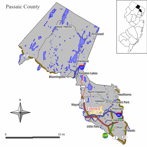
mapsize = 250x200px
map_caption = Map of Totowa in Passaic County. Inset: Location of Passaic County highlighted in the State of New Jersey.
mapsize1 = 250x200px
map_caption1 = Census Bureau map of Totowa, New Jerseysubdivision_type = Country
subdivision_name =United States
subdivision_type1 = State
subdivision_name1 =New Jersey
subdivision_type2 = County
subdivision_name2 = Passaic
government_footnotes =
government_type =Borough (New Jersey)
leader_title =Mayor
leader_name = John Coiro
leader_title1 =
leader_name1 =
established_title = Incorporated
established_date =March 15 ,1898 unit_pref = Imperial
area_footnotes =
area_magnitude =
area_total_km2 = 10.5
area_land_km2 = 10.4
area_water_km2 = 0.1
area_total_sq_mi = 4.0
area_land_sq_mi = 4.0
area_water_sq_mi = 0.1population_as_of = 2006
population_footnotes =
population_total = 10634
population_density_km2 = 955.5
population_density_sq_mi = 2474.8timezone = Eastern (EST)
utc_offset = -5
timezone_DST = EDT
utc_offset_DST = -4
elevation_footnotes = [Gnis|885420|Borough of Totowa,Geographic Names Information System . AccessedJanuary 4 ,2008 .]
elevation_m = 90
elevation_ft = 295
latd = 40 |latm = 54 |lats = 17 |latNS = N
longd = 74 |longm = 13 |longs = 19 |longEW = Wpostal_code_type =
ZIP code s
postal_code = 07511-07512
area_code = 973
blank_name = FIPS code
blank_info = 34-73140GR|2 [ [http://mcdc2.missouri.edu/webrepts/commoncodes/ccc_nj.html A Cure for the Common Codes: New Jersey] , Missouri Census Data Center. AccessedJuly 14 ,2008 .]
blank1_name = GNIS feature ID
blank1_info = 0885420GR|3
website = http://www.TotowaNJ.org
footnotes =Totowa (pronEng|ˈtotəwə) is a borough in Passaic County,
New Jersey ,United States . As of theUnited States 2000 Census , the borough population was 9,892.Totowa was formed as a borough by an Act of the
New Jersey Legislature onMarch 15 ,1898 , from portions of Manchester Township and Wayne Township."The Story of New Jersey's Civil Boundaries: 1606-1968", John P. Snyder, Bureau of Geology and Topography; Trenton, New Jersey; 1969. p. 211.]Geography
Totowa is located at coor dms|40|54|12|N|74|13|3|W|city (40.903348, -74.217638)GR|1.
According to the
United States Census Bureau , the borough has a total area of 4.1 square miles (10.5 km²), of which, 4.0 square miles (10.4 km²) of it is land and 0.1 square miles (0.1 km²) of it (1.23%) is water.Demographics
USCensusPop
1930=4600
1940=5130
1950=6045
1960=10897
1970=11580
1980=11448
1990=10177
2000=9892
estimate= 10634
estyear=2006
estref= [http://factfinder.census.gov/servlet/SAFFPopulation?_event=Search&geo_id=16000US3463150&_geoContext=01000US%7C04000US34%7C16000US3463150&_street=&_county=totowa&_cityTown=totowa&_state=04000US34&_zip=&_lang=en&_sse=on&ActiveGeoDiv=geoSelect&_useEV=&pctxt=fph&pgsl=160&_submenuId=population_0&ds_name=null&_ci_nbr=null&qr_name=null®=null%3Anull&_keyword=&_industry= Census data for Totowa borough] ,United States Census Bureau . AccessedJuly 25 ,2007 .]
footnote=Population 1930 - 1990. [ [http://www.wnjpin.net/OneStopCareerCenter/LaborMarketInformation/lmi01/poptrd6.htm New Jersey Resident Population by Municipality: 1930 - 1990] , Workforce New Jersey Public Information Network. AccessedMarch 1 ,2007 .] As of thecensus GR|2 of 2000, there were 9,892 people, 3,539 households, and 2,643 families residing in the borough. Thepopulation density was 2,474.8 people per square mile (954.8/km²). There were 3,630 housing units at an average density of 908.2/sq mi (350.4/km²). The racial makeup of the borough was 93.40% White, 1.12% African American, 0.02% Native American, 2.26% Asian, 1.97% from other races, and 1.22% from two or more races. Hispanic or Latino of any race were 6.37% of the population.As of the 2000 census, 37.2% of town residents were of Italian ancestry, the seventh-highest percentage of any municipality in the United States, and second-highest in New Jersey (behind Hammonton, at 45.9%), among all places with more than 1,000 residents identifying their ancestry. [ [http://www.epodunk.com/ancestry/Italian.html Italian Communities] ,
Epodunk . AccessedJune 9 ,2007 .]There were 3,539 households out of which 26.4% had children under the age of 18 living with them, 60.3% were married couples living together, 10.5% had a female householder with no husband present, and 25.3% were non-families. 21.8% of all households were made up of individuals and 12.5% had someone living alone who was 65 years of age or older. The average household size was 2.63 and the average family size was 3.09.
In the borough the population was spread out with 18.3% under the age of 18, 7.0% from 18 to 24, 28.3% from 25 to 44, 25.1% from 45 to 64, and 21.4% who were 65 years of age or older. The median age was 43 years. For every 100 females there were 89.5 males. For every 100 females age 18 and over, there were 85.6 males.
The median income for a household in the borough was $60,408, and the median income for a family was $69,354. Males had a median income of $44,462 versus $33,869 for females. The
per capita income for the borough was $26,561. About 0.8% of families and 4.1% of the population were below thepoverty line , including none of those under age 18 and 5.3% of those age 65 or over.Government
Local government
Totowa is governed under the Borough form of New Jersey municipal government. The government consists of a Mayor and a Borough Council comprising six council members, with all positions elected at large. A Mayor is elected directly by the voters to a four-year term of office. The Borough Council consists of six members elected to serve three-year terms on a staggered basis, with two seats coming up for election each year. ["2005 New Jersey Legislative District Data Book",
Rutgers University Edward J. Bloustein School of Planning and Public Policy , April 2005, p. 151.]The Mayor of Totowa is John Coiro. [ [http://www.totowanj.org/mayor.html A LETTER OF WELCOME FROM MAYOR JOHN COIRO] , Borough of Totowa. Accessed
April 21 ,2008 .] Members of the Totowa Borough Council are Louis D’Angelo, Arlene Festa, Jim Niland, Philip Puglise, Hubert (Hughie) Vickerilla and Councilman John Waryas. [ [http://www.totowanj.org/borocouncil.html Totowa Borough Council] , Borough of Totowa. AccessedApril 21 ,2008 .]Federal, state and county representation
Totowa is part of New Jersey's 35th Legislative District and is in the Eighth Congressional District. [ [http://www.lwvnj.org/pubs/CG06.pdf 2006 New Jersey Citizen's Guide to Government] , New Jersey
League of Women Voters , p. 65. AccessedAugust 30 ,2006 .]Education
Public school students in pre-kindergarten through eighth grade are educated by the
Totowa Borough Public Schools . Schools in the district (with 2005-06 enrollment data from theNational Center for Education Statistics [ [http://nces.ed.gov/ccd/schoolsearch/school_list.asp?Search=1&DistrictID=3416260 Data for the Totowa Borough Public Schools] ,National Center for Education Statistics . AccessedApril 21 ,2008 .] ) are Memorial School which houses students in prekindergarten through second grade (506 students) and Washington Park School for grades three through eight (437).For grades 9 - 12, students in public school attend
Passaic Valley Regional High School . The regionalpublic high school serves students from Little Falls, Totowa and West Paterson. The school facility is located in Little Falls Township. [ [http://www.pvhs.k12.nj.us/districtinfo.asp District Information] , Passaic Valley High School. AccessedJune 20 ,2007 . "The regional district which is served by Passaic Valley High School is comprised of the communities of Little Falls, Totowa Borough and West Paterson."]Also located in Totowa is [http://www.academyofstfrancis.org/ The Academy of St. Francis of Assisi] , a Catholic school that is part of the
Roman Catholic Diocese of Paterson .Points of interest
*
Annie's Road is a section of Riverview Drive between Totowa Road and Union Boulevard, which is said to be haunted by a "Lady in White".Fact|date=July 2007
*Dey Mansion is a colonial house where General, at the time, George Washington took residence during the Revolutionary War. The house gives tours of all the artifacts and furniture left there and has a genuine blacksmith shop that makes clothes hooks and horse shoes for visitors. It is located on 199 Totowa Road, Wayne. Even though located in Wayne, Totowa residents believe that it is truly located in Totowa because it is barely past the border of the two towns. [ [http://www.passaiccountynj.org/parkshistorical/historical_attractions/deymansion.htm Dey Mansion] ,Passaic County, New Jersey .]
*Totowa is home to four major luxury home developments: Dey Hill Farms, Arlington Estates, Jeremy Heights, and Hickory Hill. Dey Hill Farms, the largest of the developments was started in 1974 and received its name from The Dey Mansion located down the road.
*Totowa is home to the [http://www.state.nj.us/humanservices/pfnurse/njdc.htm North Jersey Developmental Center] , which serves 400 developmentally disabled citizens on its convert|188|acre|km2|sing=on campus.
*There are more dead people than living in Totowa. This is due to the four major cemeteries in Totowa: Holy Sepulchre Roman Catholic Cemetery, Laurel Grove Cemetery, Laurel Grove Memorial Park, and Mount Nebo Jewish Cemetery. There is also a very old cemetery that is located on the side of Interstate 80.Notable residents
Notable current and former residents of Totowa include:
*Plaxico Burress (1977-), Wide Receiver for theNew York Giants .Fact|date=November 2007
*Lou Duva (1922-),boxing trainer, along with his promoter sons, Dan and Dino, are from here. [Nash, Margo. [http://query.nytimes.com/gst/fullpage.html?res=9905E7DE1E38F937A15750C0A9649C8B63&scp=6&sq=%22lou+duva%22+totowa&st=nyt "Memories Linger Of a 'Baaad Boy' From Paterson"] , "The New York Times ",March 24 ,2002 . AccessedApril 21 ,2008 . "I tell you, he loved this town," said Mr. Duva, who now lives in Totowa. "He loved his people, and he loved good people."] Their offices remain in town.
*David Diehl (1980-), offensive lineman for theNew York Giants .Fact|date=March 2008
*John Spencer (1946-2005), actor best known for his work on "The West Wing ". [Lee, Jennifer. [http://www.iht.com/articles/2005/12/19/america/web.1219obitspen.php " Obituary: John Spencer, 'West Wing' actor"] , "International Herald Tribune ",December 19 ,2005 . AccessedJune 9 ,2007 . "Spencer was born on Dec. 20, 1946, in New York City to John and Mildred Speshock, a truck driver and a waitress, and grew up in Totowa, N.J."]References
External links
* [http://www.TotowaNJ.org Totowa Borough web site]
* [http://totowa.k12.nj.us/ Totowa Public Schools website]
*NJReportCard|31|5200|0|Totowa Borough Public Schools
* [http://nces.ed.gov/ccd/schoolsearch/school_list.asp?Search=1&DistrictID=3416260 Data for the Totowa Borough Public Schools] ,National Center for Education Statistics
* [http://www.pvhs.k12.nj.us Passaic Valley Regional High School]
* [http://www.totowaems.org Boro of Totowa First Aid Squad]
* [http://www.totowastuff.com TotowaStuff.com: Totowa, New Jersey's First Interactive Community Website]
* [http://www.lauriegiardino.com Photographic Memoir; The Totowa Book of the Dead, Laurie Giardino]
* [http://stjamesofthemarches.com St. James of the Marches]
Wikimedia Foundation. 2010.