- Neihart, Montana
-
Neihart, Montana — Town — Neihart Location of Neihart, Montana
Coordinates: 46°55′59″N 110°44′12″W / 46.93306°N 110.73667°WCoordinates: 46°55′59″N 110°44′12″W / 46.93306°N 110.73667°W Country United States State Montana County Cascade Area – Total 2.0 sq mi (5.1 km2) – Land 2.0 sq mi (5.1 km2) – Water 0.0 sq mi (0.0 km2) Elevation 5,627 ft (1,715 m) Population (2000) – Total 91 – Density 45.8/sq mi (17.7/km2) Time zone Mountain (MST) (UTC-7) – Summer (DST) MDT (UTC-6) ZIP code 59465 Area code(s) 406 FIPS code 30-53200 GNIS feature ID 0787933 Neihart is a town in Cascade County, Montana, United States.[1] It is located in the center of Little Belt Mountains.[2] The population was 91 at the 2000 census. It is part of the Great Falls, Montana, Metropolitan Statistical Area. It is one of only three places in the world where Neihart quartzite—reddish, coarse-grained sandstone with interbedded dark-green sandstone and shale—may be found (the town gives the mineral its name).[3]
Contents
Geography
According to the United States Census Bureau, the town has a total area of 2 square miles (5.2 km2) all of it land. Its elevation is 5,661 feet (1,725 m).[1]
The Neihart area is rich in mineral deposits.[4] Gold, lead, sapphires, silver, and zinc have all been discovered and mined in the area.[4] Much of the exposed rock in the area is dated to the Precambrian era (about 4567.17 to 542 million years old).[4] Rocks in the area belong to what is known as the "Belt Supergroup," and rest against granitic gneiss.[5] Amethyst and marine fossils are common in the area.[6] Pinto diorite, a red-and-green spotted diorite, is found in large quantities in the area.[6]
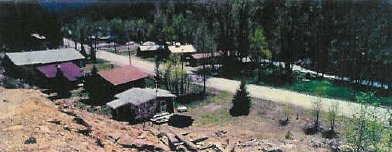
Neihart is on the Kings Hill Scenic Byway, also known as U.S. Route 89.[7] Snow removal crews work throughout the winter to keep the road open. It is the only town between Monarch to the north and White Sulphur Springs to the south.[4] The Lewis and Clark National Forest surrounds the town.[8] The area is moderately to steeply mountainous. The Showdown Ski Area is nearby, and takes advantage of the mountainous terrain.[9] Just south of Neihart, Route 89 begins to follow Sawmill Creek.[6] The highway then climbs toward King's Hill, a major pass through the Little Belt Mountains.[6]
History
On October 20, 1879,[10] E.A. "Buck" Barker and Patrick Hughes, two prospectors, discovered silver ore on Galena Creek in the Little Belt Mountains.[11] The mining towns of Barker, Galena Creek, and Hughesville soon sprang up in the area.[10][11] Among the many small mining camps which were erected was Jericho, which soon went bust.[12] In July 1881, three prospectors from Barker—James LeRoy Neihart, John O'Brien, and Richard Harley[1]—discovered silver near the present-day town of Neihart,[10] and established the Queen of the Mountains Mine.[13] When the news reached Barker, several parties of prospectors headed for the are,[14] and established a new mining camp on Belt Creek named Canyon City.[2] The camp was renamed Neihart after James LeRoy Neihart, one of the miners who discovered the silver there.[14] (His uncle was the noted poet John Neihardt.)[6] The mining district was never formally organized, but for many years was called the "Montana District."[14] More than 40 mines operated in the area over the next 75 years.[6]
In 1882, the town was large enough for the United States Post Office Department to establish a post office there.[2] A road to White Sulphur Springs was constructed shortly thereafter, although ore was packed out by mule to Barker and smelted there.[2][14] When the Barker smelter closed in 1883, a new smelter was built close to Neihart at the Mountain Chief Mine in 1885.[15] By this time, the town boasted a blacksmith's shop, a boarding house, restaurants, two saloons, and stables.[15] About 50 houses had been built in Neihart, although many residents still lived in tents.[15] From 1882 to 1929, about $16 million in silver was taken out of the area around Neihart.[1][15] The Galt and Broadwater mines were dug in 1883, and a year later the Ball and Mountain Chief mines were in operation.[16] The M and I, Rochester, and Silver Dyke mines also opened near Neihart.[6] Despite the area's rich ore deposits, investment in mining in the Neihart region remained low because it was too expensive to get ore out.[15][17] In 1887, these early mines larger shut down, as most of the richest and easy-to-reach veins of ore had been exhausted.[17] By 1890, Neihart was almost deserted.
On November 15, 1891, a spur of the Montana Central Railway reached Neihart and a strong mining boom began.[15] Now even low-grade ore could be easily and cheaply shipped to the huge smelter in Great Falls.[17] The Panic of 1893 wiped out the area's mining economy, but the town continued to exist.[15] This was due largely because some mines, such as the Benton, Big Seven, and Florence, continued in operation.[17]
Neihart went through a series of booms and busts over the next half-century. Mining booms occurred during and after World War I, in 1929, and in 1935.[15] The 1935 boom was built primarily around zinc mining.[6] In 1939, the town's population was 168.[6] During World War II, Neihart was a major source of zinc mining.[1] After the war, the rail spur was abandoned and the track removed.
Portions of Neihart have been abandoned, and ghost town ruins can be seen in the city's outer limits.[8] Among the more famous is Wu Tang's former laundry and drug store.[8] The remains of Jericho can also still be found in Neihart.[12]
Demographics
As of the census[18] of 2000, there were 91 people, 44 households, and 27 families residing in the town. The population density was 45.8 people per square mile (17.7/km²). There were 164 housing units at an average density of 82.5 per square mile (31.8/km²). The racial makeup of the town was 93.41% White, 1.10% Native American, 1.10% from other races, and 4.40% from two or more races. Hispanic or Latino of any race were 1.10% of the population.
There were 44 households out of which 15.9% had children under the age of 18 living with them, 54.5% were married couples living together, 2.3% had a female householder with no husband present, and 36.4% were non-families. 29.5% of all households were made up of individuals and 15.9% had someone living alone who was 65 years of age or older. The average household size was 2.07 and the average family size was 2.36.
In the town the population was spread out with 17.6% under the age of 18, 19.8% from 25 to 44, 30.8% from 45 to 64, and 31.9% who were 65 years of age or older. The median age was 54 years. For every 100 females there were 152.8 males. For every 100 females age 18 and over, there were 167.9 males.
The median income for a household in the town was $21,458, and the median income for a family was $25,625. Males had a median income of $11,250 versus $18,750 for females. The per capita income for the town was $20,266. There were 20.7% of families and 21.7% of the population living below the poverty line, including 20.0% of under eighteens and none of those over 64.
References
- ^ a b c d e Aarstad, et al., p. 191.
- ^ a b c d Fifer, p. 77.
- ^ Rankama, p. 189.
- ^ a b c d Soderberg and Soderberg, p. 61.
- ^ Rankama, p. 173.
- ^ a b c d e f g h i Federal Writers' Project, p. 271.
- ^ Federal Writers' Project, p. 270.
- ^ a b c Soderberg and Soderberg, p. 62.
- ^ Enzel, p. 68.
- ^ a b c Miller, p. 67.
- ^ a b Fifer, p. 76.
- ^ a b Miller, p. 165.
- ^ Weed, p. 402.
- ^ a b c d Weed, p. 403.
- ^ a b c d e f g h Fifer, p. 78.
- ^ Weed, p. 403-404.
- ^ a b c d Weed, p. 404.
- ^ "American FactFinder". United States Census Bureau. http://factfinder.census.gov. Retrieved 2008-01-31.
Bibliography
- Aarstad, Rich; Arguimbau, Ellen; Baumler, Ellen; Porsild, Charlene L.; and Shovers, Brian. Montana Place Names From Alzada to Zortman. Helena, Mont.: Montana Historical Society Press, 2009.
- Federal Writers' Project. Montana: A State Guide Book. New York: Hastings House, 1939.
- Miller, Donald C. Ghost Towns of Montana: A Classic Tour Through the Treasure State's Historic Sites. Guilford, Conn.: Two Dot, 2008.
- Enzel, Robert G. The White Book of Ski Areas. Washington, D.C.: Inter-Ski Services, 1998.
- Fifer, Barbara. Montana Mining Ghost Towns. Helena, Mont.: Farcountry Press, 2002.
- Rankama, Kalervo. The Geologic Systems: The Precambrian. New York: Interscience Publishers, 1963.
- Soderberg, Vicky and Soderberg, Ken. The Best in Tent Camping: Montana. Birmingham, Ala.: Menasha Ridge Press, 2005.
- Weed, Walter Harvey. Geology of the Little Belt Mountains, Montana, With Notes on the Mineral Deposits of the Neihart, Barker, Yogo, and Other Districts. Washington, D.C.: Government Printing Office, 1900.
Municipalities and communities of Cascade County, Montana City 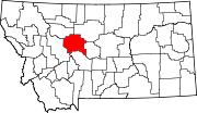
Towns CDPs Black Eagle | Fort Shaw | Malmstrom AFB | Simms | Sun Prairie | Sun River | Ulm | Vaughn
Unincorporated
communityCategories:- Populated places in Cascade County, Montana
- Towns in Montana


Wikimedia Foundation. 2010.