- Monarch, Montana
-
Wolf Creek, Montana — Unincorporated community — 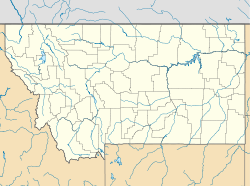
 Wolf Creek, Montana
Coordinates: 47°05′54″N 110°50′19″W / 47.09833°N 110.83861°WCoordinates: 47°05′54″N 110°50′19″W / 47.09833°N 110.83861°W Country United States State Montana County Cascade Elevation 4,560 ft (1,390 m) Time zone Mountain (MST) (UTC-7) - Summer (DST) MDT (UTC-6) ZIP code 59463 Area code(s) 406 GNIS feature ID 801711[1] Monarch is an unincorporated community in Cascade County, Montana, United States.
Contents
Geography
Monarch is located in the Little Belt Mountains of central Montana, southeast of Great Falls on US Highway 89 in the Lewis and Clark National Forest. Monarch is located near Kings Hill Pass.
History
Monarch was founded in 1889 to service the various silver mines in the Little Belt Mountains of Cascade County.
Recreation
Recreation opportunities are available at nearby Sluice Boxes State Park, where hiking and wildlife viewing are popular activities. Lodging, camping, and a post office are available to visitors at Monarch. Hiking and fishing are popular in the area and in the nearby town of Neihart, where lodging is also available.
References
Municipalities and communities of Cascade County, Montana County seat: Great Falls City 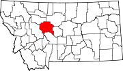
Towns CDPs Black Eagle | Fort Shaw | Malmstrom AFB | Simms | Sun Prairie | Sun River | Ulm | Vaughn
Unincorporated
communityMonarch
Categories:- Populated places in Cascade County, Montana
- Unincorporated communities in Montana


Wikimedia Foundation. 2010.