- Curryville, Missouri
-
Curryville, Missouri — City — Location of Curryville, Missouri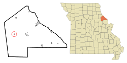
Coordinates: 39°20′41″N 91°20′33″W / 39.34472°N 91.3425°WCoordinates: 39°20′41″N 91°20′33″W / 39.34472°N 91.3425°W Country United States State Missouri County Pike Area – Total 0.3 sq mi (0.7 km2) – Land 0.3 sq mi (0.7 km2) – Water 0.0 sq mi (0.0 km2) Elevation 817 ft (249 m) Population (2000) – Total 251 – Density 909.2/sq mi (351.1/km2) Time zone Central (CST) (UTC-6) – Summer (DST) CDT (UTC-5) ZIP code 63339 Area code(s) 573 FIPS code 29-17902[1] GNIS feature ID 0716603[2] Curryville is a city in Pike County, Missouri, United States. The population was 251 at the 2000 census.
Geography
Curryville is located at 39°20′41″N 91°20′33″W / 39.34472°N 91.3425°W (39.344683, -91.342506)[3].
According to the United States Census Bureau, the city has a total area of 0.3 square miles (0.78 km2), all of it land.
Demographics
As of the census[1] of 2000, there were 251 people, 106 households, and 71 families residing in the city. The population density was 909.2 people per square mile (346.1/km²). There were 128 housing units at an average density of 463.7 per square mile (176.5/km²). The racial makeup of the city was 91.63% White, 3.98% African American, 0.40% Native American, 0.40% Asian, and 3.59% from two or more races.
There were 106 households out of which 32.1% had children under the age of 18 living with them, 49.1% were married couples living together, 17.0% had a female householder with no husband present, and 32.1% were non-families. 28.3% of all households were made up of individuals and 6.6% had someone living alone who was 65 years of age or older. The average household size was 2.37 and the average family size was 2.93.
In the city the population was spread out with 26.7% under the age of 18, 8.0% from 18 to 24, 25.1% from 25 to 44, 29.5% from 45 to 64, and 10.8% who were 65 years of age or older. The median age was 35 years. For every 100 females there were 91.6 males. For every 100 females age 18 and over, there were 85.9 males.
The median income for a household in the city was $27,500, and the median income for a family was $29,583. Males had a median income of $27,679 versus $16,250 for females. The per capita income for the city was $13,032. About 17.1% of families and 22.7% of the population were below the poverty line, including 20.8% of those under the age of eighteen and 25.0% of those sixty five or over.
Also, about 99% of all the Asian population is Indian American.
References
- ^ a b "American FactFinder". United States Census Bureau. http://factfinder.census.gov. Retrieved 2008-01-31.
- ^ "US Board on Geographic Names". United States Geological Survey. 2007-10-25. http://geonames.usgs.gov. Retrieved 2008-01-31.
- ^ "US Gazetteer files: 2010, 2000, and 1990". United States Census Bureau. 2011-02-12. http://www.census.gov/geo/www/gazetteer/gazette.html. Retrieved 2011-04-23.
Municipalities and communities of Pike County, Missouri Cities Bowling Green | Clarksville | Curryville | Frankford | Louisiana

Villages Annada | Ashburn | Eolia | Paynesville | Tarrants
Townships Ashley | Buffalo | Calumet | Cuivre | Hartford | Indian | Peno | Prairieville | Salt River | Spencer
Unincorporated
communitiesCategories:- Cities in Pike County, Missouri


Wikimedia Foundation. 2010.