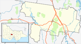
- Newstead, Victoria
-
Newstead
Victoria
Lyons StreetPopulation: 487[1] Postcode: 3462 Coordinates: 37°6′19″S 144°3′54″E / 37.10528°S 144.065°ECoordinates: 37°6′19″S 144°3′54″E / 37.10528°S 144.065°E Location: - 142 km (88 mi) from Melbourne
- 56 km (35 mi) from Bendigo
- 17 km (11 mi) from Castlemaine
- 32 km (20 mi) from Maryborough
LGA: Shire of Mount Alexander State District: Bendigo West Federal Division: Bendigo Newstead is a town in Victoria, Australia, situated along the Loddon River. It is in the Shire of Mount Alexander local government area. At the 2006 census, Newstead had a population of 487.[1] Newstead has many festivals and folk events and is in the centre of the golden triangle, close to many tourist attractions and events.
Contents
History
The Post Office opened on 1 August 1857.[2]
The Town today
It has two pubs, community centre, cafe, a general store, a Rural Transaction Centre (with Internet café, Bendigo Bank, library, daycare and other services), a small licenced IGA and bakery, a swimming pool, a hairdressers as well as a monthly newspaper, the Newstead Echo. It also has a licenced cafe, a butcher, two small shops selling vintage odds and ends and a winery just out of town. There is a town primary school and kindergarten and high schools nearby, a community hall, race park and Rotunda park for events such as the twice yearly Newstead Market. There is a women's group, four churches, performers group, organic growers group, playgroup, senior citizens club, lawn bowls club, croquet club, football, netball club, natives groups, walking group and spinners group. Annually, Newstead holds a folk music festival with artists coming from all around Australia and some from overseas. As well as 'Chopped' magazine holding their annual, Chopped Rod & Custom show, which brings traditional style rods and custom cars from all over Australia into the town for a weekend.
The Loddon River that flows through the town has caused a levee bank to be built in 1912 which has stopped the town from flooding several times. The old courthouse has now become the Newstead historical society and holds all of Newstead history and plans.
References
- ^ a b Australian Bureau of Statistics (25 October 2007). "Newstead (L) (Urban Centre/Locality)". 2006 Census QuickStats. http://www.censusdata.abs.gov.au/ABSNavigation/prenav/LocationSearch?collection=Census&period=2006&areacode=UCL238400&producttype=QuickStats&breadcrumb=PL&action=401. Retrieved 2008-09-21.
- ^ Premier Postal History, Post Office List, https://www.premierpostal.com/cgi-bin/wsProd.sh/Viewpocdwrapper.p?SortBy=VIC&country=, retrieved 2008-04-11
External links
Cities, towns and localities in the Shire of Mount Alexander Cities: Townships: Barfold · Baringhup · Baringhup West · Barkers Creek · Bradford · Campbells Creek · Chewton · Elphinstone · Faraday · Fryerstown · Glenluce · Golden Point · Gower · Green Gully · Guildford · Harcourt · Irishtown · Joyces Creek · Langley · Maldon · McKenzie Hill · Metcalfe · Metcalfe East · Moonlight Flat · Muckleford · Muckleford South · Myrtle Creek · Neereman · Newstead · Nuggetty · Ravenswood South · Redesdale · Sandon · Strangways · Strathlea · Sutton Grange · Taradale · Tarilta · Tarrengower · Vaughan · Walmer · Welshmans Reef · Werona · Yandoit Hills · Yapeen
Categories:- Towns in Victoria (Australia)
- Victoria (Australia) geography stubs
Wikimedia Foundation. 2010.

