- Guildford, Victoria
Infobox Australian Place
type = town
name = Guildford
state = vic
caption =
lga =Shire of Mount Alexander
postcode = 3451 [ [http://www1.auspost.com.au/postcodes/index.asp?Locality=guildford&sub=1&State=VIC&Postcode=&submit1=Search Australia Post postcode search] ]
est =
pop = 205
pop_footnotes =
elevation=
maxtemp =
mintemp =
rainfall =
stategov =
fedgov =
dist1 = 130
dir1 = NW
location1=Melbourne
dist2 = 11
dir2 = SE
location2= Castlemaine
dist3 = 50
dir3 = SE
location3= BendigoGuildford is a small settlement situated on the Loddon River, 130 km north-west of
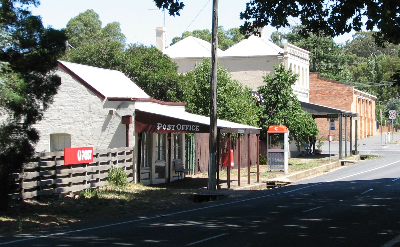
Melbourne , in Victoria,Australia . It is located on theMidland Highway between Daylesford and Castemaine. The population recorded at the 2006 census was 205.Census 2006 AUS|id=SSC25709|name=Guildford (State Suburb)|accessdate=2008-01-14|quick=on]Facilities in the town include a post office (in a building dating from 1901), hotel, community hall and a
general store .cite web|url=http://www.theage.com.au/news/Victoria/Guildford/2005/02/17/1108500206491.html |title=Guildford|work=Travel|publisher="The Age "|date=2004-02-08|accessdate=2008-01-14]It is thought that the town was named after Guildford in England.
Big Tree
The Big Tree is a large, well-preserved
River Red Gum ("Eucalyptus camaldulensis"), located at the corner of Fryers Street and Ballaarat Street. It is thought to be one of the largest in Victoria, with a height of 34 metres and circumference of 9.35 metres at the base. The tree is estimated to be over 500 years old. [cite web|url=http://www.nattrust.com.au/trust_register/search_the_register/eucalyptus_camaldulensis__1|title="Eucalyptus camaldulensis"|publisher=National Trust of Australia - Victoria|accessdate=2007-01-14] .History
The area was known as "Yarrayne" to the original inhabitants of the area, the
Jajowarrung people. The first European to explore the area wasMajor Thomas Mitchell in 1836.By the 1840s pastoral runs had been established and, in the following decade, gold miners flocked to the area during the rush at the
Mount Alexander goldfields. A large encampment of Chinese miners was situated at the junction of theLoddon River and Campbells Creek.The first hotel opened in 1854 but was destroyed by fire three years later. The Guildford Family Hotel which also dates back to this era is still operational today. Other hotels in the town included the Farmers Arms Hotel (delicenced) and the Commercial Hotel (1865), the building now serving as a
general store .A school was built and a Post Office opened Citation
last = Premier Postal History | title = Post Office List | url = https://www.premierpostal.com/cgi-bin/wsProd.sh/Viewpocdwrapper.p?SortBy=VIC&country= | accessdate = 2008-04-11 ] in 1860, followed by the Anglican Church the following year. The Catholic Church and the Wesleyan Chapel are now both private property.
In 1919 an
avenue of honour was planted along the main road, usingLondon Plane s, to commemorate locals who fought inWorld War I .References
External links
* [http://www.ga.gov.au/bin/gazd01?rec=244316 Place Names Search: Guildford] Geoscience Australia
Wikimedia Foundation. 2010.