- Oxford, Maryland
-
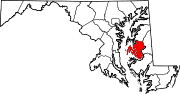
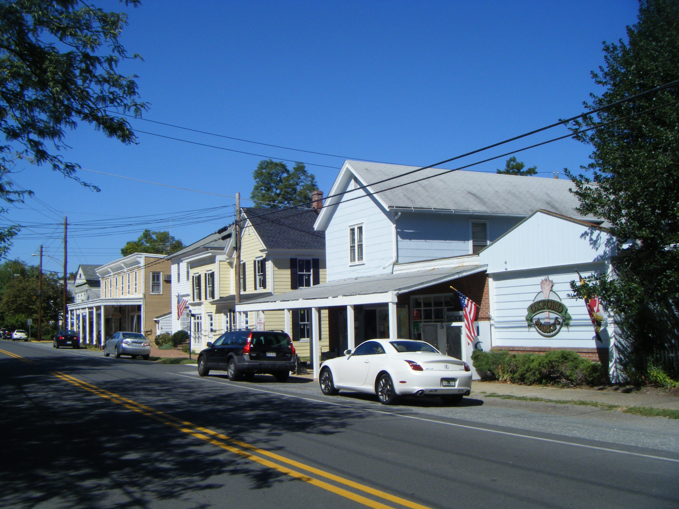
Oxford, Maryland — Town — Stores on North Morris Street Location of Oxford, Maryland
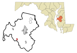
Coordinates: 38°41′12″N 76°10′15″W / 38.68667°N 76.17083°WCoordinates: 38°41′12″N 76°10′15″W / 38.68667°N 76.17083°W Country United States State Maryland County Talbot Area – Total 0.7 sq mi (1.9 km2) – Land 0.5 sq mi (1.3 km2) – Water 0.2 sq mi (0.6 km2) Elevation 7 ft (2 m) Population (2000) – Total 771 – Density 1,532.4/sq mi (591.7/km2) Time zone Eastern (EST) (UTC-5) – Summer (DST) EDT (UTC-4) ZIP code 21654 Area code(s) 410 FIPS code 24-59450 GNIS feature ID 0590961 Oxford is a waterfront town and former colonial port in Talbot County, Maryland, United States. The population was 771 at the 2000 census.
Contents
History
Oxford is one of the oldest towns in Maryland. While Oxford officially marks the year 1683 as its founding because in that year it was first named by the Maryland General Assembly as a seaport, the town began between 1666 and 1668 when 30 acres (120,000 m2) were laid out as a town called Oxford by William Stephens, Jr.. By 1669 one of the first houses was built for Innkeeper Francis Armstrong (see Talbot County Land Records, A 1, f. 10/11).[1] Oxford first appears on a map completed in 1670, and published in 1671.[2] In 1694, Oxford and a new town called Anne Arundel (now Annapolis) were selected as the only ports of entry for the entire Maryland province. Until the American Revolution, Oxford enjoyed prominence as an international shipping center surrounded by wealthy tobacco plantations.
Early inhabitants included Robert Morris, Sr., agent for a Liverpool shipping firm who greatly influenced the town's growth; his son, Robert Morris, Jr., known as "the financier of the Revolution;" Jeremiah Banning, sea captain, war hero, and statesman; The Reverend Thomas Bacon, Anglican clergyman who wrote the first compilation of the laws of Maryland; Matthew Tilghman, known as the "patriarch of Maryland" and "father of statehood"; and Colonel Tench Tilghman, aide-de-camp to George Washington and the man who carried the message of General Cornwallis's surrender to the Continental Congress in Philadelphia.
The American Revolution marked the end of Oxford's glory. Gone were the British ships with their variety of imported goods, and tobacco was replaced by wheat as a cash crop. Businesses went bankrupt, cattle grazed in the streets, and the population dwindled.
After the Civil War, Oxford emerged from its "long slumber" to nearly 100 years of a new prosperity signaled by completion of the railroad in 1871 and improved methods of canning and packing which opened national markets for oysters from the Chesapeake Bay's bountiful beds. Business was booming, houses were going up everywhere, and tourists and boaters were arriving in droves. But it was not to last. In the early part of the 20th century, the oyster beds played out, the packing houses closed, other businesses went bankrupt, and the railway and steamships eventually disappeared. Oxford became a sleepy little town inhabited mainly by watermen who still worked the waters of the Tred Avon River.
Oxford today is still a waterman's town, but is enjoying a new resurgence based on tourism and leisure activities. Its quiet charm, fresh air, summer breezes, and clean water provide a haven from the hustle and bustle of city life for boaters, weekend visitors, and summer residents. The film Failure to Launch was filmed in part here.
Geography
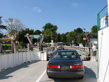
 Arriving at Oxford by ferry crossing the Tred Avon River.
Oxford is located at 38°41'12" North, 76°10'15" West (38.686776, -76.170842)[3] on the south bank of the Tred Avon river, near its mouth, where it empties into the Choptank.
According to the United States Census Bureau, the town has a total area of 0.7 square miles (1.8 km2), of which, 0.5 square miles (1.3 km2) of it is land and 0.2 square miles (0.52 km2) of it (30.56%) is water. This includes Town Creek, which nearly splits the town in two from north to south and provides a protected harbor for boaters and Oxford's local shipbuilders.
Demographics
As of the census[4] of 2000, there were 771 people, 396 households, and 241 families residing in the town. The population density was 1,532.4 people per square mile (595.4/km²). There were 523 housing units at an average density of 1,039.5 per square mile (403.9/km²). The racial makeup of the town was 92.87% White, 6.36% Black or African American, 0.13% Asian and 0.65% from two or more races. Hispanic or Latino of any race were 0.65% of the population.
There were 396 households out of which 14.9% had children under the age of 18 living with them, 53.0% were married couples living together, 7.1% had a female householder with no husband present, and 38.9% were non-families. 34.1% of all households were made up of individuals and 16.4% had someone living alone who was 65 years of age or older. The average household size was 1.95 and the average family size was 2.45.
In the town the population was spread out with 13.2% under the age of 18, 1.7% from 18 to 24, 17.3% from 25 to 44, 37.2% from 45 to 64, and 30.6% who were 65 years of age or older. The median age was 55 years. For every 100 females there were 86.2 males. For every 100 females age 18 and over, there were 83.8 males.
The median income for a household in the town was $52,054, and the median income for a family was $71,071. Males had a median income of $52,708 versus $33,929 for females. The per capita income for the town was $47,917. About 2.5% of families and 3.3% of the population were below the poverty line, including 7.1% of those under age 18 and 2.7% of those age 65 or over.
 Most of the town of Oxford sits on a peninsula.
References
- ^ See: Owsald Tilghman, History of Talbot County, 2 vols., (Baltimore: Williams & Wilkins Co., 1915). Tilghman notes the will of William Parrat [Parrott] (p. 334). Parrat leaves "my share of house and Land at Oxford" to his son. The will is dated 14 March 1668. Parrat identifies himself in his will as "William Parrat of Tredhaven In Choptank River In Talbot County." The original Parrat will is to be found at the Maryland State Archives, TALBOT COUNTY REGISTER OF WILLS (Wills, Original) Will of William Parrat, 1669, box 18, folder 41, MSA C1926-22. ecp 3/13/2008
- ^ Edward C. Papenfuse and Joseph M. Coale, The Maryland State Archives Atlas of Historical Maps of Maryland, 1608-1908, (Baltimore: The Johns Hopkins University Press, 2003), pp. 16-21.
- ^ "US Gazetteer files: 2010, 2000, and 1990". United States Census Bureau. 2011-02-12. http://www.census.gov/geo/www/gazetteer/gazette.html. Retrieved 2011-04-23.
- ^ "American FactFinder". United States Census Bureau. http://factfinder.census.gov. Retrieved 2008-01-31.
Municipalities and communities of Talbot County, Maryland Towns Easton | Oxford | Queen Anne‡ | Saint Michaels | Trappe
CDPs Other
communitiesFootnotes ‡This populated place also has portions in an adjacent county or counties
Categories:- Towns in Maryland
- Populated places in Talbot County, Maryland


Wikimedia Foundation. 2010.