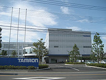
- Minuma-ku, Saitama
-
Minuma-ku (見沼区) is a ward of Saitama City, Saitama Prefecture, Japan, occupying the northeastern part of the city. It is surrounded by Iwatsuki-ku (east), Midori-ku (south), Urawa-ku (southwest), Ōmiya-ku (west), Kita-ku (northwest) of Saitama city and cities of Ageo and Hasuda (north).
History
Until May 1, 2001 it was an eastern part of Ōmiya city. On that day Ōmiya merged with neighboring cities of Urawa and Yono to form the city of Saitama. On 1 April 2003, the day Saitama city became a city designated by government ordinance, Minuma-ku was sectored as well as other eight wards.
It once occupied the northern half of Lake Minuma, which was reclaimed in the 18th century.[citation needed]
Visitor attraction
Minumatanbo (見沼田んぼ), referring to a vast green area of nearly 1260 hectares left within 20 to 30 kilometers from central Tokyo.[1]
References
 Saitama Prefecture
Saitama (capital city) 
Cities Ageo | Asaka | Chichibu | Fujimi | Fujimino | Fukaya | Gyōda | Hannō | Hanyū | Hasuda | Hidaka | Higashi-Matsuyama | Honjō | Iruma | Kasukabe | Kawagoe | Kawaguchi | Kazo | Kitamoto | Koshigaya | Kōnosu | Kuki | Kumagaya | Misato | Niiza | Okegawa | Saitama (capital) | Sakado | Satte | Sayama | Shiki | Sōka | Toda | Tokorozawa | Tsurugashima | Wakō | Warabi | Yashio | YoshikawaDistricts Former districts See also: Towns and villages by district Coordinates: 35°56′7″N 139°39′16″E / 35.93528°N 139.65444°E
Categories:- Wards of Saitama
- Saitama geography stubs
Wikimedia Foundation. 2010.


