- Sakado, Saitama
Japanese city
Name = Sakado
JapaneseName=坂戸市
Prefecture=Saitama
Region=Kantō
Area_km2=40.97
Population=100,240
PopDate=2008
Density_km2=2431
Coords=
LatitudeDegrees = 35
LatitudeMinutes = 57
LatitudeSeconds =
LongtitudeDegrees = 139
LongtitudeMinutes = 24
LongtitudeSeconds =
Postal code=
Area code=049
Mayor = Hitoshi Iri
Tree = Japanese cherry
Flower = Satsuki azalea
Bird =
Symbol
CityHallPostalCode = 350-0292
CityHallAddress= 1-1-1 Chiyoda, Sakado-shi, Saitama-ken
CityHallPhone= 049-283-1331
CityHallLink = [http://www.city.sakado.lg.jp/ City of Sakado]
City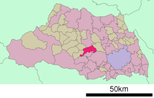
Elevation=nihongo|Sakado|坂戸市|Sakado-shi is a city located in Saitama, Japan.
As of
May 1 ,2008 , the city has an estimated population of 100,240 (40,850 households). The total area is 40.97 km².The town of Sakado was upgraded to city status on
September 1 ,1976 .The city is served by three railway stations on the
Tōbu Tōjō Line fromIkebukuro : Wakaba, Sakado, and Kita-Sakado, and alsoNishi-Ōya Station on theTōbu Ogose Line .Adjoining cities and towns
*Kawagoe
*Tsurugashima
*Higashimatsuyama
*Hidaka
*Moroyama, Iruma
*Kawajima, Hiki
*Hatoyama, HikiExternal links
* [http://www.city.sakado.lg.jp/ Sakado official website] in Japanese

Wikimedia Foundation. 2010.