- M-108 (Michigan highway)
-
M-108
Nicolet Street 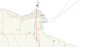
Route information Maintained by Village of Mackinaw City and the Emmet County Road Commission Length: 1.069 mi[4] (1.720 km) Existed: 1960[1][2] – December 9, 2010[3] Major junctions South end:  I-75 near Mackinaw City
 US 23 in Mackinaw City
North end: Michigan Tourism Welcome Center in Mackinaw City Location Counties: Emmet & Cheboygan Highway system Michigan State Trunkline Highway System
Interstate • US • State←  M-107
M-107M-109  →
→M-108 was a state trunkline highway in the US state of Michigan. The highway followed Nicolet Street, although some maps also labeled it as the Mackinaw Highway. The road was on the boundary between Emmet and Cheboygan counties.
The original M-108 designation dated back to 1928. This version was transferred to local control in 1957, but revived later under a different routing in 1960. On April 29, 2010, the Petoskey News-Register reported that the Michigan Department of Transportation (MDOT) will rebuild the roadway in preparation to transfer it back to local control once again. MDOT and local officials signed memoranda of understanding, completing the transfer of the roadway on December 9, 2010.
Contents
Route description
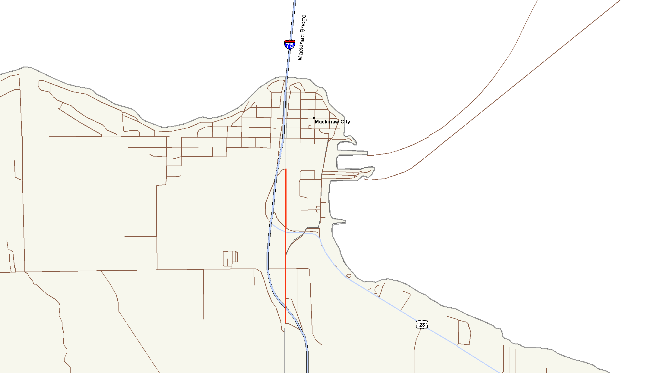
The 1.069-mile (1.720 km) long route connected two interchanges off Interstate 75 (I-75) on the south side of Mackinaw City with a tourist welcome center. The southern terminus was at a partial interchange with I-75 (exit 337) just south of Mackinaw City on the boundary between Emmet and Cheboygan counties. This interchange is about two miles (3 km) north of the northern terminus of US Highway 31 (US 31). M-108 followed Nicolet Street north from I-75 into the Village of Mackinaw City past the Thunder Falls Water Park and some local motels to an intersection with US 23. North of the US 23 intersection is the Michigan Welcome Center and other tourist amenities on the west side of the street.[5] State maintenance ends at the intersection with the off-ramp from northbound I-75 exit 338.[6]
History
In 1928, the first M-108 designation was commissioned along a rare "three-legged route" connecting the State Highway Ferry Docks with the Fort Michilimackinac State Historic Park and US 31. At one point while traveling westbound on M-108, motorists could turn right onto northbound M-108 or left onto southbound M-108.[7][8] In preparation for the opening of the Mackinac Bridge, the Michigan State Highway Department transferred all of M-108 to local control in late 1957, decommissioning the designation at the same time.[9][10] In 1960, the current M-108 was commissioned along the current routing.[1][2]
On April 29, 2010, MDOT announced plans to transfer M-108 in its entirety to the Village of Mackinaw City and Emmet County. In preparation for this transfer, MDOT repaved, widened and reconstructed the roadway. While rebuilding the section of the highway between US 23 and the northern terminus, the Welcome Center was closed. Plans had this section to be completed, and the center to bed reopened, for Memorial Day weekend, with the remainder of construction to be completed in August. Following the transfer to local control, M-108 ceased to be a state highway and the designation was decommissioned.[11] Previous news reports stated that the roadway was too small to merit highway status under federal guidelines.[12] The transfer was completed on December 9, 2010 when MDOT and local officials signed memoranda of understanding to affect the transfer. The section within the Village of Mackinaw City was transferred to the village, and the remainder to Emmet County.[3]
Major intersections
The entire route was on the Emmet–Cheboygan county line.
Location Mile[4] Destinations Notes Wawatam Township –
Mackinaw Township0.000 I-75 south – Saginaw
 To US 31 south
Northbound exit 337 on I-75 and southbound ; roadway continues south as Old US 31/Mackinaw Highway Mackinaw City 0.613 US 23 – Cheboygan, Mackinac Bridge0.784 Michigan Tourism Welcome Center 1.069 Exit ramp from I-75 Former end of state maintenance; street continues north as Nicolet Street;
no access to I-75 from M-1081.000 mi = 1.609 km; 1.000 km = 0.621 mi
Concurrency terminus • Closed/Former • Incomplete access • UnopenedReferences
- ^ a b Michigan State Highway Department (1960). Official Highway Map (Map). Section E10. (Includes all changes through July 1, 1960)
- ^ a b Michigan State Highway Department (1961). Official Highway Map (Map). Section E10. (Includes all changes through July 1, 1961)
- ^ a b "Contract Number 2011-0033". Michigan Department of Transportation. December 9, 2010. http://tech.groups.yahoo.com/group/greatlakesroads/message/16410. Retrieved December 13, 2010. "Contract Number 2011-0032, Effective date of transfer: December 9, 2010
ROADWAY SEGMENT transferred from MDOT to the County, becoming a County Primary road:
M-108/Mackinaw Highway, from its southern terminus approximately located at a point where the M-108/Mackinaw Highway centerline and the center of southbound I-75 freeway would cross if there were no grade separation between the roadways, northerly to the south city limits of the Village of Mackinaw City, a distance of about 0.32 miles in control section 16071
Contract Number 2011-0033, Effective date of transfer: December 9, 2010
ROADWAY SEGMENT transferred from MDOT to the VILLAGE, becoming a City Major street:
M-108/Nicolet Street, from the south city limits of the Village of Mackinaw City northerly to the northern M-108 terminus located at the I-75 northbound exit ramp, a distance of about 0.75 miles in control section 16071." - ^ a b "MDOT Physical Reference Finder Application". Michigan Department of Transportation. 2009. http://www.mcgi.state.mi.us/prfinder/. Retrieved April 29, 2010.
- ^ Google, Inc. Google Maps – Overview Map of M-108, Mackinaw City, MI (Map). Cartography by Google, Inc. http://maps.google.com/maps?f=q&source=s_q&hl=en&geocode=&q=Mackinaw+City,+MI&sll=37.0625,-95.677068&sspn=64.497063,65.654297&ie=UTF8&hq=&hnear=Mackinaw+City,+Cheboygan,+Michigan&ll=45.77128,-84.731798&spn=0.014159,0.016029&t=h&z=16. Retrieved April 29, 2010.
- ^ Michigan Department of Transportation (2009). Control Section/Physical Reference Atlas (Map). http://mdotwas1.mdot.state.mi.us/public/maps/pr/. Retrieved July 26, 2009.
- ^ Michigan State Highway Department (May 1, 1928). Official Highway Service Map (Map). Cartography by MSHD.
- ^ Michigan State Highway Department (July 1, 1928). Official Highway Service Map (Map). Cartography by MSHD.
- ^ Michigan State Highway Department (October 1, 1957). 1957 Official Highway Map (Map). Section E10.
- ^ Michigan State Highway Department (1958). Official Highway Map (Map). Section E10. (Includes all changes through July 1, 1958)
- ^ Zucker, Steve (April 29, 2010). "State To Fix then Hand over M-108". Petoskey News-Review. http://petoskeynews.com/news/article_d32b6e24-538f-11df-bd3f-001cc4c002e0.html. Retrieved April 29, 2010.[dead link]
- ^ Ayala, Mike (December 24, 2009). "Mackinaw City Road Work Planned". St. Ignace News: p. A1. http://www.stignacenews.com/news/2009-12-24/Front_Page/Mackinaw_City_Road_Work_Planned.html.
External links
Categories:- Former state highways in Michigan
- Northern Michigan

Wikimedia Foundation. 2010.