- North Terre Haute, Indiana
-
North Terre Haute, Indiana — CDP — 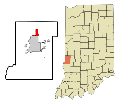
Coordinates: 39°31′54″N 87°21′43″W / 39.53167°N 87.36194°WCoordinates: 39°31′54″N 87°21′43″W / 39.53167°N 87.36194°W Country United States State Indiana County Vigo Area – Total 3.6 sq mi (9.3 km2) – Land 3.6 sq mi (9.3 km2) – Water 0.0 sq mi (0.0 km2) Elevation 495 ft (151 m) Population (2010) – Total 4,305 – Density 1,287.3/sq mi (497.0/km2) Time zone Eastern (EST) (UTC-5) – Summer (DST) EDT (UTC-4) ZIP code 47805 Area code(s) 812 FIPS code 18-55098[1] GNIS feature ID 0440299[2] North Terre Haute is a census-designated place (CDP) in Vigo County, Indiana, United States. The population was 4,305 at the 2010 census. It is part of the Terre Haute Metropolitan Statistical Area.
Geography
North Terre Haute is located at 39°31′54″N 87°21′43″W / 39.53167°N 87.36194°W (39.531681, -87.361847)[3].
According to the United States Census Bureau, the CDP has a total area of 3.6 square miles (9.3 km²), all of it land.
Demographics
As of the census[1] of 2000, there were 4,606 people, 1,850 households, and 1,235 families residing in the CDP. The population density was 1,287.3 people per square mile (496.8/km²). There were 1,950 housing units at an average density of 545.0/sq mi (210.3/km²). The racial makeup of the CDP was 96.18% White, 2.56% African American, 0.30% Native American, 0.35% Asian, 0.04% from other races, and 0.56% from two or more races. Hispanic or Latino of any race were 1.00% of the population.
There were 1,850 households out of which 30.8% had children under the age of 18 living with them, 51.4% were married couples living together, 11.1% had a female householder with no husband present, and 33.2% were non-families. 27.9% of all households were made up of individuals and 9.5% had someone living alone who was 65 years of age or older. The average household size was 2.42 and the average family size was 2.94.
In the CDP the population was spread out with 26.7% under the age of 18, 8.6% from 18 to 24, 29.3% from 25 to 44, 22.6% from 45 to 64, and 12.8% who were 65 years of age or older. The median age was 36 years. For every 100 females there were 101.4 males. For every 100 females age 18 and over, there were 92.3 males.
The median income for a household in the CDP was $34,617, and the median income for a family was $42,469. Males had a median income of $33,306 versus $22,813 for females. The per capita income for the CDP was $15,729. About 8.7% of families and 9.6% of the population were below the poverty line, including 8.0% of those under age 18 and 8.7% of those age 65 or over.
References
- ^ a b "American FactFinder". United States Census Bureau. http://factfinder.census.gov. Retrieved 2008-01-31.
- ^ "US Board on Geographic Names". United States Geological Survey. 2007-10-25. http://geonames.usgs.gov. Retrieved 2008-01-31.
- ^ "US Gazetteer files: 2010, 2000, and 1990". United States Census Bureau. 2011-02-12. http://www.census.gov/geo/www/gazetteer/gazette.html. Retrieved 2011-04-23.
Municipalities and communities of Vigo County, Indiana City 
Towns Townships Fayette | Harrison | Honey Creek | Linton | Lost Creek | Nevins | Otter Creek | Pierson | Prairie Creek | Prairieton | Riley | Sugar Creek
Unincorporated
communitiesAllendale | Atherton | Barnhart Town | Blackhawk | Brown Jug Corner | Burnett | Cherryvale | Coal Bluff | Cobb | Deming Woods | Dewey | Duane Yards | East Glenn | Ehrmandale | Ferguson Hill | Fontanet | Glenn Ayr | Gospel Grove | Grange Corner | Harrison | Hickory Island | Hutton | Keller | Larimer Hill | Lewis | Libertyville | Liggett | Marion Heights | Markles | New Goshen | North Terre Haute | Otter Creek Junction | Parkview | Pimento | Pine Ridge | Prairie Creek | Prairieton | Preston | Saint Mary-of-the-Woods | Sandcut | Sandford | Shepardsville | Shirkieville | Southwood | Spelterville | Spring Hill | State Line | Swalls | Tabertown | Taylorville | Tecumseh | Terre Town | Toad Hop | Twelve Points | Vigo | Whitcomb Heights | Woodgate | Youngstown
Categories:- Populated places in Vigo County, Indiana
- Census-designated places in Indiana
- Terre Haute metropolitan area

Wikimedia Foundation. 2010.