- Coal Bluff, Indiana
-
Coal Bluff — Unincorporated town — Vigo County's location in Indiana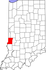 location in Vigo County, Indiana
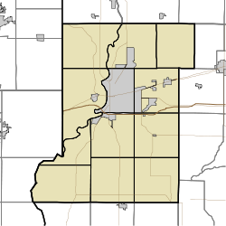
 Coal Bluff
Coordinates: 39°34′58″N 87°13′12″W / 39.58278°N 87.22°WCoordinates: 39°34′58″N 87°13′12″W / 39.58278°N 87.22°W Country  United States
State  Indiana
County Vigo County Township Nevins Township Elevation 169 m (554 ft) Time zone eastern time zone ZIP code 47874 Area code(s) 765 GNIS feature ID 449640[1] Coal Bluff is an unincorporated town in northern Nevins Township, Vigo County, Indiana, USA. It is part of the Terre Haute metropolitan area.
History
Coal Bluff grew to be a hamlet in consequence of Webster's coal mine, one of the first in the county being opened. Webster sold the mine to the Coal Bluff Mining Company, and hence the name of the place. As of 1890 it was exclusively a mining town with a post office and a railroad station on the Indianapolis and St. Louis Railroad. At that time it had a population of approximately 176. Since the Coal Mines closed, Coal Bluff has now become a residential community. The post comes from Rosedale,IN and the telephone numbers are from Clay County. There are farms in the area and a few prominent families. [2]
Geography
Coal Bluff is located at 39°34′58″N 87°13′12″W / 39.58278°N 87.22°W at an elevation of 554 feet.
References
- ^ "Coal Bluff". Geographic Names Information System, U.S. Geological Survey. http://geonames.usgs.gov/pls/gnispublic/f?p=gnispq:3:::NO::P3_FID:0449640. Retrieved 2010-06-24.
- ^ Bradsby, H.C. (1891). History of Vigo County, Indiana, with Biographical Selections. Chicago: S. B. Nelson & Co. pp. 481. http://www.archive.org/details/historyofvigocou00brad.
Municipalities and communities of Vigo County, Indiana City 
Towns Townships Fayette | Harrison | Honey Creek | Linton | Lost Creek | Nevins | Otter Creek | Pierson | Prairie Creek | Prairieton | Riley | Sugar Creek
Unincorporated
communitiesAllendale | Atherton | Barnhart Town | Blackhawk | Brown Jug Corner | Burnett | Cherryvale | Coal Bluff | Cobb | Deming Woods | Dewey | Duane Yards | East Glenn | Ehrmandale | Ferguson Hill | Fontanet | Glenn Ayr | Gospel Grove | Grange Corner | Harrison | Hickory Island | Hutton | Keller | Larimer Hill | Lewis | Libertyville | Liggett | Marion Heights | Markles | New Goshen | North Terre Haute | Otter Creek Junction | Parkview | Pimento | Pine Ridge | Prairie Creek | Prairieton | Preston | Saint Mary-of-the-Woods | Sandcut | Sandford | Shepardsville | Shirkieville | Southwood | Spelterville | Spring Hill | State Line | Swalls | Tabertown | Taylorville | Tecumseh | Terre Town | Toad Hop | Twelve Points | Vigo | Whitcomb Heights | Woodgate | Youngstown
Categories:- Indiana geography stubs
- Unincorporated communities in Indiana
- Populated places in Vigo County, Indiana
- Terre Haute metropolitan area


Wikimedia Foundation. 2010.