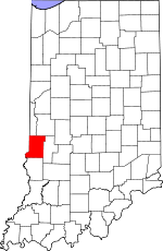
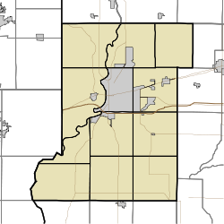
- Cobb, Indiana
-
Cobb — Unincorporated town — Vigo County's location in Indiana location in Vigo County, Indiana Coordinates: 39°34′52″N 87°13′24″W / 39.58111°N 87.22333°WCoordinates: 39°34′52″N 87°13′24″W / 39.58111°N 87.22333°W Country  United States
State  Indiana
County Vigo County Township Nevins Township Elevation 169 m (554 ft) GNIS feature ID 432716[1] Cobb is an unincorporated town in northern Nevins Township, Vigo County, Indiana, USA. It is part of the Terre Haute metropolitan area.
Geography
Cobb is located at 39°34′52″N 87°13′24″W / 39.58111°N 87.22333°W at an elevation of 554 feet.
References
- ^ "Cobb". Geographic Names Information System, U.S. Geological Survey. http://geonames.usgs.gov/pls/gnispublic/f?p=gnispq:3:::NO::P3_FID:0432716. Retrieved 2010-06-24.
Municipalities and communities of Vigo County, Indiana City Towns Townships Fayette | Harrison | Honey Creek | Linton | Lost Creek | Nevins | Otter Creek | Pierson | Prairie Creek | Prairieton | Riley | Sugar Creek
Unincorporated
communitiesAllendale | Atherton | Barnhart Town | Blackhawk | Brown Jug Corner | Burnett | Cherryvale | Coal Bluff | Cobb | Deming Woods | Dewey | Duane Yards | East Glenn | Ehrmandale | Ferguson Hill | Fontanet | Glenn Ayr | Gospel Grove | Grange Corner | Harrison | Hickory Island | Hutton | Keller | Larimer Hill | Lewis | Libertyville | Liggett | Marion Heights | Markles | New Goshen | North Terre Haute | Otter Creek Junction | Parkview | Pimento | Pine Ridge | Prairie Creek | Prairieton | Preston | Saint Mary-of-the-Woods | Sandcut | Sandford | Shepardsville | Shirkieville | Southwood | Spelterville | Spring Hill | State Line | Swalls | Tabertown | Taylorville | Tecumseh | Terre Town | Toad Hop | Twelve Points | Vigo | Whitcomb Heights | Woodgate | Youngstown
Categories:- Indiana geography stubs
- Unincorporated communities in Indiana
- Populated places in Vigo County, Indiana
- Terre Haute metropolitan area
Wikimedia Foundation. 2010.


