- Orland, Indiana
-
Orland, Indiana — Town — Location of Orland in the state of Indiana
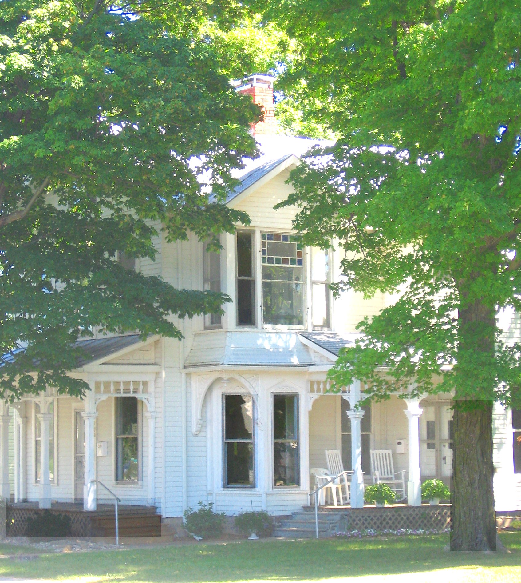
Coordinates: 41°43′50″N 85°10′11″W / 41.73056°N 85.16972°WCoordinates: 41°43′50″N 85°10′11″W / 41.73056°N 85.16972°W Country United States State Indiana County Steuben Township Millgrove Area – Total 0.7 sq mi (1.7 km2) – Land 0.7 sq mi (1.7 km2) – Water 0.0 sq mi (0.0 km2) Elevation 955 ft (291 m) Population (2010) – Total 434 – Density 512.8/sq mi (198.0/km2) Time zone Eastern (EST) (UTC-5) – Summer (DST) EDT (UTC-4) ZIP code 46776 Area code(s) 260 FIPS code 18-57006[1] GNIS feature ID 0440699[2]  The Ernsberger House, formerly a stop on the Underground Railroad.[3] Today, it is better known as the Parker House, once home to John G. Parker and his wife Elmira J. Parker, daughter of Michigan Governor Cyrus Gray Luce.
Orland is a town located in the northwest corner of Steuben County, Indiana in Millgrove Township at the intersection of State Road 120 and State Road 327. The population was 434 at the 2010 census. Orland was founded by John Stocker.
Contents
History
Orland is recognized as the first settlement in Steuben County,[4] populated by immigrants from Vermont and originally known as Vermont Settlement. Each year in late July, Orland celebrates this heritage with the Vermont Settlement Festival.
In the decades leading up to the American Civil War, Orland was a stop on the Underground Railroad, sheltering and protecting runaway slaves until they could complete the journey to Windsor, Ontario, Canada. The home of Russell Brown was said to contain a secret apartment on the second floor, complete with a separate stairway, in which 15 to 20 slaves might hide. S. U. Clark's hotel also was said to have a secret hiding place behind a basement cupboard, while the Butler family south of Orland "fed and sheltered scores of them and then took them on to other stations."[5]
At one time or another during the period leading up to the Civil War, Brown, Clark, Benjamin Waterhouse, and Captain Samuel Barry were arrested for violating the Fugitive Slave Act of 1850.[6] Both Waterhouse and Barry were convicted, with Barry serving 1 hour in jail and paying a $30 fine (although other sources put the fine at $1000).[7]
Geography
Orland is located at 41°43′50″N 85°10′11″W / 41.73056°N 85.16972°W.
According to the United States Census Bureau, the town has a total area of 0.7 square miles (1.8 km2), all of it land.
Demographics
As of the census[1] of 2000, there were 341 people, 137 households, and 90 families residing in the town. The population density was 512.8 people per square mile (199.5/km²). There were 153 housing units at an average density of 230.1 per square mile (89.5/km²). The racial makeup of the town was 98.83% White, 0.29% Native American, 0.29% Asian, 0.29% from other races, and 0.29% from two or more races. Hispanic or Latino of any race were 0.29% of the population.
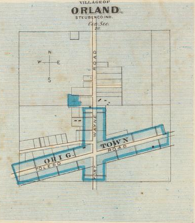
 Orland, Indiana from 1876 Atlas
There were 137 households out of which 34.3% had children under the age of 18 living with them, 49.6% were married couples living together, 12.4% had a female householder with no husband present, and 33.6% were non-families. 29.2% of all households were made up of individuals and 13.9% had someone living alone who was 65 years of age or older. The average household size was 2.49 and the average family size was 3.10.
In the town the population was spread out with 27.6% under the age of 18, 8.2% from 18 to 24, 29.9% from 25 to 44, 19.9% from 45 to 64, and 14.4% who were 65 years of age or older. The median age was 36 years. For every 100 females there were 100.6 males. For every 100 females age 18 and over, there were 93.0 males.
The median income for a household in the town was $38,542, and the median income for a family was $45,417. Males had a median income of $33,438 versus $20,893 for females. The per capita income for the town was $15,188. About 9.2% of families and 7.9% of the population were below the poverty line, including 11.4% of those under age 18 and 7.7% of those age 65 or over.
Notable natives and former residents
- Rollie Zeider (1883–1967), major league baseball player, 1910–1918, played for Chicago White Sox, New York Yankees, Chicago Chi-Feds, Chicago Whales and Chicago Cubs. He was born in Cass County, grew up in Auburn, operated a restaurant in Garrett after retiring from baseball and moved to Orland in 1959 where he lived until just before his death.
- Azariah Southworth (May 13, 1986), Television producer/personality 2006-2008.
Footnotes
- ^ a b "American FactFinder". United States Census Bureau. http://factfinder.census.gov. Retrieved 2008-01-31.
- ^ "US Board on Geographic Names". United States Geological Survey. 2007-10-25. http://geonames.usgs.gov. Retrieved 2008-01-31.
- ^ See Sauer and Indiana DNR.
- ^ Taylor, et al., p. 26.
- ^ Butler.
- ^ Indiana Department of Natural Resources, Division of Historic Preservation and Archaeology.
- ^ Sauer.
References
- Butler, Marvin Benjamin (1914) My story of the Civil War and the Underground Railroad, United Brethren Publishing Establishment, Huntington, Ind.
- Goodspeed, Weston A.; Indiana Historical and Biographical Atlas, F.A. Battey and Company Publishers, Chicago, 1882.
- Indiana Department of Natural Resources "Underground Railroad site: Orland", access August 16, 2008.
- Sauer, Lee "Freedom Trail: The Underground Railroad ran through northeast Indiana, KPC News.net, accessed August 18, 2008.
- Taylor, Robert M.; Stevens, Errol Wayne; Ponder, Mary Ann (1990) Indiana: A New Historical Guide, Indiana Historical Society, ISBN 978-0871950482.
External links
Municipalities and communities of Steuben County, Indiana City 
Towns Ashley‡ | Clear Lake | Fremont | Hamilton‡ | Hudson | Orland
Townships Footnotes ‡This populated place also has portions in an adjacent county or counties
Categories:- Populated places in Steuben County, Indiana
- Towns in Indiana
- Underground Railroad locations

Wikimedia Foundation. 2010.