- Owensville, Indiana
-
Owensville, Indiana — Town — Location of Owensville in the state of Indiana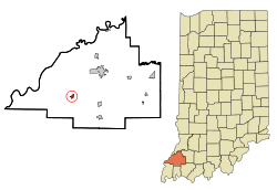
Coordinates: 38°16′18″N 87°41′26″W / 38.27167°N 87.69056°WCoordinates: 38°16′18″N 87°41′26″W / 38.27167°N 87.69056°W Country United States State Indiana County Gibson Township Montgomery Area – Total 0.5 sq mi (1.3 km2) – Land 0.5 sq mi (1.3 km2) – Water 0.0 sq mi (0.0 km2) Elevation 509 ft (155 m) Population (2000) – Total 1,322 – Density 2,665.3/sq mi (1,020.9/km2) Time zone Central (CST) (UTC-6) – Summer (DST) CDT (UTC-5) ZIP code 47665 Area code(s) 812 FIPS code 18-57528[1] GNIS feature ID 0440801[2] Website http://owensville.org/1.html For communities with a similar name, see Owensville.
Owensville is a town in and the seat of Montgomery Township, Gibson County, Indiana, United States. The population was 1,322 at the 2000 census.
Contents
Geography
Owensville is located at 38°16′18″N 87°41′26″W / 38.27167°N 87.69056°W (38.271769, -87.690652)[3].
According to the United States Census Bureau, the town has a total area of 0.5 square miles (1.3 km2), all of it land.
Demographics
As of the census[1] of 2000, there were 1,322 people, 523 households, and 359 families residing in the town. The population density was 2,665.3 people per square mile (1,020.9/km²). There were 565 housing units at an average density of 1,139.1 per square mile (436.3/km²). The racial makeup of the town was 98.18% White, 0.23% African American, 0.38% Native American, 0.23% Asian, 0.53% from other races, and 0.45% from two or more races. Hispanic or Latino of any race were 1.13% of the population.
There were 523 households out of which 32.9% had children under the age of 18 living with them, 56.0% were married couples living together, 10.3% had a female householder with no husband present, and 31.2% were non-families. 28.3% of all households were made up of individuals and 16.4% had someone living alone who was 65 years of age or older. The average household size was 2.41 and the average family size was 2.94.
In the town the population was spread out with 24.4% under the age of 18, 6.8% from 18 to 24, 27.7% from 25 to 44, 19.3% from 45 to 64, and 21.9% who were 65 years of age or older. The median age was 39 years. For every 100 females there were 89.4 males. For every 100 females age 18 and over, there were 82.1 males.
The median income for a household in the town was $34,306, and the median income for a family was $40,263. Males had a median income of $35,294 versus $23,897 for females. The per capita income for the town was $15,916. About 5.2% of families and 8.9% of the population were below the poverty line, including 8.7% of those under age 18 and 8.1% of those age 65 or over.
Schools
South Gibson School Corporation
K-8: Owensville Community School
9-12: Gibson Southern High School
Former Schools
Owensville High School (merged into Gibson Southern High School in 1974.)
Economy
Unlike Princeton and Fort Branch, Owensville's economy practically consists of a scant few family-owned business with only three exceptions with a Dollar General a Mount Carmel, Illinois - Based gas company and a locally owned insurance chain. The largest family owned business in Owensville is Holder's Furniture. However, like Fort Branch, Owensville has a rapidly growing population in subdivisions that are primarily north of the town. The two largest employers of Owensville's residents are the Toyota Motor Manufacturing Indiana plant located halfway between Princeton and Fort Branch, as well as Gibson Generating Station located 5.5 miles north - northwest of Owensville.
Owensville High School, which merged with Fort Branch and Haubstadt high schools to form Gibson Southern, had the first high school gymnasium in Indiana with a glass backboard. One of those backboards is now in the Indiana High School Basketball Hall of Fame in New Castle, Indiana.
Highways - Local Names
 Indiana State Road 65 - First, Brummitt, and Mill Streets from north to south.
 Indiana State Road 165 - Brummitt Street west of Mill Street.
 Indiana State Road 168 - Walnut Street east of Mill Street.
Notable Residents & Natives
- Eric Campbell - Class A Minor League Player for the Myrtle Beach Pelicans
- Max Armstrong - Chicago radio broadcaster for WGN (AM)
References
- ^ a b "American FactFinder". United States Census Bureau. http://factfinder.census.gov. Retrieved 2008-01-31.
- ^ "US Board on Geographic Names". United States Geological Survey. 2007-10-25. http://geonames.usgs.gov. Retrieved 2008-01-31.
- ^ "US Gazetteer files: 2010, 2000, and 1990". United States Census Bureau. 2011-02-12. http://www.census.gov/geo/www/gazetteer/gazette.html. Retrieved 2011-04-23.
External links
Municipalities and communities of Gibson County, Indiana Cities 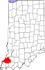
Towns Fort Branch | Francisco | Haubstadt | Hazleton | Mackey | Owensville | Patoka | Somerville
Townships Barton | Center | Columbia | Johnson | Montgomery | Patoka | Union | Wabash | Washington | White River
Unincorporated
communitiesBaldwin Heights | Buckskin | Crawleyville | Dongola | Douglas | Durham | East Mount Carmel | Giro | Gray Junction | Gudgel | Hickory Ridge | Johnson | King | Lyles Station | Mount Olympus | Mounts | Oak Hill | Port Gibson | Saint James | Skelton | Snake Run | Warrenton | Wheeling
Categories:- Populated places in Gibson County, Indiana
- Owensville, Indiana
- Towns in Indiana
- Communities of Southwestern Indiana
- Evansville metropolitan area
- Populated places established in the 1790s


Wikimedia Foundation. 2010.