- Columbia Township, Gibson County, Indiana
-
Columbia Township
Gibson County— Township — Location in Gibson County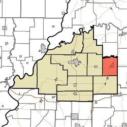
Coordinates: 38°20′07″N 87°21′42″W / 38.33528°N 87.36167°WCoordinates: 38°20′07″N 87°21′42″W / 38.33528°N 87.36167°W Country United States State Indiana County Gibson Township Seat Oakland City School District East Gibson School Corporation Government – Type Indiana township – Trustee Karen Rowe Area – Total 31.03 sq mi (80.37 km2) – Land 30.65 sq mi (79.39 km2) – Water 0.38 sq mi (0.99 km2) Elevation[1] 489 ft (149 m) Population (2000) – Total 4,149 – Density 135.36/sq mi (52.26/km2) Time zone CST (UTC-6) – Summer (DST) CDT (UTC-5) ZIP code 47660 Area code(s) 812 FIPS code 18-14662[2] GNIS feature ID 453240 Columbia Township is one of ten townships in Gibson County, Indiana. As of the 2000 census, its population was 4,149. Oakland City is the township seat.
Contents
Geography
Columbia Township covers an area of 31.03 square miles (80.4 km2); of this, 0.38 square miles (0.98 km2) or 1.23 percent is water.
Cities and towns
Unincorporated towns
- Dongola
- Gray Junction
- Gudgel
- Oak Hill
(This list is based on USGS data and may include former settlements.)
Adjacent townships
Gibson County
- Barton Township (south)
- Center Township (west)
Pike County
- Logan Township (north)
- Patoka Township (east)
- Monroe Township (southeast)
Cemeteries
The township contains one cemetery, Montgomery.
Major highways
- Interstate 69 (Under Construction)
- Indiana State Road 57
- Indiana State Road 64
- Indiana State Road 357
Education
Columbia Township is the center of the East Gibson School Corporation.
Primary and secondary schools
- Oakland City Elementary
- Waldo J. Wood Memorial Jr/Sr High School
Higher education
- Oakland City University - Main Campus
References
- "Columbia Township, Gibson County, Indiana". Geographic Names Information System, U.S. Geological Survey. http://geonames.usgs.gov/pls/gnispublic/f?p=gnispq:3:::NO::P3_FID:453240. Retrieved 2009-09-24.
- United States Census Bureau cartographic boundary files
- ^ "US Board on Geographic Names". United States Geological Survey. 2007-10-25. http://geonames.usgs.gov. Retrieved 2008-01-31.
- ^ "American FactFinder". United States Census Bureau. http://factfinder.census.gov. Retrieved 2008-01-31.
External links
Municipalities and communities of Gibson County, Indiana Cities 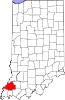
Towns Fort Branch | Francisco | Haubstadt | Hazleton | Mackey | Owensville | Patoka | Somerville
Townships Barton | Center | Columbia | Johnson | Montgomery | Patoka | Union | Wabash | Washington | White River
Unincorporated
communitiesBaldwin Heights | Buckskin | Crawleyville | Dongola | Douglas | Durham | East Mount Carmel | Giro | Gray Junction | Gudgel | Hickory Ridge | Johnson | King | Lyles Station | Mount Olympus | Mounts | Oak Hill | Port Gibson | Saint James | Skelton | Snake Run | Warrenton | Wheeling
Categories:- Townships in Gibson County, Indiana
- Southern Indiana geography stubs


Wikimedia Foundation. 2010.