- Olonets
-
Olonets (English)
Олонец (Russian)
Anuksenlinnu (Karelian)- Town[1] -
Town under the district jurisdiction[2]
Location of the Republic of Karelia in Russia
 OlonetsLocation of Olonets in the Republic of Karelia
Coordinates: 60°59′N 32°58′E / 60.983°N 32.967°ECoordinates: 60°59′N 32°58′E / 60.983°N 32.967°E 
Coat of arms of Olonets Administrative status (as of 2009) Country Russia Federal subject Republic of Karelia Administrative district Olonetsky District[1] Administrative center of Olonetsky District[1] Municipal status (as of 2009) Municipal district Olonetsky Municipal District[citation needed] Urban settlement Olonets Urban Settlement[citation needed] Administrative center of Olonetsky Municipal District, Olonets Urban Settlement[citation needed] Statistics Population (2010 Census,
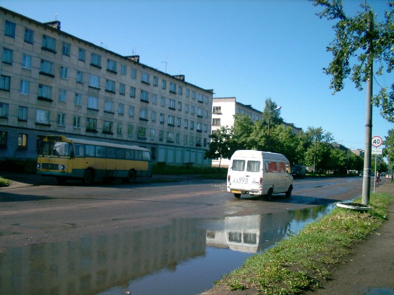
preliminary)9,060 inhabitants[3] Population (2002 Census) 10,240 inhabitants[4] Time zone MSD (UTC+04:00)[5]  A street in Olonets
Olonets (Russian: Олонец; Karelian: Anuksenlinnu; Finnish: Aunus) is a town and the administrative center of Olonetsky District of the Republic of Karelia, Russia, situated on the Olonka River, to the east from Lake Ladoga. Population: 9,060 (2010 Census preliminary results);[3] 10,240 (2002 Census);[4] 11,888 (1989 Census).[6]
Contents
History
Olonets is the oldest documented settlement in Karelia, mentioned by Novgorodian sources as early as 1137. Its history is obscure until 1649, when a fortress was built there to protect Muscovy against the Swedes. The same year it was granted municipal rights. Until the Great Northern War, Olonets developed as a principal market for Russian trade with Sweden. To the south from the town, there sprawled a belt of fortified abbeys, of which the Alexander-Svirsky Monastery was the most important.
In the 18th century, Olonets's importance shifted from trade to ironworking industries. In 1773, it was made capital of Olonets Governorate. Eleven years later, however, the regional capital was moved to Petrozavodsk, and Olonets started to decline.
Modern Olonets is ranked among historical towns of Karelia, and it is the only city in the republic where Karelians are in majority (over 60% as of 2004).
International relations
Twin towns/sister cities
Olonets is twinned with:
See also
References
- ^ a b c Law #871-ZRK, Article 5.1
- ^ Государственный комитет Российской Федерации по статистике. Комитет Российской Федерации по стандартизации, метрологии и сертификации. №ОК 019-95 1 января 1997 г «Общероссийский классификатор объектов административно-территориального деления. Код 86 230 501», в ред. изменения №168/2011 от 1 октября 2011 г. (State Statistics Committee of the Russian Federation. Committee of the Russian Federation on Standardization, Metrology, and Certification. #OK 019-95 January 1, 1997 Russian Classification of Objects of Administrative Division . Code 86 230 501, as amended by the Amendment #168/2010 of October 1, 2011. ).
- ^ a b Федеральная служба государственной статистики (Federal State Statistics Service) (2011). "Предварительные итоги Всероссийской переписи населения 2010 года (Preliminary results of the 2010 All-Russian Population Census)" (in Russian). Всероссийская перепись населения 2010 года (All-Russia Population Census of 2010). Federal State Statistics Service. http://www.perepis-2010.ru/results_of_the_census/results-inform.php. Retrieved 2011-04-25.
- ^ a b Федеральная служба государственной статистики (Federal State Statistics Service) (2004-05-21). "Численность населения России, субъектов Российской Федерации в составе федеральных округов, районов, городских поселений, сельских населённых пунктов – районных центров и сельских населённых пунктов с населением 3 тысячи и более человек (Population of Russia, its federal districts, federal subjects, districts, urban localities, rural localities—administrative centers, and rural localities with population of over 3,000)" (in Russian). Всероссийская перепись населения 2002 года (All-Russia Population Census of 2002). Federal State Statistics Service. http://www.perepis2002.ru/ct/doc/1_TOM_01_04.xls. Retrieved 2010-03-23.
- ^ Правительство Российской Федерации. Постановление №725 от 31 августа 2011 г. «О составе территорий, образующих каждую часовую зону, и порядке исчисления времени в часовых зонах, а также о признании утратившими силу отдельных Постановлений Правительства Российской Федерации». Вступил в силу по истечении 7 дней после дня официального опубликования. Опубликован: "Российская Газета", №197, 6 сентября 2011 г. (Government of the Russian Federation. Resolution #725 of August 31, 2011 On the Composition of the Territories Included into Each Time Zone and on the Procedures of Timekeeping in the Time Zones, as Well as on Abrogation of Several Resolutions of the Government of the Russian Federation. Effective as of after 7 days following the day of the official publication).
- ^ "Всесоюзная перепись населения 1989 г. Численность наличного населения союзных и автономных республик, автономных областей и округов, краёв, областей, районов, городских поселений и сёл-райцентров. (All Union Population Census of 1989. Present population of union and autonomous republics, autonomous oblasts and okrugs, krais, oblasts, districts, urban settlements, and villages serving as district administrative centers.)" (in Russian). Всесоюзная перепись населения 1989 года (All-Union Population Census of 1989). Demoscope Weekly (website of the Institute of Demographics of the State University—Higher School of Economics. 1989. http://demoscope.ru/weekly/ssp/rus89_reg.php. Retrieved 2010-03-23.
Sources
- Законодательное Собрание Республики Карелия. Закон №871-ЗРК от 29 апреля 2005 г. «Об административно-территориальном устройстве Республики Карелия», в ред. Закона №1207-ЗРK от 9 июня 2008 г «О внесении изменения в Закон Республики Карелия "Об административно-территориальном устройстве Республики Карелия"». Вступил в силу со дня официального опубликования. Опубликован: газета "Карелия", №48, 7 мая 2005 г. (Legislative Assembly of the Republic of Karelia. Law #871-ZRK of April 29, 2005 On the Administrative and Territorial Structure of the Republic of Karelia, as amended by the Law #1207-ZRK of June 9, 2008 On Amending the Law of the Republic of Karelia "On the Administrative and Territorial Structure of the Republic of Karelia". Effective as of the official publication date).
Administrative divisions of the Republic of Karelia Capital: Petrozavodsk Cities and towns Belomorsk · Kem · Kondopoga · Kostomuksha · Lakhdenpokhya · Medvezhyegorsk · Olonets · Pitkyaranta · Pudozh · Segezha · Sortavala · Suoyarvi
Urban-type settlements Chupa · Kalevala · Khelyulya · Loukhi · Muyezersky · Nadvoitsy · Pryazha · Pyaozersky · Pindushi · Povenets · VyartsilyaAdministrative districts (raions) Belomorsky · Kalevalsky · Kemsky · Kondopozhsky · Lakhdenpokhsky · Loukhsky · Medvezhyegorsky · Muyezersky · Olonetsky · Pitkyarantsky · Prionezhsky · Pryazhinsky · Pudozhsky · Segezhsky · SuoyarvskyCategories:- Cities and towns in the Republic of Karelia


Wikimedia Foundation. 2010.