- Clayton, Georgia
-
This article is about the city in the US state of Georgia. For the county in the state of Georgia, see Clayton County, Georgia. For other places named "Clayton", see Clayton (disambiguation).
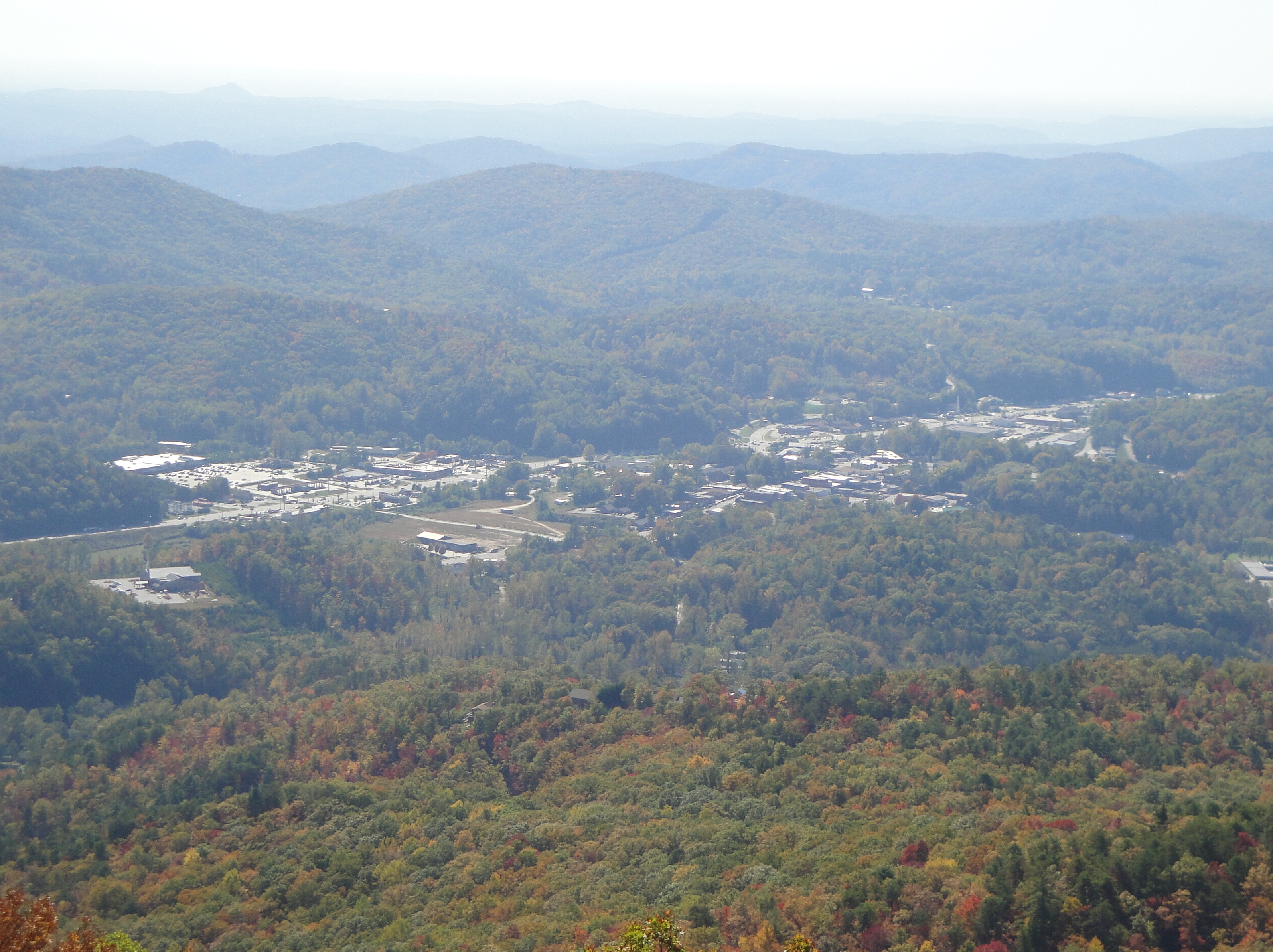
Clayton, Georgia — City — View of Clayton from Black Rock Mountain State Park Location in Rabun County and the state of Georgia
Coordinates: 34°52′40″N 83°24′6″W / 34.87778°N 83.40167°WCoordinates: 34°52′40″N 83°24′6″W / 34.87778°N 83.40167°W Country United States State Georgia County Rabun Area – Total 3.1 sq mi (8 km2) – Land 3.1 sq mi (8 km2) – Water 0 sq mi (0 km2) Elevation 1,929 ft (588 m) Population (2000) – Total 2,019 – Density 651.3/sq mi (252.4/km2) Time zone Eastern (EST) (UTC-5) – Summer (DST) EDT (UTC-4) ZIP code 30525 Area code(s) 706 FIPS code 13-16656[1] GNIS feature ID 0355183[2] Clayton is a city in Rabun County, Georgia, United States. The population was 2,019 at the 2000 census. The city is the county seat of Rabun County[3] and is located in the Blue Ridge Mountains.
Contents
History
The area that would eventually become Clayton was called the Dividings because it sat at the intersection of three important Cherokee trails. Explorer and naturalist William Bartram came through the Dividings in May, 1775 while exploring what would later become Rabun County. Much later, after Clayton had grown to include the Dividings, two of the old Cherokee trails became the main roads for Clayton and the county: U.S. 441 and U.S. 76.
Clayton was incorporated December 13, 1823 as Claytonville but the name was later shortened to Clayton. The city was named after a prominent jurist and congressman, Judge Augustin S. Clayton who served in both the Georgia House of Representatives and Georgia Senate before becoming as a representative of Georgia in the United States House of Representatives from 1831–1835. In 1824, 67 acres (270,000 m2) were purchased from Solomon Beck for $150 and a site for a courthouse and the surrounding streets was laid out.
In 1904, the Tallulah Falls Railway was completed to Clayton from Cornelia, Georgia and was later extended to Franklin, North Carolina by 1907. Clayton has had public water and sanitary sewer service since the 1920s. Initially, the water supply was two springs on nearby Buzzard Roost Mountain, but today Clayton uses Lake Rabun as its water supply.
In 1936, Clayton recorded 30.0 inches (760 mm) of total snowfall making that year the snowiest year in the city.[4] The recorded snowfall in Clayton in 1936 is also a state record.[5]
Part of Disney's Old Yeller was shot here in 1957.
Geography
Clayton is located at 34°52′40″N 83°24′6″W / 34.87778°N 83.40167°W (34.877788, -83.401691)[6] and is situated at the southern base of 3,640-foot Black Rock Mountain. Immediately to the east of the city is 3,000-foot Screamer Mountain. Other Blue Ridge Mountain peaks between 2,500 and 3,000 feet surround the city.
According to the United States Census Bureau, the city has a total area of 3.1 square miles (8.0 km2), all of it land. The elevation of Clayton's downtown area is 1,925 feet (587 m). A number of hilltops within the city limits exceed 2,200 feet.
Demographics
As of the census[1] of 2000, there were 2,019 people, 816 households, and 497 families residing in the city. The population density was 653.2 people per square mile (252.3/km²). There were 1,006 housing units at an average density of 325.5 per square mile (125.7/km²). The racial makeup of the city was 84.55% White, 2.77% African American, 0.89% Native American, 1.34% Asian, 0.15% Pacific Islander, 9.41% from other races, and 0.89% from two or more races. Hispanic or Latino of any race were 14.71% of the population.
There were 816 households out of which 22.7% had children under the age of 18 living with them, 44.7% were married couples living together, 11.2% had a female householder with no husband present, and 39.0% were non-families. 33.8% of all households were made up of individuals and 18.1% had someone living alone who was 65 years of age or older. The average household size was 2.29 and the average family size was 2.79.
In the city the population was spread out with 19.2% under the age of 18, 9.4% from 18 to 24, 26.3% from 25 to 44, 21.7% from 45 to 64, and 23.4% who were 65 years of age or older. The median age was 40 years. For every 100 females there were 99.1 males. For every 100 females age 18 and over, there were 93.0 males.
The median income for a household in the city was $26,600, and the median income for a family was $36,164. Males had a median income of $25,823 versus $18,304 for females. The per capita income for the city was $15,977. About 7.9% of families and 14.6% of the population were below the poverty line, including 14.3% of those under age 18 and 11.2% of those age 65 or over.
Education
Rabun County School District
The Rabun County School District holds grades pre-school to grade twelve, that consists of three elementary schools, a middle school, and a high school.[7] The district has 140 full-time teachers and over 2,221 students.[8]
- Rabun County Elementary School
- Rabun Gap Community School
- South Rabun Elementary School
- Rabun County Middle School
- Rabun County High School
Private Education
Camps
The area around Clayton has long been the location for a number of camps for young people, mostly operated during the summertime.[citation needed]
- Camp Ramah Darom is located in the Persimmon Valley northwest of Clayton.[citation needed]
- Camp Rainey Mountain is located 4 miles (6 km) southeast of Clayton.[citation needed]
- Camp Pinnacle is located 2 miles (3 km) northeast of Clayton.[citation needed]
- Camp Dixie is located 2 miles (3 km) west of Clayton.[citation needed]
- Camp Blue Ridge is located in Mountain City, 3 miles (5 km) north of Clayton.[citation needed]
Notable citizens of Clayton
Clayton was home to author and civil rights activist Lillian Smith (1897–1966), whose works included The Winner Names the Age,and Strange Fruit, as well as Killers of the Dream. Smith owned and operated Laurel Falls Camp for Girls, located just outside of Clayton. Clayton was also home to children's author Caroline Rowan Kidd (1951-2011) who passed away due to ALS complications at Traces of Tiger, a nursing home south of Clayton.
John Gourlay, 2005-09, Lehigh University basketball player, University of Arkansas RSVP Program, has strong connections with Clayton, GA through his grandparents.
References
- ^ a b "American FactFinder". United States Census Bureau. http://factfinder.census.gov. Retrieved 2008-01-31.
- ^ "US Board on Geographic Names". United States Geological Survey. 2007-10-25. http://geonames.usgs.gov. Retrieved 2008-01-31.
- ^ "Find a County". National Association of Counties. http://www.naco.org/Counties/Pages/FindACounty.aspx. Retrieved 2011-06-07.
- ^ Top Ten Snowiest Years in Clayton
- ^ Georgia Snowfall Extremes Table
- ^ "US Gazetteer files: 2010, 2000, and 1990". United States Census Bureau. 2011-02-12. http://www.census.gov/geo/www/gazetteer/gazette.html. Retrieved 2011-04-23.
- ^ Georgia Board of Education, Retrieved June 25, 2010.
- ^ School Stats, Retrieved June 25, 2010.
External links
- Official website for the City of Clayton
- Clayton, Georgia restaurants, attractions, and local merchants.
Municipalities and communities of Rabun County, Georgia Cities Clayton | Dillard

Towns Unincorporated
communityFootnotes ‡This populated place also has portions in an adjacent county or counties
Categories:- Cities in Georgia (U.S. state)
- Populated places in Rabun County, Georgia
- Populated places established in 1823
- County seats in Georgia (U.S. state)


Wikimedia Foundation. 2010.