- Marina di Camerota
-
Marina di Camerota — Frazione — 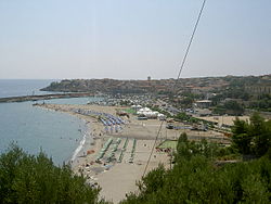 Location of Marina di Camerota in Italy
 Marina di Camerota
Coordinates: 40°00′00″N 15°22′00″E / 40°N 15.3666667°ECoordinates: 40°00′00″N 15°22′00″E / 40°N 15.3666667°E Country  Italy
ItalyRegion  Campania
Province Salerno (SA) Comune Camerota Elevation 5 m (16 ft) Population (2007) - Total 3,500 Demonym Marinai Time zone CET (UTC+1) - Summer (DST) CEST (UTC+2) Postal code 84059 Dialing code (+39) 0974 Marina di Camerota is an Italian town, the largest hamlet (frazione) of Camerota, situated in the province of Salerno, Campania. In 2007 it had a population of 3,500 inhabitants.
Contents
Geography
Marina di Camerota lies on the southern side of Cilento, on the Tyrrhenian Sea, and it is the port of its "commune". The town is 5 km from Camerota, 8 from Palinuro, 25 from Policastro, and 90 from Salerno. The town, located on 40°N parallel, is the southernmost inhabited area of Campania.
History
In the 17th century Marina di Linfreschi was a little group of houses, and the urban population expanded it around a church of Saint Dominic.
The town was a place of emigration to South America, especially to Venezuela, in the 19th century. The relationship with the American country is still strong, evidenced, for example, by a statue of Simón Bolívar built in the middle of the village, in front of the harbour side.
Tourism
The town is part of the Cilento and Vallo di Diano National Park, whose natural environment is composed of "Maquis", typical of Mediterranean countries. It is a main tourism location, especially in the summer, due to the quality of its water, which has earned it the Blue Flag beach award [1] every year since 2000.
Marina di Camerota is also interesting for its paleontologic caves,[2] with human fossils discovered in 1980s. One of these caves, located in Lentiscella zone, is a museum which accommodates the "Lion of Caprera"[3] (Leone di Caprera), a little schooner which in 1880–1881 crossed the Atlantic Ocean from Montevideo to Livorno.
Another point of interest is represented by three "telegraph towers", built by Bourbons and included in a system of defence and communication points, along the southern side of the Tyrrhenian coast.Transport
The main infrastructure in the town is represented by the port, linked also to Salerno and Naples by hydrofoils. Nearest main road is distant 20 km (north) and is the Salerno-Battipaglia-Paestum-Agropoli-Vallo della Lucania-Policastro-Sapri. Nearest railway station is Pisciotta-Palinuro, distant 20 km, on Naples-Reggio Calabria line.
Photogallery
-
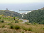
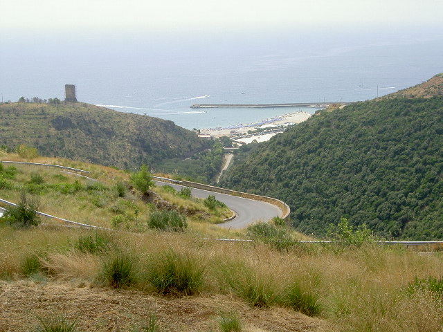
View from the road to San Giovanni a Piro and Policastro
-

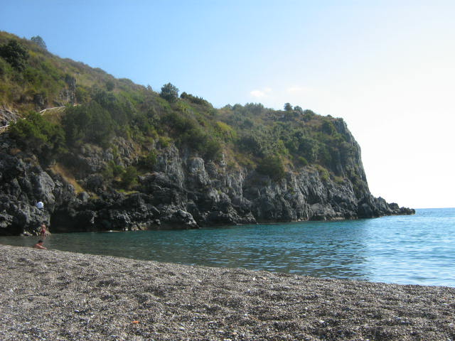
The beach of Lentiscella
-
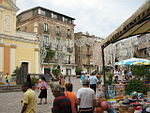
"Piazza San Domenico", main town square
-
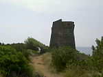
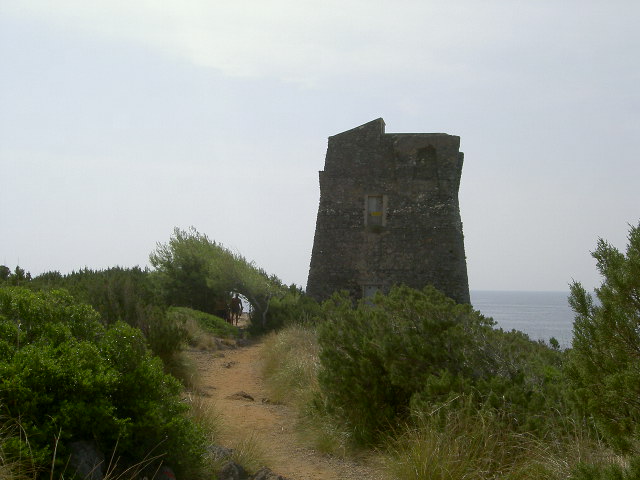
The ancient tower "Zancale"
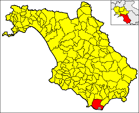
 Locator map of Marina di Camerota in the province of Salerno.[4]
See also
References
- ^ Blueflag.org
- ^ Palaeolithic in the area of Camerota
- ^ Museum of "resurgence"
- ^ In red, the area of the municipality of Camerota
External links
- Marina di Camerota (touristic site) (EN)-(IT)-(DE)
- Marina di Camerota.info (IT)
- Guide to Marina di Camerota (IT)
- Camerota Caves (EN)
- Marina di Camerota.net (IT)
- The Lion of Caprera (IT)
Towns, villages and zones of Cilentan Coast Torre Kernot • Laura • Paestum • Licinella • Mattine • Agropoli • Tresino • Santa Maria • San Marco • Licosa • Ogliastro Marina • Case del Conte • Agnone Cilento • Mezzatorre • Acciaroli • Pioppi • Marina di Casalvelino • Velia • Marina di Ascea • Marina di Pisciotta • Caprioli • Palinuro • Cape Palinuro • Marina di Camerota • Porto Infreschi • Scario • Policastro Bussentino • Capitello • Villammare • Sapri Categories:
- Frazioni of the Province of Salerno
- Localities of Cilento
-


Wikimedia Foundation. 2010.