- New Jersey Route 54
-
Route 54
12th Street 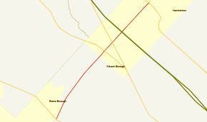
Route information Maintained by NJDOT Length: 11.86 mi[1] (19.09 km) Existed: 1938 – present Major junctions South end: 

 US 40 / CR 557 / CR 619 in Buena Vista Township
 US 322 in Folsom


 Route 73 / CR 561 Spur in Folsom
 AC Exwy. in Hammonton
North end: 
 US 30 / US 206 in Hammonton
Highway system New Jersey State Highway Routes
Interstate and US←  Route 53
Route 55  →
→Route 54 (known locally as 12th Street) is a state highway located in Atlantic County in New Jersey, United States. It is a southern extension of U.S. Route 206 (US 206), running 11.86 mi (19.09 km) from an intersection with US 206 and US 30 in Hammonton to an intersection with US 40 in Buena Vista Township. The road passes through the center of Hammonton before running into rural areas. It intersects US 322 and Route 73 in Folsom and the Atlantic City Expressway in Hammonton.
What is now Route 54 was originally legislated in 1938 to run from US 30/US 206 in Hammonton south to Main Road in Landis Township (part of present-day Vineland). The only part taken over as a state highway and designated Route 54 was north of US 40 in Buena, the proposed route south of this point remained as county-maintained Lincoln Avenue. In 1953, Route 54 was defined onto its current alignment. A freeway was proposed along the Route 54 corridor in the late 1960s to connect the southern terminus of US 206 in Hammonton to Route 55 in the Vineland/Millville area; it was eventually canceled.
Contents
Route description
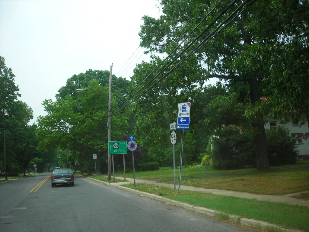
Route 54 begins at an intersection with US 40/County Route 557 (CR 557) and CR 619 on the border of Buena and Buena Vista Township.[1] Known as Buena Hammonton Road, it proceeds north-northeast as a two-lane undivided road through agricultural areas, forming the border between Buena to the west and Buena Vista Township to the east.[1][2] After fully entering Buena Vista Township and becoming 12th Street, the road reaches an intersection with CR 690 and makes a turn more to the northeast.[1] At this point, Route 54 enters forested areas, with a few breaks for residences.[2] Upon entering Folsom, the route passes over a Conrail Shared Assets Operations railroad line before coming to a cloverleaf interchange with US 322 (Black Horse Pike).[1] After this interchange, the road comes to a crossroads with Route 73, which is signed as County Route 561 Spur. Following this intersection, Route 54 heads through a mix of woods and farm fields as it enters Hammonton and reaches an interchange with the Atlantic City Expressway.[1][2] In the area of this interchange, the route is a four-lane divided highway.[1]
Past the Atlantic City Expressway, the two-lane undivided road comes to an intersection with CR 559.[1][2] From this point, Route 54 is lined with residences and businesses as it comes into downtown Hammonton.[2] The road crosses New Jersey Transit’s Atlantic City Line immediately before a junction with CR 561. After CR 561, the route becomes Bellevue Avenue and encounters the western terminus of CR 542.[1] As the road leaves the downtown area, the surroundings become more residential.[2] Route 54 ends at an intersection with US 30 and US 206, where the road continues north as US 206.[1]
History
By 1927, what is now Route 54 was an unnumbered, unpaved road connecting Buena to Hammonton.[3] Route 54 was legislated in 1938 to run from US 30/Route 43 and US 206/Route 39 in Hammonton south along Lincoln Avenue to an intersection with Main Road in Landis Township, Cumberland County (now a part of Vineland).[4] The only portion of Route 54 that was taken over as a state highway was north of the US 40/Route 48 intersection in Buena.[5] The portion of Lincoln Avenue south of US 40 remained a county route called CR 25 in Cumberland County and CR 55 and CR 19 in Atlantic County.[6][7] This road is presently both Cumberland and Atlantic CRs 655 and a part of Atlantic CR 619.[8][9][10] In the 1953 New Jersey state highway renumbering, Route 54 was defined onto its current alignment between US 40 in Buena Vista and US 30/US 206 in Hammonton.[11][12] In the late 1960s, a freeway was proposed for the US 206/Route 54 corridor, running from US 30 in Hammonton south to Route 55 and the proposed Route 60 near Vineland and Millville.[13] The freeway between Vineland/Millville and Hammonton was to cost $47 million and was intended to provide a better route between the two areas than the existing two-lane roads. This proposed freeway was never built due to environmental and financial issues.[14]
Major intersections
The entire route is in Atlantic County.
Location Mile Destinations Notes Buena Vista Township 0.00 US 40 / CR 557 (Harding Highway)Southern terminus Folsom 6.67 US 322 (Black Horse Pike)Interchange 7.58
Route 73 / CR 561 Spur (Mays Landing Road)Hammonton 8.71 AC Exwy.ACE exit 28 10.01  CR 559 (Chew Road)
10.65 CR 561 (Egg Harbor Road)10.76  CR 542 east (Central Avenue)
11.86 US 30 (White Horse Pike) / US 206 northNorthern terminus 1.000 mi = 1.609 km; 1.000 km = 0.621 mi See also
 U.S. Roads portal
 New Jersey portal
References
- ^ a b c d e f g h i j "Route 54 straight line diagram" (PDF). New Jersey Department of Transportation. http://www.state.nj.us/transportation/refdata/sldiag/00000054__-.pdf. Retrieved 2009-12-16.
- ^ a b c d e f Google, Inc. Google Maps – overview of New Jersey Route 54 (Map). Cartography by Google, Inc. http://maps.google.com/maps?hl=en&q=from:+Blue%20Anchor%20Rd/RT-54%20@39.514240,%20-74.924680+to:+Bellevue%20Ave/RT-54%20@39.647626,%20-74.789552. Retrieved 2008-02-17.
- ^ Tydol Trails. 1927 Tydol Trails Map - South (Map).
- ^ State of New Jersey, Laws of 1938, Chapter 43, Page 118, Section 1.
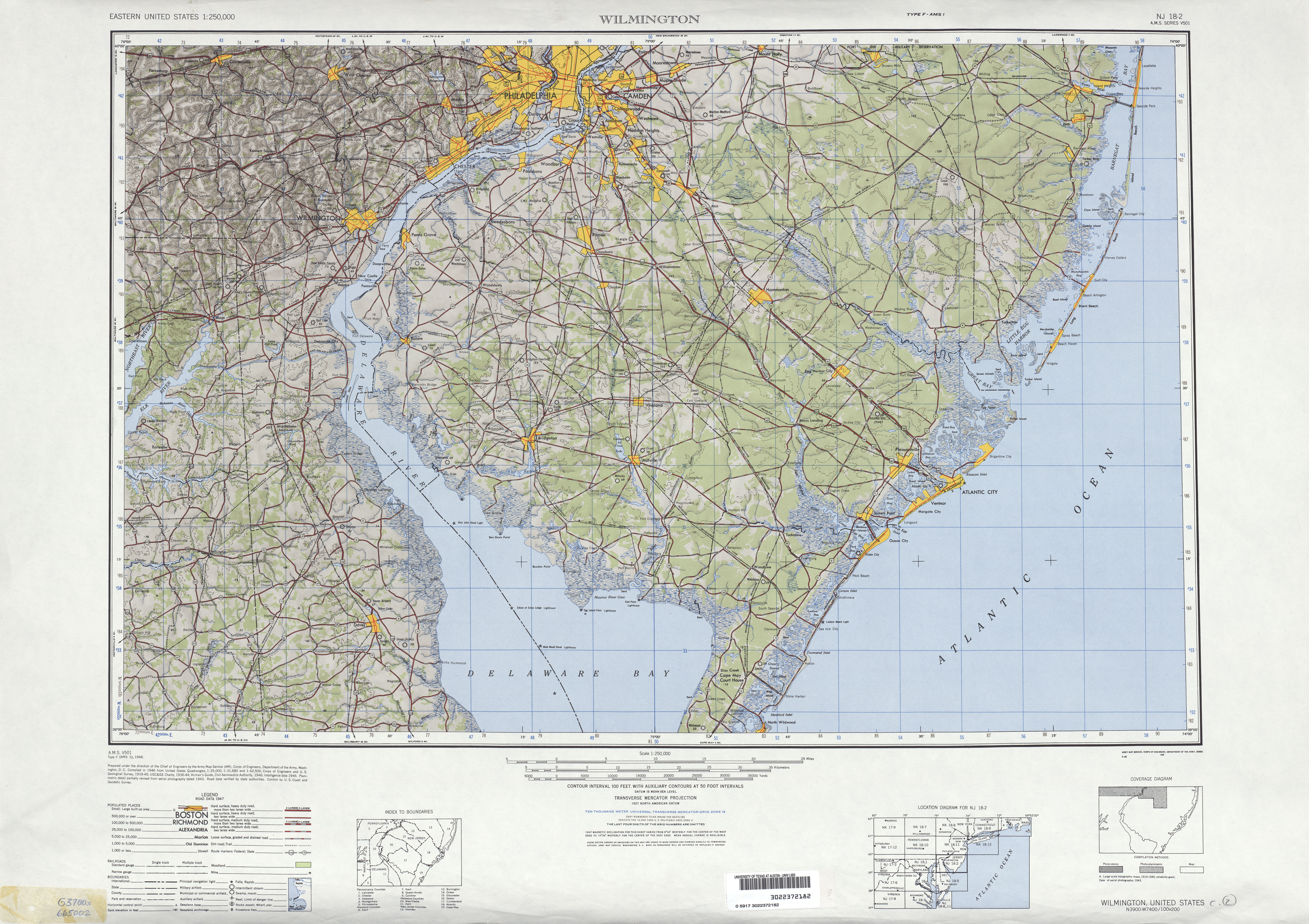
- ^ United States Geological Survey (1946). Wilmington, Delaware 1:250,000 quadrangle (Map). http://www.lib.utexas.edu/maps/topo/250k/txu-pclmaps-topo-us-wilmington-1946.jpg. Retrieved 2009-03-28.
- ^ Cumberland County, New Jersey (1954). Road Map County of Cumberland New Jersey (Map). http://mapmaker.rutgers.edu/CUMBERLAND_COUNTY/CumberlandCo_1954.jpg. Retrieved 2009-08-03.
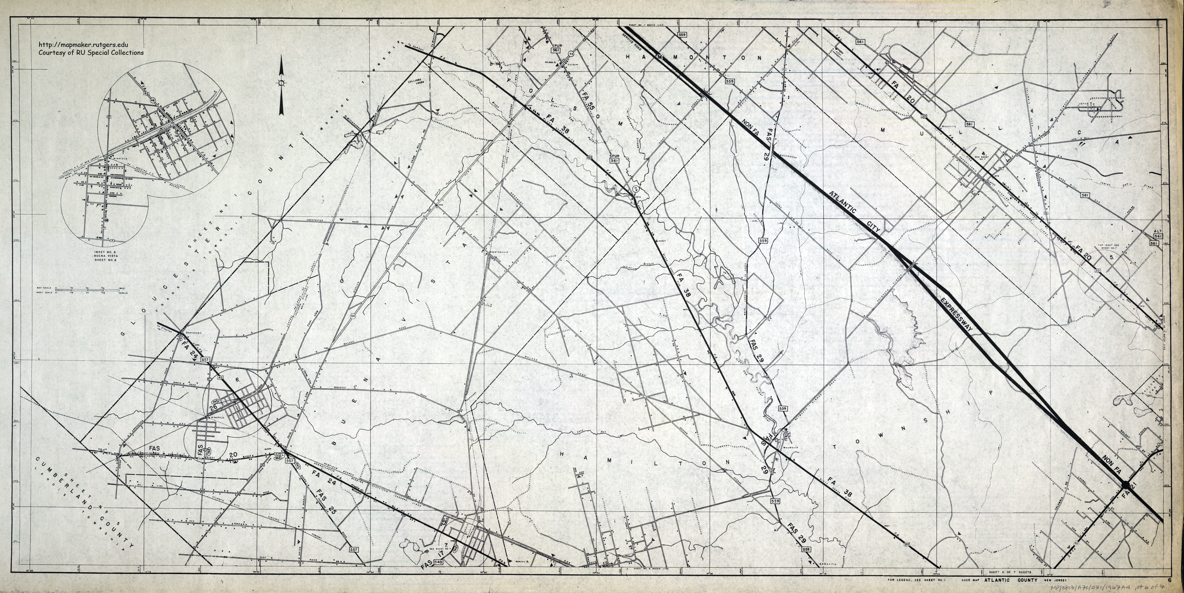
- ^ Atlantic County, New Jersey (1967). Road Map of Atlantic County Sheet 6 (Map). http://mapmaker.rutgers.edu/Atlantic/AtlanticCoHighway_1967_6.gif. Retrieved 2009-12-16.
- ^ "Cumberland County 655 straight line diagram". New Jersey Department of Transportation. http://www.state.nj.us/transportation/refdata/sldiag/06000655__-.pdf. Retrieved 2009-12-16.
- ^ "Atlantic County 655 straight line diagram". New Jersey Department of Transportation. http://www.state.nj.us/transportation/refdata/sldiag/01000655__-.pdf. Retrieved 2009-12-16.
- ^ "Atlantic County 619 straight line diagram". New Jersey Department of Transportation. http://www.state.nj.us/transportation/refdata/sldiag/01000619__-.pdf. Retrieved 2009-12-16.
- ^ 1953 renumbering, New Jersey Department of Highways, http://en.wikisource.org/wiki/1953_New_Jersey_state_highway_renumbering, retrieved 2009-07-31
- ^ "New Road Signs Ready in New Jersey". The New York Times. 1952-12-16. http://img123.imageshack.us/img123/6933/19521216newroadsignsreaiu6.jpg. Retrieved 2009-07-20.
- ^ New Jersey Highway Facts. New Jersey Department of Transportation. 1969.
- ^ Master Plan for Transportation. New Jersey Department of Transportation. 1972.
External links
Categories:- State highways in New Jersey
- Transportation in Atlantic County, New Jersey


Wikimedia Foundation. 2010.