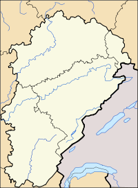
- Montbenoît
-
Montbenoît
Administration Country France Region Franche-Comté Department Doubs Arrondissement Pontarlier Canton Montbenoît Intercommunality Canton of Montbenoît Mayor Frédéric Bourdin
(2008–2014)Statistics Elevation 762–1,125 m (2,500–3,691 ft)
(avg. 790 m/2,590 ft)Land area1 5.03 km2 (1.94 sq mi) Population2 365 (2008) - Density 73 /km2 (190 /sq mi) INSEE/Postal code 25390/ 25650 1 French Land Register data, which excludes lakes, ponds, glaciers > 1 km² (0.386 sq mi or 247 acres) and river estuaries. 2 Population without double counting: residents of multiple communes (e.g., students and military personnel) only counted once. Coordinates: 46°59′37″N 6°27′46″E / 46.9936111111°N 6.46277777778°E
Montbenoît is a commune in the Doubs department in the Franche-Comté region in eastern France.
Contents
Geography
The commune lies 14 km (8.7 mi) north of Pontarlier in the Jura mountains.
History
In the early 12th century, Landry, Lord of Joux, gave land in the upper Doubs valley to Humbert, Archbishop of Besançon, to found an abbey.[1][2] The local summit in the area was at the time called Mont Benoît after a religious hermit named Benoît who resided there. Humbert invited monks to come from Valais and an abbey under St. Columbanus's rule was built by a monk called Nardouin (Norduin) in 1141-1142.[3][4] The town grew up nearby the abbey. Both the abbey and the town were named Montbenoît after the local summit. The abbey later came under the Augustine rule.[4]
In 1947, Montbenoît was proclaimed capital of the Republic of Saugeais by Georges Pourchet, a local hotel owner, who also created the republic on the spot.[citation needed]
Population
Historical population of Montbenoît 1962 1968 1975 1982 1990 1999 2008 180 205 182 163 238 219 365 See also
References
- ^ "Montbenoît" Congrès Archéologique de France 118: p. 306
- ^ Landry, Donald J. (1999) The History of the Surname Landry from Clovis to the Present volume I, Donald J. Landry, Metairie, Louisiana, p. 22, OCLC 42748089 citing Suchaux, L. (1878) Galerie Héraldo: Nobiliaire de la Franche-Comté H. Champion, Paris, p. 314, OCLC 18349834
- ^ "Montbenoît Abbey" Structurae an architectural database
- ^ a b "abbaye d'augustins" Architecture et Patrimoine database in French, accessed 5 May 2009
External links
Categories:- Communes of Doubs
- Doubs geography stubs
Wikimedia Foundation. 2010.


